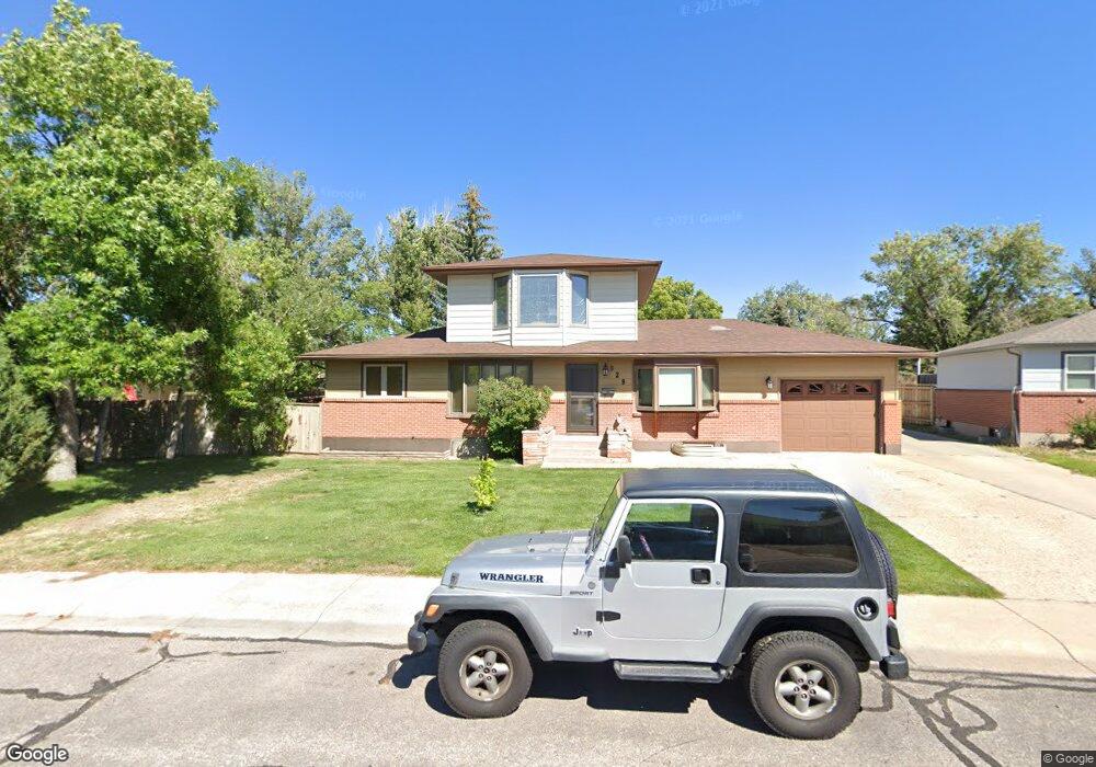
929 Mcgovern Ave Cheyenne, WY 82001
Sun Valley NeighborhoodEstimated Value: $343,000 - $403,315
--
Bed
--
Bath
1,564
Sq Ft
$234/Sq Ft
Est. Value
About This Home
This home is located at 929 Mcgovern Ave, Cheyenne, WY 82001 and is currently estimated at $365,329, approximately $233 per square foot. 929 Mcgovern Ave is a home located in Laramie County with nearby schools including Bain Elementary School, Johnson Junior High School, and South High School.
Ownership History
Date
Name
Owned For
Owner Type
Purchase Details
Closed on
Jul 16, 2013
Sold by
Mcmurtry Timothy D and Mcmurtry Peggy S
Bought by
Mcmurtry Timothy D
Current Estimated Value
Home Financials for this Owner
Home Financials are based on the most recent Mortgage that was taken out on this home.
Original Mortgage
$94,000
Outstanding Balance
$22,231
Interest Rate
3.93%
Mortgage Type
New Conventional
Estimated Equity
$343,098
Purchase Details
Closed on
Aug 29, 2003
Sold by
Glandt Dan A and Glandt Ina E
Bought by
Mcmurtry Timothy D and Mcmurtry Peggy S
Home Financials for this Owner
Home Financials are based on the most recent Mortgage that was taken out on this home.
Original Mortgage
$100,000
Interest Rate
5.87%
Mortgage Type
Purchase Money Mortgage
Create a Home Valuation Report for This Property
The Home Valuation Report is an in-depth analysis detailing your home's value as well as a comparison with similar homes in the area
Home Values in the Area
Average Home Value in this Area
Purchase History
| Date | Buyer | Sale Price | Title Company |
|---|---|---|---|
| Mcmurtry Timothy D | -- | None Available | |
| Mcmurtry Timothy D | -- | -- |
Source: Public Records
Mortgage History
| Date | Status | Borrower | Loan Amount |
|---|---|---|---|
| Open | Mcmurtry Timothy D | $94,000 | |
| Closed | Mcmurtry Timothy D | $100,000 | |
| Closed | Mcmurtry Timothy D | $65,000 |
Source: Public Records
Tax History Compared to Growth
Tax History
| Year | Tax Paid | Tax Assessment Tax Assessment Total Assessment is a certain percentage of the fair market value that is determined by local assessors to be the total taxable value of land and additions on the property. | Land | Improvement |
|---|---|---|---|---|
| 2025 | $2,752 | $30,519 | $4,318 | $26,201 |
| 2024 | $2,752 | $38,915 | $5,758 | $33,157 |
| 2023 | $2,726 | $38,556 | $5,758 | $32,798 |
| 2022 | $2,592 | $35,910 | $5,758 | $30,152 |
| 2021 | $2,344 | $32,402 | $5,758 | $26,644 |
| 2020 | $2,173 | $30,125 | $5,758 | $24,367 |
| 2019 | $2,018 | $27,954 | $5,758 | $22,196 |
| 2018 | $1,784 | $24,938 | $4,008 | $20,930 |
| 2017 | $1,767 | $24,479 | $3,305 | $21,174 |
| 2016 | $1,827 | $25,298 | $3,238 | $22,060 |
| 2015 | $1,674 | $23,181 | $3,238 | $19,943 |
| 2014 | $1,654 | $22,750 | $3,238 | $19,512 |
Source: Public Records
Map
Nearby Homes
- 828 Sun Valley Dr
- 828 Cleveland Ave
- TBD Taft Ave
- 4404 Cottage Ln
- 813 Cottonwood Dr
- 4811 E 14th St
- 4909 E 14th St
- 917 Phoenix Dr
- 5330 Kennedy Dr
- 5200 Kennedy Dr
- 5001 Phoenix Dr
- 1604 Taft Ave
- 4705 Raleigh Dr
- Lot 10 Raleigh Dr
- Lot 11 Raleigh Dr
- Lot 12 Raleigh Dr
- 930 Centennial Dr
- 4109 E 6th St
- 1301 Diamond Ave
- 5123 Atlantic Dr
- 4705 E 10th St
- 4711 E 10th St
- 930 Sun Valley Dr
- 936 Sun Valley Dr
- 4717 E 10th St
- 919 Mcgovern Ave
- 924 Sun Valley Dr
- 942 Sun Valley Dr
- 926 Mcgovern Ave
- 948 Sun Valley Dr
- 918 Sun Valley Dr
- 4617 E 10th St
- 913 Mcgovern Ave
- 4727 E 10th St
- 4710 E 10th St
- 4704 E 10th St
- 4716 E 10th St
- 4700 E 10th St
- 8508 E 10th St
- 4722 E 10th St