Estimated Value: $605,000 - $667,103
3
Beds
3
Baths
2,196
Sq Ft
$295/Sq Ft
Est. Value
About This Home
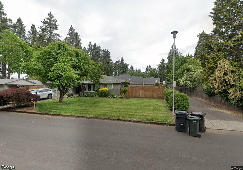
This home is located at 929 N Maple Ln, Canby, OR 97013 and is currently estimated at $647,526, approximately $294 per square foot. 929 N Maple Ln is a home located in Clackamas County with nearby schools including Josefa L. Sambrano Elementary School, William Knight Elementary School, and Baker Prairie Middle School.
Ownership History
Date
Name
Owned For
Owner Type
Purchase Details
Closed on
Feb 20, 2008
Sold by
Ed Netter Construction Inc
Bought by
Barnes Dwayne and Barnes Kelly
Current Estimated Value
Home Financials for this Owner
Home Financials are based on the most recent Mortgage that was taken out on this home.
Original Mortgage
$236,000
Outstanding Balance
$144,883
Interest Rate
5.64%
Mortgage Type
Purchase Money Mortgage
Estimated Equity
$502,643
Purchase Details
Closed on
May 30, 2006
Sold by
Wilson Jason and Wilson Jennifer
Bought by
Bell Loren and Bell Jennifer
Create a Home Valuation Report for This Property
The Home Valuation Report is an in-depth analysis detailing your home's value as well as a comparison with similar homes in the area
Home Values in the Area
Average Home Value in this Area
Purchase History
| Date | Buyer | Sale Price | Title Company |
|---|---|---|---|
| Barnes Dwayne | $358,000 | Chicago Title Insurance Co | |
| Bell Loren | $60,000 | Chicago Title Insurance Co |
Source: Public Records
Mortgage History
| Date | Status | Borrower | Loan Amount |
|---|---|---|---|
| Open | Barnes Dwayne | $236,000 |
Source: Public Records
Tax History Compared to Growth
Tax History
| Year | Tax Paid | Tax Assessment Tax Assessment Total Assessment is a certain percentage of the fair market value that is determined by local assessors to be the total taxable value of land and additions on the property. | Land | Improvement |
|---|---|---|---|---|
| 2025 | $5,713 | $322,439 | -- | -- |
| 2024 | $5,552 | $313,048 | -- | -- |
| 2023 | $5,552 | $303,931 | $0 | $0 |
| 2022 | $5,107 | $295,079 | $0 | $0 |
| 2021 | $4,918 | $286,485 | $0 | $0 |
| 2020 | $4,830 | $278,141 | $0 | $0 |
| 2019 | $4,599 | $270,040 | $0 | $0 |
| 2018 | $4,497 | $262,175 | $0 | $0 |
| 2017 | $4,383 | $254,539 | $0 | $0 |
| 2016 | $4,237 | $247,125 | $0 | $0 |
| 2015 | $4,091 | $239,927 | $0 | $0 |
| 2014 | $3,973 | $232,939 | $0 | $0 |
Source: Public Records
Map
Nearby Homes
- 318 NE 9th Ave
- 184 NE 10th Ave
- 860 NE 14th Ave
- 312 NE 14th Ave
- 187 NE 14th Ave
- 853 NE 17th Ave
- 835 SE 1st Ave Unit 64
- 835 SE 1st Ave Unit 14
- 835 SE 1st Ave Unit 12
- 835 SE 1st Ave Unit 17
- 838 NE 17th Ave
- 844 NE 17th Ave
- 832 NE 17th Ave
- 947 NE 17th Ave
- 620 SE 2nd Ave
- 620 SE 2nd Ave Unit 11
- 1009 NE 17th Ave
- 878 NE 17th Ave
- 952 NE 17th Ave
- 1751 N Laurelwood Loop
- 919 N Maple Ln
- 583 NE 10th Ave
- 911 N Maple Ln
- 573 NE 10th Ave
- 941 N Maple Ln
- 601 NE 10th Ave
- 563 NE 10th Ave
- 549 NE 10th Ave
- 619 NE 10th Ave
- 922 N Maple Ln
- 912 N Maple Ln
- 940 N Maple Ln
- 673 NE 10th Ave
- 517 NE 10th Ave
- 602 NE 10th Ave
- 715 NE 10th Ave
- 650 NE 10th Ave
- 1025 N Manzanita St
- 548 NE 10th Ave
- 658 NE 10th Ave