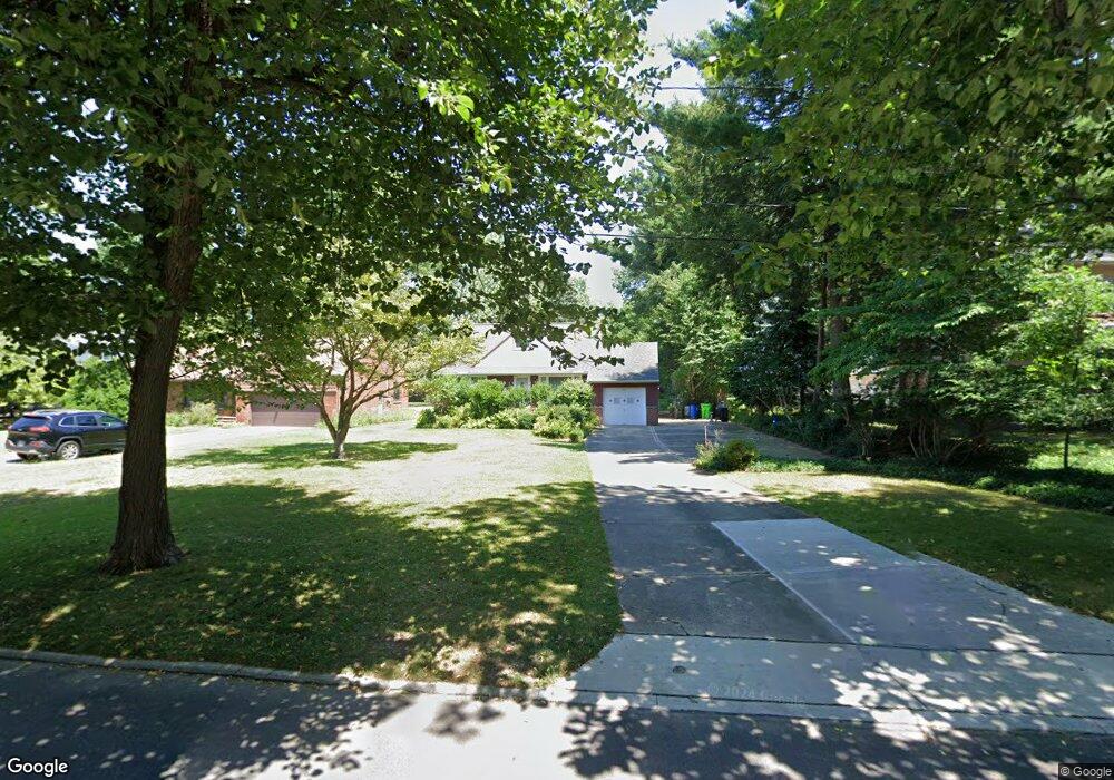
929 Stuart Dr Cleveland, OH 44121
Estimated Value: $165,000 - $188,000
3
Beds
2
Baths
1,255
Sq Ft
$141/Sq Ft
Est. Value
About This Home
This home is located at 929 Stuart Dr, Cleveland, OH 44121 and is currently estimated at $176,823, approximately $140 per square foot. 929 Stuart Dr is a home located in Cuyahoga County with nearby schools including Adrian Elementary School, Greenview Upper Elementary School, and Memorial Junior High School.
Ownership History
Date
Name
Owned For
Owner Type
Purchase Details
Closed on
Aug 3, 2004
Sold by
Severino James E
Bought by
Severino Anthony P
Current Estimated Value
Purchase Details
Closed on
Oct 11, 2002
Sold by
Severino Helen K
Bought by
Severino James E and Severino Helen K
Purchase Details
Closed on
Mar 25, 1985
Sold by
Severino James C
Bought by
Severino James C and Severino Helen K
Purchase Details
Closed on
Sep 7, 1979
Sold by
Severino James C and Severino Helen K
Bought by
Severino James C
Purchase Details
Closed on
Jan 1, 1975
Bought by
Severino James C and Severino Helen K
Create a Home Valuation Report for This Property
The Home Valuation Report is an in-depth analysis detailing your home's value as well as a comparison with similar homes in the area
Home Values in the Area
Average Home Value in this Area
Purchase History
| Date | Buyer | Sale Price | Title Company |
|---|---|---|---|
| Severino Anthony P | $112,700 | Guardian Title & Guaranty | |
| Severino James E | -- | Prospect Title Agency Inc | |
| Severino James C | -- | -- | |
| Severino James C | -- | -- | |
| Severino James C | -- | -- |
Source: Public Records
Tax History
| Year | Tax Paid | Tax Assessment Tax Assessment Total Assessment is a certain percentage of the fair market value that is determined by local assessors to be the total taxable value of land and additions on the property. | Land | Improvement |
|---|---|---|---|---|
| 2024 | $2,955 | $46,690 | $14,105 | $32,585 |
| 2023 | $2,230 | $31,120 | $9,980 | $21,140 |
| 2022 | $2,340 | $32,060 | $9,975 | $22,085 |
| 2021 | $2,323 | $32,060 | $9,980 | $22,090 |
| 2020 | $2,175 | $27,650 | $8,610 | $19,040 |
| 2019 | $2,792 | $79,000 | $24,600 | $54,400 |
| 2018 | $2,778 | $27,650 | $8,610 | $19,040 |
| 2017 | $3,678 | $34,510 | $8,540 | $25,970 |
| 2016 | $3,655 | $34,510 | $8,540 | $25,970 |
| 2015 | $3,545 | $34,510 | $8,540 | $25,970 |
| 2014 | $3,545 | $34,510 | $8,540 | $25,970 |
Source: Public Records
Map
Nearby Homes
- 843 Haywood Dr
- 4561 Wilburn Dr
- 1029 Cutters Creek Dr
- 4752 Fay Dr
- 4643 Monticello Blvd
- 4388 Adrian Rd
- 4267 Bluestone Rd
- 4859 Delevan Dr
- 4677 Liberty Rd
- 4693 Liberty Rd
- 4606 Liberty Rd
- 1271 Dorsh Rd
- 4808 Geraldine Ave
- 4838 N Sedgewick Rd
- 4948 Anderson Rd
- 4389 Ardmore Rd
- 4410 Ardmore Rd
- 1303 Dorsh Rd
- 1324 Dorsh Rd
- 4876 Monticello Blvd
- 923 Stuart Dr
- 939 Stuart Dr
- 915 Stuart Dr
- 943 Stuart Dr
- 4587 Anderson Rd
- 909 Stuart Dr
- 924 King George Blvd
- 916 King George Blvd
- 4573 Anderson Rd
- 930 Stuart 4 5bo
- 930 Stuart Dr
- 924 Stuart Dr
- 4597 Anderson Rd
- 4595 Anderson Rd
- 901 Stuart Dr
- 910 King George Blvd
- 916 Stuart Dr
- 952 Stuart Dr
- 930 King George Blvd
- 4599 Anderson Rd