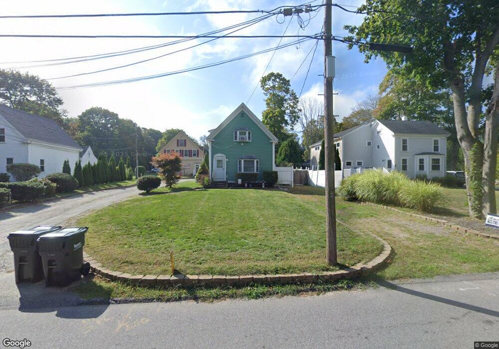
93 Captain Peirce Rd Scituate, MA 02066
3
Beds
1
Bath
1,206
Sq Ft
0.64
Acres
About This Home
This home is located at 93 Captain Peirce Rd, Scituate, MA 02066. 93 Captain Peirce Rd is a home located in Plymouth County with nearby schools including Cushing Elementary School, Lester J. Gates Middle School, and Scituate High School.
Create a Home Valuation Report for This Property
The Home Valuation Report is an in-depth analysis detailing your home's value as well as a comparison with similar homes in the area
Home Values in the Area
Average Home Value in this Area
Tax History
| Year | Tax Paid | Tax Assessment Tax Assessment Total Assessment is a certain percentage of the fair market value that is determined by local assessors to be the total taxable value of land and additions on the property. | Land | Improvement |
|---|---|---|---|---|
| 2025 | $6,921 | $692,800 | $384,500 | $308,300 |
| 2024 | $6,753 | $651,800 | $349,500 | $302,300 |
| 2023 | $5,641 | $506,800 | $335,400 | $171,400 |
| 2022 | $5,760 | $456,400 | $306,300 | $150,100 |
| 2021 | $5,657 | $424,400 | $291,800 | $132,600 |
| 2020 | $5,581 | $413,400 | $280,500 | $132,900 |
| 2019 | $5,587 | $406,600 | $275,000 | $131,600 |
| 2018 | $5,912 | $423,800 | $285,200 | $138,600 |
| 2017 | $5,811 | $412,400 | $273,800 | $138,600 |
| 2016 | $5,435 | $384,400 | $251,000 | $133,400 |
| 2015 | $4,886 | $373,000 | $239,600 | $133,400 |
Source: Public Records
Map
Nearby Homes
- 49 Whittier Dr
- 54 Woodland Rd
- 33 Rosas Ln
- 629 Country Way
- 74 Branch St Unit 15
- 701 Country Way
- 7 3 Ring Rd
- 327 Country Way
- 11 Forest Ln
- 9 Forest Ln Unit 9
- 20 Lee Ave
- 26 Mordecai Lincoln Rd
- 537 First Parish Rd
- 17 Bradford Ave
- 20 Grace Way Unit 20
- 6 Grace Way Unit 6
- 27 Grace Way
- 115 Elm St
- 111 Elm St
- 38 Lauren Ln
- 91 Captain Peirce Rd
- 95 Captain Peirce Rd
- 85 Captain Peirce Rd
- 89 Captain Peirce Rd
- 101 Captain Peirce Rd
- 79 Captain Peirce Rd
- 84 Captain Peirce Rd
- 89A Captain Pierce Rd
- 88 Captain Peirce Rd
- 104 Captain Peirce Rd
- 83 Captain Pierce Rd
- 14 Curtis St
- 75 Captain Peirce Rd
- 75 Captain Pierce Rd
- 48 Whittier Dr
- 48 Whittier Dr Unit 1
- 48 Whittier Dr Unit 2
- 80 Captain Peirce Rd
- 10 Curtis St
- 80 Captain Peirce Rd
Your Personal Tour Guide
Ask me questions while you tour the home.