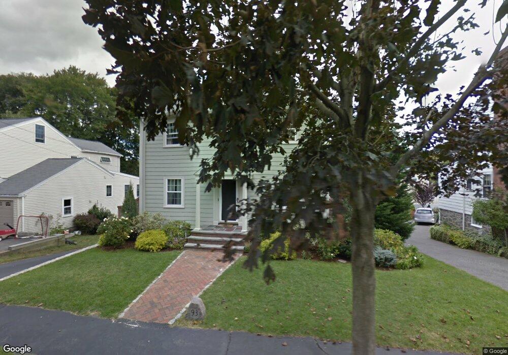
93 Gulliver St Milton, MA 02186
Milton Center NeighborhoodEstimated Value: $1,091,000 - $1,432,000
3
Beds
3
Baths
2,328
Sq Ft
$553/Sq Ft
Est. Value
About This Home
This home is located at 93 Gulliver St, Milton, MA 02186 and is currently estimated at $1,286,468, approximately $552 per square foot. 93 Gulliver St is a home located in Norfolk County with nearby schools including Milton High School, St. Mary of the Hills School, and Milton Academy.
Ownership History
Date
Name
Owned For
Owner Type
Purchase Details
Closed on
Jan 13, 2025
Sold by
Mcloughlin Peter D and Mcloughlin Brenda C
Bought by
Gulliver St Rt and Mcloughlin
Current Estimated Value
Purchase Details
Closed on
Oct 17, 2007
Sold by
Mcloughlin Peter D and Mcloughlin Brenda C
Bought by
Mcloughlin Peter D and Mcloughlin Brenda C
Create a Home Valuation Report for This Property
The Home Valuation Report is an in-depth analysis detailing your home's value as well as a comparison with similar homes in the area
Home Values in the Area
Average Home Value in this Area
Purchase History
| Date | Buyer | Sale Price | Title Company |
|---|---|---|---|
| Gulliver St Rt | -- | None Available | |
| Gulliver St Rt | -- | None Available | |
| Mcloughlin Peter D | -- | -- | |
| Mcloughlin Peter D | -- | -- | |
| Mcloughlin Peter D | -- | -- |
Source: Public Records
Mortgage History
| Date | Status | Borrower | Loan Amount |
|---|---|---|---|
| Previous Owner | Mcloughlin Peter D | $126,000 |
Source: Public Records
Tax History Compared to Growth
Tax History
| Year | Tax Paid | Tax Assessment Tax Assessment Total Assessment is a certain percentage of the fair market value that is determined by local assessors to be the total taxable value of land and additions on the property. | Land | Improvement |
|---|---|---|---|---|
| 2025 | $11,804 | $1,064,400 | $463,200 | $601,200 |
| 2024 | $9,137 | $836,700 | $441,200 | $395,500 |
| 2023 | $8,908 | $781,400 | $420,400 | $361,000 |
| 2022 | $8,744 | $701,200 | $420,400 | $280,800 |
| 2021 | $8,344 | $635,500 | $368,100 | $267,400 |
| 2020 | $8,065 | $614,700 | $352,700 | $262,000 |
| 2019 | $7,867 | $596,900 | $342,500 | $254,400 |
| 2018 | $7,544 | $546,300 | $295,400 | $250,900 |
| 2017 | $7,057 | $520,400 | $281,300 | $239,100 |
| 2016 | $6,955 | $515,200 | $281,300 | $233,900 |
| 2015 | $6,341 | $454,900 | $235,800 | $219,100 |
Source: Public Records
Map
Nearby Homes
- 54 Elm St
- 651 Canton Ave
- 10 Weston St
- 1 Chilton Park
- 70 Warren Ave
- 438 Central Ave Unit 2
- 96 Houston Ave
- 137 Thacher St Unit 137
- 485 Blue Hills Pkwy Unit 11
- 485 Blue Hills Pkwy Unit 27
- 485 Blue Hills Pkwy Unit 6
- 485 Blue Hills Pkwy Unit 21
- 485 Blue Hills Pkwy Unit 44
- 485 Blue Hills Pkwy Unit 23
- 485 Blue Hills Pkwy Unit 20
- 485 Blue Hills Pkwy Unit 26
- 485 Blue Hills Pkwy Unit 28
- 485 Blue Hills Pkwy Unit 2
- 485 Blue Hills Pkwy Unit 33
- 390 Central Ave