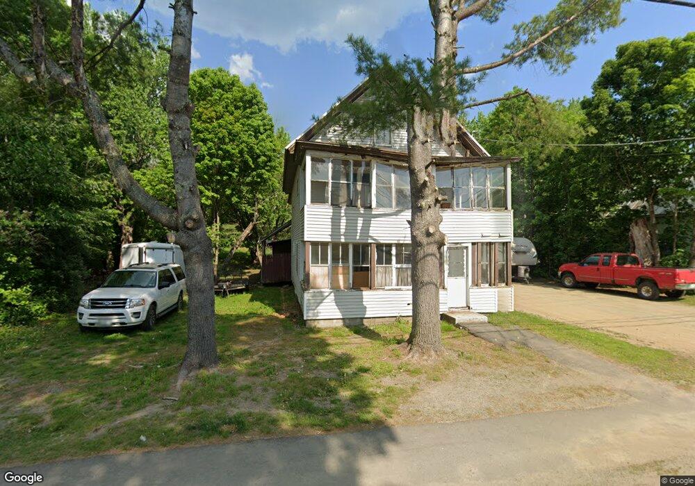
93 N Main St Strong, ME 04983
Estimated Value: $189,149 - $298,000
4
Beds
2
Baths
2,386
Sq Ft
$102/Sq Ft
Est. Value
About This Home
This home is located at 93 N Main St, Strong, ME 04983 and is currently estimated at $243,537, approximately $102 per square foot. 93 N Main St is a home located in Franklin County with nearby schools including Mt. Abram Regional High School.
Create a Home Valuation Report for This Property
The Home Valuation Report is an in-depth analysis detailing your home's value as well as a comparison with similar homes in the area
Home Values in the Area
Average Home Value in this Area
Tax History Compared to Growth
Tax History
| Year | Tax Paid | Tax Assessment Tax Assessment Total Assessment is a certain percentage of the fair market value that is determined by local assessors to be the total taxable value of land and additions on the property. | Land | Improvement |
|---|---|---|---|---|
| 2024 | $1,940 | $110,250 | $13,460 | $96,790 |
| 2023 | $1,764 | $110,250 | $13,460 | $96,790 |
| 2022 | $1,742 | $110,250 | $13,460 | $96,790 |
| 2021 | $1,819 | $110,250 | $13,460 | $96,790 |
| 2020 | $2,035 | $118,990 | $21,650 | $97,340 |
| 2019 | $2,118 | $118,990 | $21,650 | $97,340 |
| 2018 | $1,844 | $118,990 | $21,650 | $97,340 |
| 2017 | $1,713 | $118,990 | $21,650 | $97,340 |
| 2016 | $1,690 | $118,990 | $21,650 | $97,340 |
| 2015 | $1,749 | $118,990 | $21,650 | $97,340 |
| 2013 | $1,523 | $118,990 | $21,650 | $97,340 |
Source: Public Records
Map
Nearby Homes
- 16 Whitetail Dr
- U03-68-C Tbd
- 18 N Main St
- 44 Norton Hill Rd
- 22 W Freeman Rd
- 266 Phillips Rd
- LOT #162.7 St
- R-5 13-A Norton Hill Rd
- 43 Brookside Ln
- 9 Beechnut Ridge
- 593 S Strong Rd
- 722 Farmington Rd
- 4 Cousineaus Tory Hill Heights
- 228 Tory Hill Rd
- 152 Johnson Rd
- 94 New Vineyard Rd
- 802 Foster Hill Rd
- 150 River
- 85 Griffin Mountain Rd
- 67 Parlin Rd