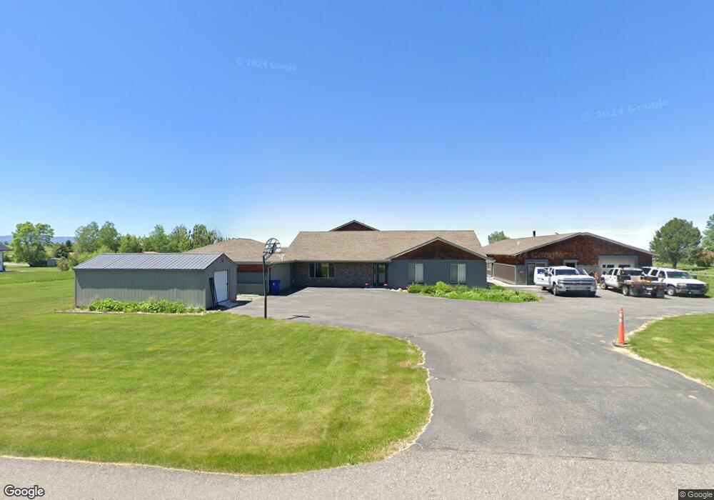
93 N Pheasant Dr Bozeman, MT 59718
Estimated Value: $1,364,000 - $1,510,717
3
Beds
2
Baths
2,309
Sq Ft
$625/Sq Ft
Est. Value
About This Home
This home is located at 93 N Pheasant Dr, Bozeman, MT 59718 and is currently estimated at $1,442,429, approximately $624 per square foot. 93 N Pheasant Dr is a home located in Gallatin County with nearby schools including Anderson Elementary School, Thomas Jefferson Middle School, and Anderson Junior High School.
Ownership History
Date
Name
Owned For
Owner Type
Purchase Details
Closed on
Mar 3, 2005
Sold by
Tadday Cynthia
Bought by
Steele Shahn P and Steele Pamela S
Current Estimated Value
Home Financials for this Owner
Home Financials are based on the most recent Mortgage that was taken out on this home.
Original Mortgage
$231,200
Outstanding Balance
$116,034
Interest Rate
5.66%
Mortgage Type
Unknown
Estimated Equity
$1,326,395
Create a Home Valuation Report for This Property
The Home Valuation Report is an in-depth analysis detailing your home's value as well as a comparison with similar homes in the area
Home Values in the Area
Average Home Value in this Area
Purchase History
| Date | Buyer | Sale Price | Title Company |
|---|---|---|---|
| Steele Shahn P | -- | Stb |
Source: Public Records
Mortgage History
| Date | Status | Borrower | Loan Amount |
|---|---|---|---|
| Open | Steele Shahn P | $231,200 |
Source: Public Records
Tax History Compared to Growth
Tax History
| Year | Tax Paid | Tax Assessment Tax Assessment Total Assessment is a certain percentage of the fair market value that is determined by local assessors to be the total taxable value of land and additions on the property. | Land | Improvement |
|---|---|---|---|---|
| 2025 | $6,365 | $1,417,800 | $0 | $0 |
| 2024 | $9,095 | $1,544,100 | $0 | $0 |
| 2023 | $9,240 | $1,544,100 | $0 | $0 |
| 2022 | $6,743 | $844,200 | $0 | $0 |
| 2021 | $7,442 | $844,200 | $0 | $0 |
| 2020 | $6,704 | $708,500 | $0 | $0 |
| 2019 | $5,787 | $708,500 | $0 | $0 |
| 2018 | $5,847 | $640,200 | $0 | $0 |
| 2017 | $5,480 | $640,200 | $0 | $0 |
| 2016 | $5,470 | $560,800 | $0 | $0 |
| 2015 | $5,196 | $560,800 | $0 | $0 |
| 2014 | $5,786 | $384,515 | $0 | $0 |
Source: Public Records
Map
Nearby Homes
- 9000 S 19th Ave
- 0 Hyalite Canyon Rd
- 15 Forest Creek Dr
- 6271 Alamosa Ln
- 10400 Hyalite Canyon Rd
- TBD McLure Dr
- 12977 Cottonwood Rd
- 12977 S Cottonwood Rd
- 151 Clancy Way
- Lot 32 Clancy Way
- 65 Hyalite Ranch Ln
- Lot 13 Waylon Way
- 606 Hyalite View Dr
- 13011 Cottonwood Canyon Rd
- 657 Hyalite View Dr
- Lot 2 Reilley Rd
- Lot 30 Glendale Loop
- Lot 19 Reilley Rd
- Lot 5 Reilley Rd
- Lot 9 Holtz Ln
- 106 N Pheasant Dr
- 68 Owl Way
- 115 N Pheasant Dr
- 149 Starling Dr
- 145 N Pheasant Dr
- 158 N Pheasant Dr
- 103 Starling Dr
- 145 Pheasant Trail
- 82 Owl Way
- 249 Starling Dr
- 190 N Pheasant Dr
- 138 Starling Dr
- 55 Owl Way Unit GRAY
- 55 Owl Way
- 210 Starling Dr
- 81 Owl Way
- 88 Starling Dr
- 301 Starling Dr
- 207 N Pheasant Dr
- 195 Mountain Aire Ln