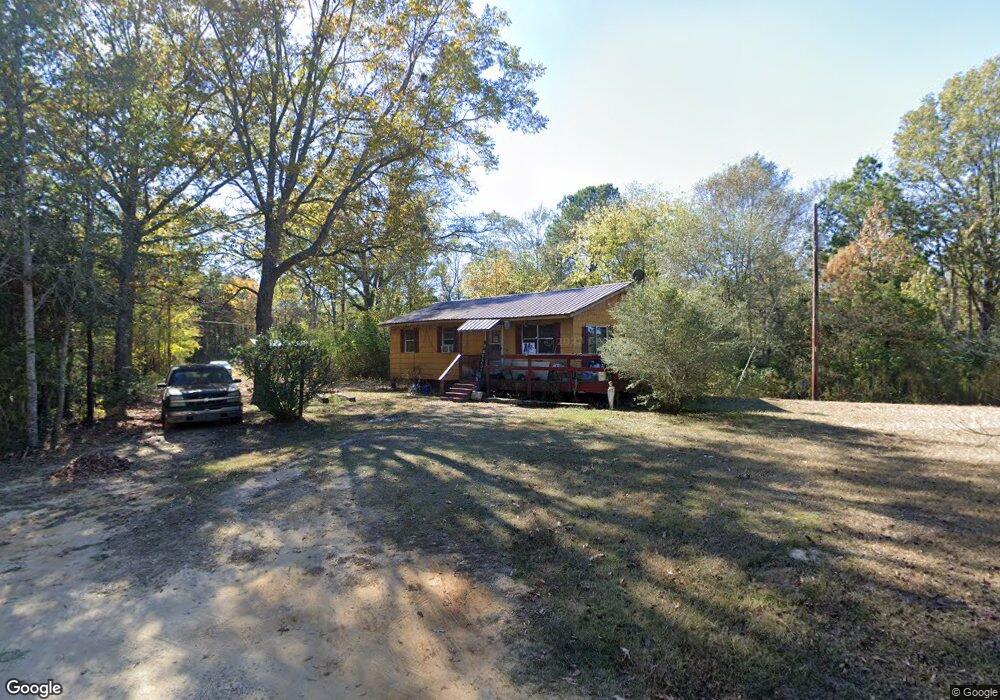
93 Reese Rd Newton, MS 39345
Estimated Value: $65,283 - $102,000
--
Bed
--
Bath
912
Sq Ft
$97/Sq Ft
Est. Value
About This Home
This home is located at 93 Reese Rd, Newton, MS 39345 and is currently estimated at $88,071, approximately $96 per square foot. 93 Reese Rd is a home with nearby schools including Newton Elementary School, N.H. Pilate Middle School, and Newton High School.
Create a Home Valuation Report for This Property
The Home Valuation Report is an in-depth analysis detailing your home's value as well as a comparison with similar homes in the area
Home Values in the Area
Average Home Value in this Area
Tax History Compared to Growth
Tax History
| Year | Tax Paid | Tax Assessment Tax Assessment Total Assessment is a certain percentage of the fair market value that is determined by local assessors to be the total taxable value of land and additions on the property. | Land | Improvement |
|---|---|---|---|---|
| 2024 | -- | $3,896 | $0 | $0 |
| 2023 | -- | $3,896 | $0 | $0 |
| 2022 | $0 | $3,896 | $0 | $0 |
| 2021 | $149 | $3,648 | $0 | $0 |
| 2020 | $149 | $1,975 | $0 | $0 |
| 2019 | $149 | $1,975 | $0 | $0 |
| 2018 | $0 | $1,975 | $0 | $0 |
| 2017 | $149 | $1,882 | $0 | $0 |
| 2016 | $148 | $1,882 | $0 | $0 |
| 2015 | -- | $2,824 | $0 | $0 |
| 2014 | -- | $2,824 | $0 | $0 |
Source: Public Records
Map
Nearby Homes
- Lot 3 Triple Ridge Blvd
- 0000 Airport Rd
- 0 Airport Rd
- 0 Clyde Evans Rd
- 0 High St
- 0 1st Ave
- 402 E Church St
- 107 Adeline Ln
- 105 Pinewood Dr
- 704 Decatur St
- 103 Rew St
- 2906 Highway 15
- 202 New Ireland St
- 200 W Tatum St
- 106 Stennis St
- 306 W Church St
- 0 Eastside Dr
- 110 Victoria Cir
- 205 Ridge Dr
- 501 W Church St
- 57 Reese Rd
- 780 Corinth Rd
- 836 Corinth Rd
- 883 Corinth Rd
- 863 Corinth Rd
- 894 Corinth Rd
- 1105 Corinth Rd
- 53 Corinth Rd
- 2481 Airport Rd
- 2683 Airport Rd
- 2773 Airport Rd
- 2710 Airport Rd
- 2372 Airport Rd
- 2758 Airport Rd
- 2782 Airport Rd
- 3013 Airport Rd
- 2226 Airport Rd
- 1665 Airport Rd
- 2274 Airport Rd
- 1993 Airport Rd