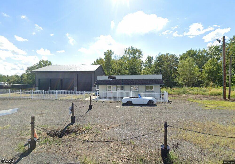
93 Route 539 Allentown, NJ 08501
--
Bed
--
Bath
2,118
Sq Ft
1.58
Acres
About This Home
This home is located at 93 Route 539, Allentown, NJ 08501. 93 Route 539 is a home located in Monmouth County with nearby schools including Newell Elementary School, Stonebridge Middle School, and Allentown High School.
Ownership History
Date
Name
Owned For
Owner Type
Purchase Details
Closed on
Jun 1, 2017
Sold by
Route 539 Log Cabin Llc
Bought by
1981 R E Holdings Llc
Home Financials for this Owner
Home Financials are based on the most recent Mortgage that was taken out on this home.
Interest Rate
3.94%
Purchase Details
Closed on
Jun 15, 2004
Sold by
Gm Ewing Holdings Co Inc
Bought by
Route 539 Log Cabin Llc
Purchase Details
Closed on
Jun 30, 2003
Sold by
Lemieux Raymond
Bought by
Gm Ewing Holding Co Inc
Create a Home Valuation Report for This Property
The Home Valuation Report is an in-depth analysis detailing your home's value as well as a comparison with similar homes in the area
Home Values in the Area
Average Home Value in this Area
Purchase History
| Date | Buyer | Sale Price | Title Company |
|---|---|---|---|
| 1981 R E Holdings Llc | $435,000 | -- | |
| Route 539 Log Cabin Llc | $275,000 | -- | |
| Gm Ewing Holding Co Inc | $168,000 | -- |
Source: Public Records
Mortgage History
| Date | Status | Borrower | Loan Amount |
|---|---|---|---|
| Closed | 1981 R E Holdings Llc | -- |
Source: Public Records
Tax History Compared to Growth
Tax History
| Year | Tax Paid | Tax Assessment Tax Assessment Total Assessment is a certain percentage of the fair market value that is determined by local assessors to be the total taxable value of land and additions on the property. | Land | Improvement |
|---|---|---|---|---|
| 2025 | $7,678 | $466,600 | $253,300 | $213,300 |
| 2024 | $7,682 | $356,100 | $142,800 | $213,300 |
| 2023 | $7,682 | $345,900 | $142,600 | $203,300 |
| 2022 | $7,995 | $336,500 | $133,200 | $203,300 |
| 2021 | $7,995 | $330,200 | $126,900 | $203,300 |
| 2020 | $8,002 | $331,500 | $128,200 | $203,300 |
| 2019 | $7,970 | $332,500 | $128,200 | $204,300 |
| 2018 | $8,272 | $340,000 | $128,200 | $211,800 |
| 2017 | $5,220 | $217,400 | $125,600 | $91,800 |
| 2016 | $5,157 | $217,400 | $125,600 | $91,800 |
| 2015 | $5,691 | $242,500 | $150,700 | $91,800 |
| 2014 | $6,284 | $269,800 | $168,700 | $101,100 |
Source: Public Records
Map
Nearby Homes
- 6 Sleepy Hollow Ct
- 11 Probasco Dr
- 164 Ellisdale Rd
- 3 Johnson Dr
- 90 Minuteman Cir
- 8 Coates Rd
- 40 Bunker Hill Dr
- 7 Corral Dr
- 41 Gina Dr
- 106 Holmes Mill Rd
- 392 Extonville Rd
- 17 Grant Dr
- 926 Province Line Rd
- 926 Province Line Rd
- 926 Province Line Rd
- 420 Extonville Rd
- 9 Denise Dr
- 467 Gordon Rd
- 3 Dartmouth Ct
- 9 Meetinghouse Rd
- 91 Route 539
- 89 Route 539
- 87 Route 539
- 85 Route 539
- 83 Route 539
- 81 Route 539
- 118 Route 539
- 148 Walnford Rd
- 79 Route 539
- 150 Allentown Davis Station
- 152 Allentown Davis Station
- 150 Route 539
- 109 Route 539
- 152 Route 539
- 77 Route 539
- 111 Route 539
- 6 Waterbury Ct
- 2 Waterbury Ct
- 4 Waterbury Ct
- 8 Waterbury Ct