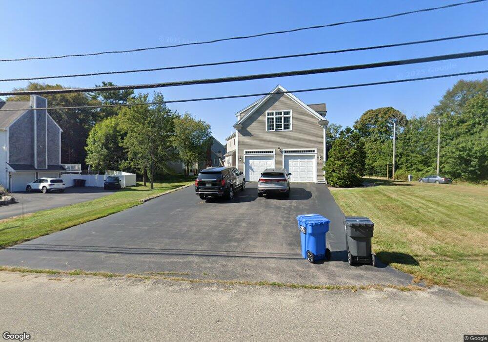
93 Stockbridge Rd Scituate, MA 02066
Estimated Value: $1,512,000 - $1,646,000
4
Beds
4
Baths
3,924
Sq Ft
$403/Sq Ft
Est. Value
About This Home
This home is located at 93 Stockbridge Rd, Scituate, MA 02066 and is currently estimated at $1,581,350, approximately $402 per square foot. 93 Stockbridge Rd is a home located in Plymouth County with nearby schools including Jenkins Elementary School, Lester J. Gates Middle School, and Scituate High School.
Ownership History
Date
Name
Owned For
Owner Type
Purchase Details
Closed on
Aug 26, 2010
Sold by
Cushing William T
Bought by
Cushing Constr Inc
Current Estimated Value
Home Financials for this Owner
Home Financials are based on the most recent Mortgage that was taken out on this home.
Original Mortgage
$160,000
Outstanding Balance
$106,348
Interest Rate
4.57%
Estimated Equity
$1,475,002
Purchase Details
Closed on
Sep 29, 2003
Sold by
Cushing Constr Inc
Bought by
Mcinnis John P and Mcinnis Brenda C
Create a Home Valuation Report for This Property
The Home Valuation Report is an in-depth analysis detailing your home's value as well as a comparison with similar homes in the area
Home Values in the Area
Average Home Value in this Area
Purchase History
| Date | Buyer | Sale Price | Title Company |
|---|---|---|---|
| Cushing Constr Inc | -- | -- | |
| Mcinnis John P | $690,000 | -- |
Source: Public Records
Mortgage History
| Date | Status | Borrower | Loan Amount |
|---|---|---|---|
| Open | Mcinnis John P | $160,000 | |
| Previous Owner | Mcinnis John P | $410,000 | |
| Previous Owner | Mcinnis John P | $230,000 | |
| Previous Owner | Mcinnis John P | $333,700 |
Source: Public Records
Tax History Compared to Growth
Tax History
| Year | Tax Paid | Tax Assessment Tax Assessment Total Assessment is a certain percentage of the fair market value that is determined by local assessors to be the total taxable value of land and additions on the property. | Land | Improvement |
|---|---|---|---|---|
| 2025 | $12,301 | $1,231,300 | $415,600 | $815,700 |
| 2024 | $12,307 | $1,187,900 | $377,800 | $810,100 |
| 2023 | $11,917 | $1,107,700 | $343,500 | $764,200 |
| 2022 | $11,917 | $944,300 | $294,900 | $649,400 |
| 2021 | $11,529 | $864,900 | $280,900 | $584,000 |
| 2020 | $11,254 | $833,600 | $270,100 | $563,500 |
| 2019 | $11,396 | $829,400 | $291,200 | $538,200 |
| 2018 | $10,981 | $787,200 | $287,000 | $500,200 |
| 2017 | $10,656 | $756,300 | $276,000 | $480,300 |
| 2016 | $10,382 | $734,200 | $253,900 | $480,300 |
| 2015 | $9,474 | $723,200 | $242,900 | $480,300 |
Source: Public Records
Map
Nearby Homes
- 67 Greenfield Ln
- 59 Greenfield Ln
- 12 Meeting House Ln Unit 308
- 50 First Parish Rd
- 76 A Brook St
- 76 A Brook St Unit 1
- 91 Front St Unit 106
- 29 Ladds Way Unit 29
- 74 Tilden Rd
- 19 Ford Place Unit 3
- 19 Ford Place Unit 1
- 19 Ford Place Unit 4
- 12 Sassamon Rd
- 111 Elm St
- 115 Elm St
- 23 Sunset Rd
- 17 Old Oaken Bucket Rd
- 148 Tilden Rd
- 12 Richfield Rd
- 2 Collier Rd
- 113 Greenfield Ln
- 97 Stockbridge Rd
- 25 Elm Park
- 114 Greenfield Ln
- 88 Stockbridge Rd
- 103 Stockbridge Rd
- 0 Common St
- 17 Elm Park
- 11 Woodbine Way
- 109 Stockbridge Rd
- 100 Greenfield Ln
- 90 Stockbridge Rd
- 21 Woodbine Way
- 7 Elm Park
- 106 Stockbridge Rd
- 13 Elm Park
- 116 Stockbridge Rd
- 15 Lynda Ln
- 119 Stockbridge Rd
- 94 Greenfield Ln