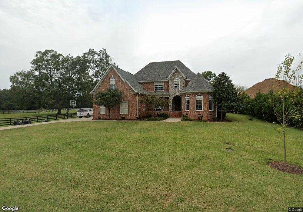
930 Allen Rd Murfreesboro, TN 37129
Estimated Value: $644,773 - $752,000
--
Bed
--
Bath
3,244
Sq Ft
$219/Sq Ft
Est. Value
About This Home
This home is located at 930 Allen Rd, Murfreesboro, TN 37129 and is currently estimated at $711,943, approximately $219 per square foot. 930 Allen Rd is a home located in Rutherford County with nearby schools including Walter Hill Elementary School, Siegel Middle School, and Siegel High School.
Ownership History
Date
Name
Owned For
Owner Type
Purchase Details
Closed on
Sep 1, 2010
Sold by
Castle Rock Construction
Bought by
Golden Lee
Current Estimated Value
Purchase Details
Closed on
Jan 23, 2007
Sold by
E & H Development Llc
Bought by
Castle Rock Construction Llc
Purchase Details
Closed on
Dec 28, 2004
Sold by
Ross Vester W and Ross Mary S
Bought by
Hayes Donald L
Purchase Details
Closed on
Nov 10, 1999
Sold by
Ross Scott A
Bought by
Ross Scott A
Purchase Details
Closed on
May 22, 1998
Sold by
Ross Scott A and Ross Bonia
Bought by
Ross Scott A
Purchase Details
Closed on
Mar 26, 1997
Sold by
Vester Ross
Bought by
Ross Scott A and Ross Bonia
Create a Home Valuation Report for This Property
The Home Valuation Report is an in-depth analysis detailing your home's value as well as a comparison with similar homes in the area
Home Values in the Area
Average Home Value in this Area
Purchase History
| Date | Buyer | Sale Price | Title Company |
|---|---|---|---|
| Golden Lee | $250,000 | -- | |
| Castle Rock Construction Llc | $79,900 | -- | |
| Hayes Donald L | $320,582 | -- | |
| Ross Scott A | -- | -- | |
| Ross Scott A | -- | -- | |
| Ross Scott A | -- | -- |
Source: Public Records
Tax History Compared to Growth
Tax History
| Year | Tax Paid | Tax Assessment Tax Assessment Total Assessment is a certain percentage of the fair market value that is determined by local assessors to be the total taxable value of land and additions on the property. | Land | Improvement |
|---|---|---|---|---|
| 2025 | $2,698 | $143,800 | $23,750 | $120,050 |
| 2024 | $2,698 | $143,800 | $23,750 | $120,050 |
| 2023 | $2,698 | $143,800 | $23,750 | $120,050 |
| 2022 | $2,306 | $142,650 | $23,750 | $118,900 |
| 2021 | $2,170 | $97,775 | $13,750 | $84,025 |
| 2020 | $2,170 | $97,775 | $13,750 | $84,025 |
| 2019 | $2,170 | $97,775 | $13,750 | $84,025 |
Source: Public Records
Map
Nearby Homes
- 0 Leanna Rd
- 1061 Alford Rd
- 2245 N Ranch Rd
- 3543 John Richards Dr
- 3533 John Richards Dr
- 1831 Pennington Dr
- 3417 Leanna Rd Unit LT 10A
- 1201 Cranberry Dr
- 0 Unit RTC3002253
- 3433 Cortona Way
- 3538 Winterfell Dr
- 3534 Winterfell Dr
- 3187 N Thompson Ln
- 3530 Winterfell Dr
- 3526 Winterfell Dr
- 3522 Winterfell Dr
- 3811 Acorn Ave
- Bancroft Plan at Kings Landing
- Alamont Plan at Kings Landing
- Chelsey Plan at Kings Landing