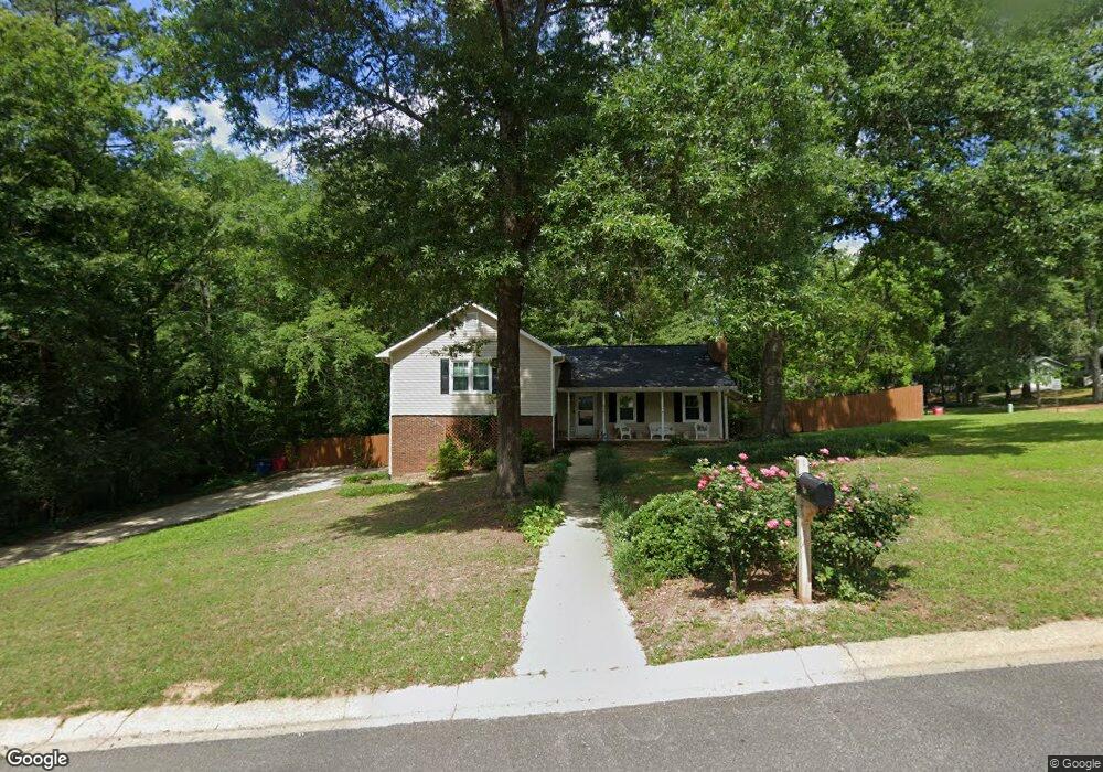
930 Smoke Rise Way Macon, GA 31210
Estimated Value: $221,494 - $297,000
3
Beds
3
Baths
1,570
Sq Ft
$155/Sq Ft
Est. Value
About This Home
This home is located at 930 Smoke Rise Way, Macon, GA 31210 and is currently estimated at $242,624, approximately $154 per square foot. 930 Smoke Rise Way is a home located in Bibb County with nearby schools including Springdale Elementary School, Howard Middle School, and Howard High School.
Ownership History
Date
Name
Owned For
Owner Type
Purchase Details
Closed on
Mar 25, 2019
Sold by
Cape James David
Bought by
Story Seth Edward
Current Estimated Value
Home Financials for this Owner
Home Financials are based on the most recent Mortgage that was taken out on this home.
Original Mortgage
$152,668
Outstanding Balance
$133,672
Interest Rate
4.3%
Mortgage Type
FHA
Estimated Equity
$108,952
Purchase Details
Closed on
Jun 4, 2008
Sold by
Cape Anson Grady and Cape Derrick Daniel
Bought by
Cape James David
Create a Home Valuation Report for This Property
The Home Valuation Report is an in-depth analysis detailing your home's value as well as a comparison with similar homes in the area
Home Values in the Area
Average Home Value in this Area
Purchase History
| Date | Buyer | Sale Price | Title Company |
|---|---|---|---|
| Story Seth Edward | $162,000 | None Available | |
| Cape James David | -- | None Available | |
| Cape James David | -- | None Available |
Source: Public Records
Mortgage History
| Date | Status | Borrower | Loan Amount |
|---|---|---|---|
| Open | Story Seth Edward | $152,668 | |
| Closed | Story Seth Edward | $15,000 |
Source: Public Records
Tax History Compared to Growth
Tax History
| Year | Tax Paid | Tax Assessment Tax Assessment Total Assessment is a certain percentage of the fair market value that is determined by local assessors to be the total taxable value of land and additions on the property. | Land | Improvement |
|---|---|---|---|---|
| 2025 | $1,468 | $66,750 | $16,920 | $49,830 |
| 2024 | $1,517 | $66,750 | $16,920 | $49,830 |
| 2023 | $1,060 | $66,750 | $16,920 | $49,830 |
| 2022 | $2,072 | $66,850 | $12,441 | $54,409 |
| 2021 | $2,152 | $63,626 | $12,441 | $51,185 |
| 2020 | $2,198 | $63,626 | $12,441 | $51,185 |
| 2019 | $1,752 | $44,749 | $9,048 | $35,701 |
| 2018 | $2,443 | $44,749 | $9,048 | $35,701 |
| 2017 | $1,414 | $44,749 | $9,048 | $35,701 |
| 2016 | $1,306 | $44,749 | $9,048 | $35,701 |
| 2015 | $1,849 | $44,749 | $9,048 | $35,701 |
| 2014 | $1,852 | $44,749 | $9,048 | $35,701 |
Source: Public Records
Map
Nearby Homes
- 5161 Wesleyan Cir
- 4964 Kathryn Dr
- 920 Wesleyan Dr
- 5104 Pine Ridge Dr
- 150 Springdale Ct
- 4726 Cheryle Ann Dr
- 5341 Northside Dr
- 203 Oberon Place
- 1475 Maplewood Dr
- 200 N Wesleyan Cir
- 4661 N Beechwood Dr
- 757 Silver Springs Dr
- 199 Springfield Blvd
- 4653 S Beechwood Dr
- 178 Springfield Blvd
- 4630 Sprucewood Dr
- 4713 Lattimore Dr
- 137 Senora Place
- 181 Rivoli Landing
- 1297 Wesleyan Dr
- 918 Smoke Rise Way
- 5114 Smoke Rise Dr
- 5094 Smoke Rise Dr
- 5101 Smoke Rise Dr
- 5109 Smoke Rise Dr
- 5124 Smoke Rise Dr
- 906 Smoke Rise Way
- 5084 Smoke Rise Dr
- 5095 Smoke Rise Dr
- 5119 Smoke Rise Dr
- 913 Smoke Rise Way
- 5136 Smoke Rise Dr
- 5083 Smoke Rise Dr
- 5131 Smoke Rise Dr
- 5079 Wesleyan Cir
- 5446 White House Plantation Rd
- 5440 White House Plantation Rd
- 965 Smoke Rise Way
- 5146 Smoke Rise Dr
- 5072 Smoke Rise Dr