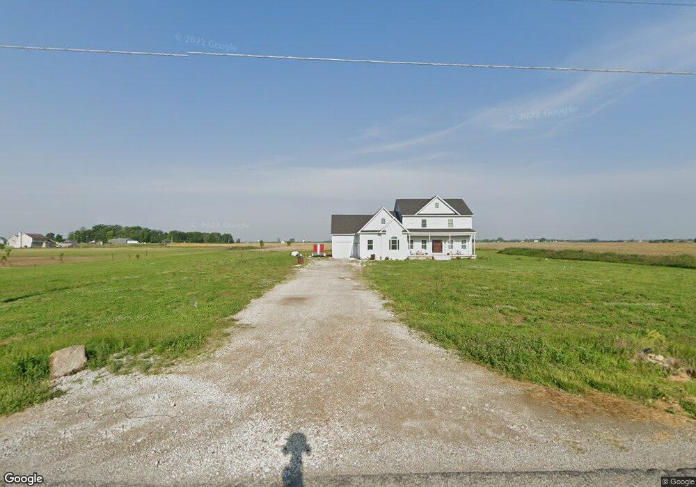
9301 Beavers Rd Orient, OH 43146
Estimated Value: $449,000 - $944,000
4
Beds
3
Baths
2,637
Sq Ft
$249/Sq Ft
Est. Value
About This Home
This home is located at 9301 Beavers Rd, Orient, OH 43146 and is currently estimated at $655,939, approximately $248 per square foot. 9301 Beavers Rd is a home.
Ownership History
Date
Name
Owned For
Owner Type
Purchase Details
Closed on
Oct 28, 2013
Sold by
Schemrich John A and Schemrich Andrea C
Bought by
Schemrich John A
Current Estimated Value
Home Financials for this Owner
Home Financials are based on the most recent Mortgage that was taken out on this home.
Original Mortgage
$260,000
Interest Rate
4.5%
Mortgage Type
Construction
Purchase Details
Closed on
Mar 27, 2012
Sold by
Lo & Ro Enterprises Llc and Lotz William F
Bought by
Schemrich John A and Schemrich Andrea C
Home Financials for this Owner
Home Financials are based on the most recent Mortgage that was taken out on this home.
Original Mortgage
$65,000
Interest Rate
4%
Mortgage Type
Credit Line Revolving
Create a Home Valuation Report for This Property
The Home Valuation Report is an in-depth analysis detailing your home's value as well as a comparison with similar homes in the area
Purchase History
| Date | Buyer | Sale Price | Title Company |
|---|---|---|---|
| Schemrich John A | -- | Arrow Title Agency Llc | |
| Schemrich John A | $80,000 | Valmer Land Title Agency |
Source: Public Records
Mortgage History
| Date | Status | Borrower | Loan Amount |
|---|---|---|---|
| Closed | Schemrich John A | $260,000 | |
| Closed | Schemrich John A | $65,000 |
Source: Public Records
Tax History
| Year | Tax Paid | Tax Assessment Tax Assessment Total Assessment is a certain percentage of the fair market value that is determined by local assessors to be the total taxable value of land and additions on the property. | Land | Improvement |
|---|---|---|---|---|
| 2024 | $9,503 | $184,130 | $53,400 | $130,730 |
| 2023 | $7,109 | $184,130 | $53,400 | $130,730 |
| 2022 | $5,479 | $130,440 | $36,280 | $94,160 |
| 2021 | $5,495 | $130,440 | $36,280 | $94,160 |
| 2020 | $5,497 | $130,440 | $36,280 | $94,160 |
| 2019 | $4,845 | $111,730 | $33,550 | $78,180 |
| 2018 | $4,477 | $111,730 | $33,550 | $78,180 |
| 2017 | $5,871 | $111,730 | $33,550 | $78,180 |
| 2016 | $4,203 | $101,960 | $28,430 | $73,530 |
| 2015 | $5,085 | $101,960 | $28,430 | $73,530 |
| 2014 | $904 | $26,120 | $26,120 | $0 |
| 2013 | $640 | $23,080 | $23,080 | $0 |
Source: Public Records
Map
Nearby Homes
- 9148 Matville Rd
- 0 Burgett Rd
- 0 Ridpath Rd
- 190 Rosewood Loop SW
- 161 Rosewood Loop SE
- 160 Chestnut Commons Dr
- 182 Honey Locust Ln
- 161 Chestnut Estates Dr
- 6210 Seeds Rd
- 6446 Harrisburg Pike
- 231 Maddoxx Dr
- 201 Maddoxx Dr
- 7879 Railroad St
- 38 Waterman Ave
- 66 Genoa Cir
- 305 Cherry Hills Rd
- 24 Erin Hills Rd
- 290 Olympic Loop
- 305 Olympic Loop
- 358 Oakmont Dr
Your Personal Tour Guide
Ask me questions while you tour the home.