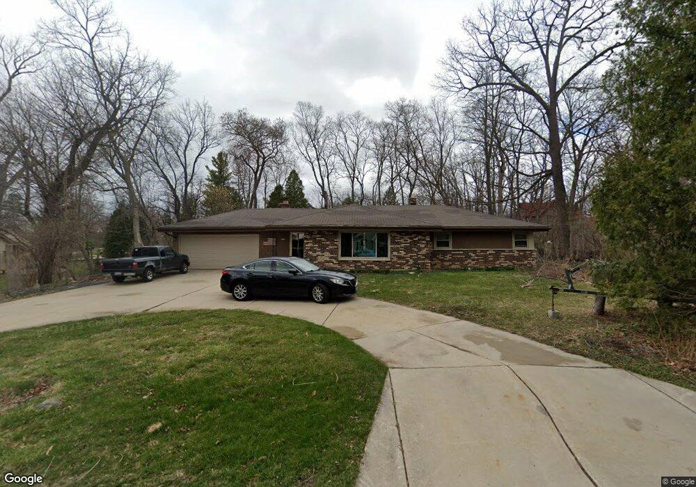
9304 W Dosie Ave Milwaukee, WI 53228
Estimated Value: $387,140 - $486,000
3
Beds
2
Baths
1,656
Sq Ft
$259/Sq Ft
Est. Value
About This Home
This home is located at 9304 W Dosie Ave, Milwaukee, WI 53228 and is currently estimated at $429,035, approximately $259 per square foot. 9304 W Dosie Ave is a home located in Milwaukee County with nearby schools including Hales Corners Elementary School, Whitnall Middle School, and Whitnall High School.
Ownership History
Date
Name
Owned For
Owner Type
Purchase Details
Closed on
Jun 29, 2000
Sold by
Jaeger Raymond J and Jaeger Beverly J
Bought by
Behrs Gerald G and Behrs Laurel A
Current Estimated Value
Home Financials for this Owner
Home Financials are based on the most recent Mortgage that was taken out on this home.
Original Mortgage
$136,000
Outstanding Balance
$48,371
Interest Rate
8.55%
Mortgage Type
Purchase Money Mortgage
Estimated Equity
$380,664
Create a Home Valuation Report for This Property
The Home Valuation Report is an in-depth analysis detailing your home's value as well as a comparison with similar homes in the area
Home Values in the Area
Average Home Value in this Area
Purchase History
| Date | Buyer | Sale Price | Title Company |
|---|---|---|---|
| Behrs Gerald G | $170,000 | -- |
Source: Public Records
Mortgage History
| Date | Status | Borrower | Loan Amount |
|---|---|---|---|
| Open | Behrs Gerald G | $136,000 |
Source: Public Records
Tax History Compared to Growth
Tax History
| Year | Tax Paid | Tax Assessment Tax Assessment Total Assessment is a certain percentage of the fair market value that is determined by local assessors to be the total taxable value of land and additions on the property. | Land | Improvement |
|---|---|---|---|---|
| 2024 | $5,161 | $299,100 | $104,100 | $195,000 |
| 2023 | $5,161 | $299,100 | $104,100 | $195,000 |
| 2022 | $4,981 | $188,700 | $80,100 | $108,600 |
| 2021 | $5,042 | $188,700 | $80,100 | $108,600 |
| 2020 | $5,162 | $188,700 | $80,100 | $108,600 |
| 2019 | $4,982 | $188,700 | $80,100 | $108,600 |
| 2018 | $5,286 | $188,700 | $80,100 | $108,600 |
| 2017 | $5,663 | $188,700 | $80,100 | $108,600 |
| 2016 | $5,672 | $188,700 | $80,100 | $108,600 |
| 2015 | $5,426 | $188,700 | $80,100 | $108,600 |
| 2014 | $5,433 | $188,700 | $80,100 | $108,600 |
| 2013 | $5,571 | $188,700 | $80,100 | $108,600 |
Source: Public Records
Map
Nearby Homes
- 5175 S Root River Pkwy Unit 6
- 4256 S 96th St
- 9000 W Cold Spring Rd
- 9839 Brookside Dr
- 4962 S 82nd St
- 10201 Brookside Dr
- 9015 W Grange Ave
- 5445 Wild Cherry Cir
- 5210 S Froemming Dr
- 4050 S Shady Lane Ct
- 7701 W Barnard Ave
- 4475 S 108th St
- 7911 W Cold Spring Rd
- 4848 S 76th St
- 8805 Greenmeadow Ln
- 8866 Greenmeadow Ln
- 3965 S 84th St Unit 5
- 3939 S 85th St
- 4005 S 83rd St
- 5121 S 111th St
- 9247 W Dosie Ave
- 4860 S 94th St
- 9332 W Dosie Ave
- 9233 W Dosie Ave
- 9236 W Dosie Ave
- 9309 W Barnard Ave
- 9250 W Carpenter Ave
- 4855 S 92nd St
- 4868 S 94th St
- 9231 W Barnard Ave
- 4800 S 94th St
- 9230 W Carpenter Ave
- 4871 S 92nd St
- 4837 S 94th St
- 4827 S 94th St
- 4901 S 92nd St
- 9221 W Barnard Ave
- 4881 S 94th St
- 4801 S 94th St
- 4836 S 95th St