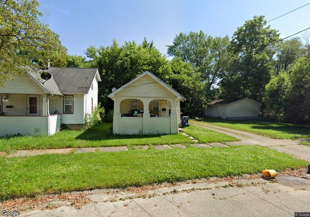
931 Clinton St Flint, MI 48507
South Side NeighborhoodEstimated Value: $47,000 - $58,000
2
Beds
1
Bath
680
Sq Ft
$78/Sq Ft
Est. Value
About This Home
This home is located at 931 Clinton St, Flint, MI 48507 and is currently estimated at $52,706, approximately $77 per square foot. 931 Clinton St is a home located in Genesee County with nearby schools including Neithercut Elementary School, Flint Southwestern Classical Academy, and International Academy of Flint (K-12).
Ownership History
Date
Name
Owned For
Owner Type
Purchase Details
Closed on
Mar 8, 2023
Sold by
Genesee County Land Bank Authority
Bought by
Edwards Kevin
Current Estimated Value
Purchase Details
Closed on
May 31, 2019
Sold by
The Genesee County Land Bank Authority
Bought by
Edwards Kevin
Purchase Details
Closed on
Dec 18, 2018
Sold by
Cherry Deborah L
Bought by
Genesee County Land Bank Authority
Purchase Details
Closed on
Dec 12, 2007
Sold by
Woodell Brian
Bought by
Us Bank Na and Wachovia Bank Na
Purchase Details
Closed on
Aug 18, 2004
Sold by
Martin Daniel and Martin Melissa Ann
Bought by
Woodell Brian
Home Financials for this Owner
Home Financials are based on the most recent Mortgage that was taken out on this home.
Original Mortgage
$58,400
Interest Rate
8.2%
Mortgage Type
Purchase Money Mortgage
Create a Home Valuation Report for This Property
The Home Valuation Report is an in-depth analysis detailing your home's value as well as a comparison with similar homes in the area
Home Values in the Area
Average Home Value in this Area
Purchase History
| Date | Buyer | Sale Price | Title Company |
|---|---|---|---|
| Edwards Kevin | $8,000 | None Listed On Document | |
| Edwards Kevin | $8,000 | None Available | |
| Genesee County Land Bank Authority | -- | None Available | |
| Us Bank Na | $69,761 | None Available | |
| Woodell Brian | $73,000 | Centennial Title Insurance A |
Source: Public Records
Mortgage History
| Date | Status | Borrower | Loan Amount |
|---|---|---|---|
| Previous Owner | Woodell Brian | $58,400 | |
| Closed | Woodell Brian | $14,600 | |
| Closed | Edwards Kevin | $0 |
Source: Public Records
Tax History
| Year | Tax Paid | Tax Assessment Tax Assessment Total Assessment is a certain percentage of the fair market value that is determined by local assessors to be the total taxable value of land and additions on the property. | Land | Improvement |
|---|---|---|---|---|
| 2025 | $1,115 | $21,100 | $0 | $0 |
| 2024 | $1,005 | $22,300 | $0 | $0 |
| 2023 | $985 | $17,800 | $0 | $0 |
| 2022 | $0 | $15,200 | $0 | $0 |
| 2021 | $1,027 | $14,000 | $0 | $0 |
| 2020 | $931 | $14,000 | $0 | $0 |
| 2019 | $941 | $0 | $0 | $0 |
| 2018 | $973 | $11,600 | $0 | $0 |
| 2017 | $948 | $0 | $0 | $0 |
| 2016 | $941 | $0 | $0 | $0 |
| 2015 | -- | $0 | $0 | $0 |
| 2014 | -- | $0 | $0 | $0 |
| 2012 | -- | $13,300 | $0 | $0 |
Source: Public Records
Map
Nearby Homes
- 912 Huron St
- 1015 Alvord Ave
- 845 Alvord Ave
- 925 Leland St
- 805 Alvord Ave
- 806 Alvord Ave
- 1125 Ingleside Ave
- 3902 Brunswick Ave
- 842 Leland St
- 1122 Markham St
- 846 W Hemphill Rd
- 1028 Campbell St
- 1210 Pinehurst Ave
- 1234 Huron St
- 822 Campbell St
- 1310 Huron St
- 1310 Alvord Ave
- 1318 Ingleside Ave
- 713 Leland St
- 1130 W Atherton Rd
Your Personal Tour Guide
Ask me questions while you tour the home.