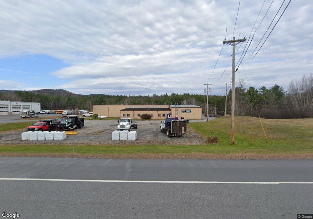
931 John Stark Hwy Newport, NH 03773
Estimated Value: $1,340,943
--
Bed
2
Baths
19,555
Sq Ft
$69/Sq Ft
Est. Value
About This Home
This home is located at 931 John Stark Hwy, Newport, NH 03773 and is currently estimated at $1,340,943, approximately $68 per square foot. 931 John Stark Hwy is a home located in Sullivan County with nearby schools including Richards Elementary School, Newport High School, and Newport Montessori School.
Ownership History
Date
Name
Owned For
Owner Type
Purchase Details
Closed on
Apr 30, 2010
Sold by
Pollution Research & D
Bought by
Krystal Management Llc
Current Estimated Value
Home Financials for this Owner
Home Financials are based on the most recent Mortgage that was taken out on this home.
Original Mortgage
$240,000
Interest Rate
4.99%
Mortgage Type
Commercial
Create a Home Valuation Report for This Property
The Home Valuation Report is an in-depth analysis detailing your home's value as well as a comparison with similar homes in the area
Home Values in the Area
Average Home Value in this Area
Purchase History
| Date | Buyer | Sale Price | Title Company |
|---|---|---|---|
| Krystal Management Llc | $600,000 | -- |
Source: Public Records
Mortgage History
| Date | Status | Borrower | Loan Amount |
|---|---|---|---|
| Open | Krystal Management Llc | $505,000 | |
| Closed | Krystal Management Llc | $240,000 |
Source: Public Records
Tax History Compared to Growth
Tax History
| Year | Tax Paid | Tax Assessment Tax Assessment Total Assessment is a certain percentage of the fair market value that is determined by local assessors to be the total taxable value of land and additions on the property. | Land | Improvement |
|---|---|---|---|---|
| 2024 | $16,271 | $669,300 | $218,000 | $451,300 |
| 2023 | $16,346 | $693,200 | $218,000 | $475,200 |
| 2022 | $14,488 | $693,200 | $218,000 | $475,200 |
| 2021 | $16,533 | $501,000 | $84,000 | $417,000 |
| 2020 | $16,583 | $501,000 | $84,000 | $417,000 |
| 2019 | $16,298 | $501,000 | $84,000 | $417,000 |
| 2018 | $15,230 | $501,000 | $84,000 | $417,000 |
| 2017 | $15,050 | $501,000 | $84,000 | $417,000 |
| 2016 | $13,902 | $483,900 | $90,800 | $393,100 |
| 2015 | $14,154 | $483,900 | $90,800 | $393,100 |
| 2014 | $15,311 | $483,900 | $90,800 | $393,100 |
| 2013 | $14,275 | $476,000 | $90,800 | $385,200 |
Source: Public Records
Map
Nearby Homes
- 736 John Stark Hwy
- 300 E Green Mountain Rd
- 381 E Green Mountain Rd
- 680-2 John Stark Hwy
- 430 John Stark Hwy
- 342 E Green Mountain Rd
- 00 E Green Mountain Rd Unit 13
- 003 E Green Mountain Rd
- 002 E Green Mountain Rd
- 001 E Green Mountain Rd
- 225 Sugar River Dr
- 98 & 102 Washington St
- 128 Roberts Hill Rd
- 44 Petrin Heights Rd
- 0 Cat Hole Rd Unit 5052634
- 0 Off First St Unit 60
- 87 Old Chandlers Mills Rd
- 223 Chestnut St
- 146 Elm St
- 12 4th St
- 939 John Stark Hwy
- 940 John Stark Hwy Unit Front
- 958 John Stark Hwy
- 959 John Stark Hwy
- 21 Mcdonough Rd
- 3 Mcdonough Rd
- 880 John Stark Hwy
- 877 John Stark Hwy
- 24 Mcdonough Rd
- 876 John Stark Hwy
- 2 Mcdonough Rd
- 868 John Stark Hwy
- 2 John Stark Hwy
- 16 Mcdonough Rd
- 1005 John Stark Hwy
- 1005 John Stark Hwy
- 50 Mcdonough Rd
- 4 John Stark Hwy
- 862 John Stark Hwy
- 73 Mcdonough Rd