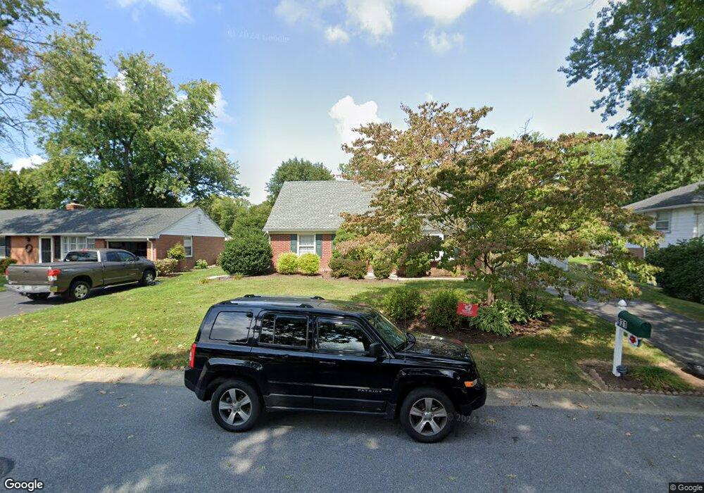
931 Sherry Ln Lancaster, PA 17601
Oyster Point NeighborhoodEstimated Value: $315,000 - $370,000
3
Beds
2
Baths
1,365
Sq Ft
$248/Sq Ft
Est. Value
About This Home
This home is located at 931 Sherry Ln, Lancaster, PA 17601 and is currently estimated at $338,685, approximately $248 per square foot. 931 Sherry Ln is a home located in Lancaster County with nearby schools including Centerville Elementary School, Centerville Middle School, and Hempfield Senior High School.
Ownership History
Date
Name
Owned For
Owner Type
Purchase Details
Closed on
May 13, 2010
Sold by
Cartus Financial Corporation
Bought by
Applegate William
Current Estimated Value
Home Financials for this Owner
Home Financials are based on the most recent Mortgage that was taken out on this home.
Original Mortgage
$114,300
Outstanding Balance
$77,283
Interest Rate
5.23%
Mortgage Type
New Conventional
Estimated Equity
$261,402
Purchase Details
Closed on
Mar 31, 2010
Sold by
Padelsky John D and Sears Amy L
Bought by
Cartus Financial Corporation
Home Financials for this Owner
Home Financials are based on the most recent Mortgage that was taken out on this home.
Original Mortgage
$114,300
Outstanding Balance
$77,283
Interest Rate
5.23%
Mortgage Type
New Conventional
Estimated Equity
$261,402
Purchase Details
Closed on
Dec 24, 2009
Sold by
Padelsky John D and Padelsky Yvonne M
Bought by
Padelsky John D
Create a Home Valuation Report for This Property
The Home Valuation Report is an in-depth analysis detailing your home's value as well as a comparison with similar homes in the area
Home Values in the Area
Average Home Value in this Area
Purchase History
| Date | Buyer | Sale Price | Title Company |
|---|---|---|---|
| Applegate William | $142,900 | None Available | |
| Cartus Financial Corporation | $158,500 | None Available | |
| Padelsky John D | -- | None Available |
Source: Public Records
Mortgage History
| Date | Status | Borrower | Loan Amount |
|---|---|---|---|
| Open | Applegate William | $114,300 |
Source: Public Records
Tax History Compared to Growth
Tax History
| Year | Tax Paid | Tax Assessment Tax Assessment Total Assessment is a certain percentage of the fair market value that is determined by local assessors to be the total taxable value of land and additions on the property. | Land | Improvement |
|---|---|---|---|---|
| 2025 | $3,581 | $165,700 | $54,500 | $111,200 |
| 2024 | $3,581 | $165,700 | $54,500 | $111,200 |
| 2023 | $3,509 | $165,700 | $54,500 | $111,200 |
| 2022 | $3,413 | $165,700 | $54,500 | $111,200 |
| 2021 | $3,358 | $165,700 | $54,500 | $111,200 |
| 2020 | $3,358 | $165,700 | $54,500 | $111,200 |
| 2019 | $3,301 | $165,700 | $54,500 | $111,200 |
| 2018 | $650 | $165,700 | $54,500 | $111,200 |
| 2017 | $3,193 | $126,800 | $38,100 | $88,700 |
| 2016 | $3,193 | $126,800 | $38,100 | $88,700 |
| 2015 | $641 | $126,800 | $38,100 | $88,700 |
| 2014 | $2,343 | $126,800 | $38,100 | $88,700 |
Source: Public Records
Map
Nearby Homes
- 880 Corvair Rd
- 916 Dorsea Rd
- 695 Imperial Dr
- 854 Centerville Rd
- 2827 Michener Dr
- 2778 Spring Valley Rd
- 2940 Marietta Ave
- 3 Spring Walk Ct
- 9 Spring Walk Ct
- 660 Lawrence Blvd Unit DEVONSHIRE
- 660 Lawrence Blvd Unit MAGNOLIA
- 660 Lawrence Blvd Unit ADDISON
- 660 Lawrence Blvd Unit LACHLAN
- 660 Lawrence Blvd Unit COVINGTON
- 660 Lawrence Blvd Unit ARCADIA
- 660 Lawrence Blvd Unit PARKER
- Kipling Plan at Enclave at Independence Ridge
- Woodford Plan at Enclave at Independence Ridge
- Magnolia Plan at Enclave at Independence Ridge
- Sebastian Plan at Enclave at Independence Ridge
- 925 Sherry Ln
- 937 Sherry Ln
- 919 Sherry Ln
- 943 Sherry Ln
- 2860 Spring Valley Rd
- 2860 Spring Valley Rd
- 2868 Spring Valley Rd
- 936 Sherry Ln
- 2856 Spring Valley Rd
- 2856 Spring Valley Rd
- 913 Sherry Ln
- 924 Sherry Ln
- 930 Sherry Ln
- 2874 Spring Valley Rd
- 949 Sherry Ln
- 918 Sherry Ln
- 942 Sherry Ln
- 912 Sherry Ln
- 907 Sherry Ln
- 930 Corvair Rd