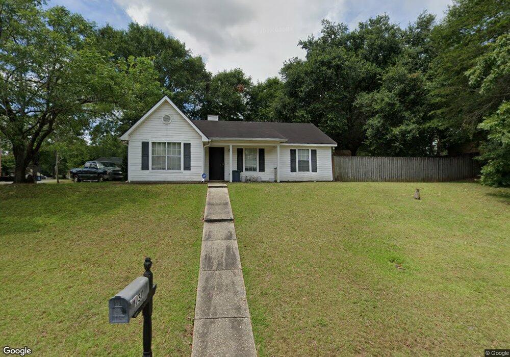
9311 Burnt Tree Dr Mobile, AL 36695
Baker NeighborhoodEstimated Value: $173,567 - $205,000
3
Beds
2
Baths
1,211
Sq Ft
$154/Sq Ft
Est. Value
About This Home
This home is located at 9311 Burnt Tree Dr, Mobile, AL 36695 and is currently estimated at $186,892, approximately $154 per square foot. 9311 Burnt Tree Dr is a home located in Mobile County with nearby schools including Elsie Collier Elementary School, Bernice J Causey Middle School, and Baker High School.
Ownership History
Date
Name
Owned For
Owner Type
Purchase Details
Closed on
May 26, 2015
Sold by
Payne William and Payne Victoria L
Bought by
Lambert Christopher L
Current Estimated Value
Home Financials for this Owner
Home Financials are based on the most recent Mortgage that was taken out on this home.
Original Mortgage
$104,080
Outstanding Balance
$82,219
Interest Rate
4.4%
Mortgage Type
FHA
Estimated Equity
$104,673
Purchase Details
Closed on
Jul 25, 2011
Sold by
Little James and Little Kym
Bought by
Payne William and Payne Victoria I
Home Financials for this Owner
Home Financials are based on the most recent Mortgage that was taken out on this home.
Original Mortgage
$99,901
Interest Rate
4.5%
Mortgage Type
FHA
Purchase Details
Closed on
Nov 14, 2001
Sold by
Leonard Charles Travis and Leonard Angela M
Bought by
Little James and Little Kym
Home Financials for this Owner
Home Financials are based on the most recent Mortgage that was taken out on this home.
Original Mortgage
$75,050
Interest Rate
6.57%
Purchase Details
Closed on
Jan 30, 1998
Sold by
Colvin Steven C and Colvin Cynthia J
Bought by
Leonard Charles Travis and Leonard Angela M
Home Financials for this Owner
Home Financials are based on the most recent Mortgage that was taken out on this home.
Original Mortgage
$72,462
Interest Rate
7.07%
Mortgage Type
FHA
Create a Home Valuation Report for This Property
The Home Valuation Report is an in-depth analysis detailing your home's value as well as a comparison with similar homes in the area
Home Values in the Area
Average Home Value in this Area
Purchase History
| Date | Buyer | Sale Price | Title Company |
|---|---|---|---|
| Lambert Christopher L | $106,000 | None Available | |
| Payne William | $102,901 | Dst | |
| Little James | -- | -- | |
| Leonard Charles Travis | -- | -- |
Source: Public Records
Mortgage History
| Date | Status | Borrower | Loan Amount |
|---|---|---|---|
| Open | Lambert Christopher L | $104,080 | |
| Previous Owner | Payne William | $99,901 | |
| Previous Owner | Little James | $75,050 | |
| Previous Owner | Leonard Charles Travis | $72,462 |
Source: Public Records
Tax History Compared to Growth
Tax History
| Year | Tax Paid | Tax Assessment Tax Assessment Total Assessment is a certain percentage of the fair market value that is determined by local assessors to be the total taxable value of land and additions on the property. | Land | Improvement |
|---|---|---|---|---|
| 2024 | $678 | $13,000 | $3,000 | $10,000 |
| 2023 | $634 | $11,320 | $3,300 | $8,020 |
| 2022 | $432 | $10,270 | $3,000 | $7,270 |
| 2021 | $435 | $10,350 | $2,400 | $7,950 |
| 2020 | $435 | $10,350 | $2,400 | $7,950 |
| 2019 | $434 | $10,320 | $0 | $0 |
| 2018 | $397 | $9,560 | $0 | $0 |
| 2017 | $471 | $9,640 | $0 | $0 |
| 2016 | $417 | $9,980 | $0 | $0 |
| 2013 | -- | $9,200 | $0 | $0 |
Source: Public Records
Map
Nearby Homes
- 9425 Yorktowne Way
- 9410 Ashwood Ct
- 1111 Valley View Ct
- 0 New Neck Rd Unit 387066
- 9556 Bridgeton Ct
- 0 Twelve Oaks Dr Unit 7603591
- 11905 Airport Blvd
- 11905 Airport Blvd Unit 3
- 8880 Ohara Dr
- 821 Copperfield Dr W
- 791 Copperfield Dr W
- 860 Trailwood Dr E
- 781 Copperfield Dr W
- 790 Hale Rd
- 750 Hale Rd
- 1675 Stonebridge Ct
- 789 Royal Woods Dr W Unit 7
- 1519 Vassar Ct
- 9751 Pine Knoll Rd
- 8712 Fangorn Rd
- 9321 Burnt Tree Dr
- 1260 Woodstock Ct
- 9281 Burnt Tree Dr
- 9310 Burnt Tree Dr
- 1270 Woodstock Ct
- 9300 Burnt Tree Dr
- 9320 Burnt Tree Dr
- 9331 Burnt Tree Dr
- 1251 Comstock Ct
- 1271 Woodstock Ct
- 9290 Burnt Tree Dr
- 9330 Burnt Tree Dr
- 1280 Woodstock Ct
- 9271 Burnt Tree Dr
- 1271 Comstock Ct
- 1281 Woodstock Ct
- 9280 Burnt Tree Dr
- 9283 Maplewood Dr
- 9295 Maplewood Dr
- 9275 Maplewood Dr