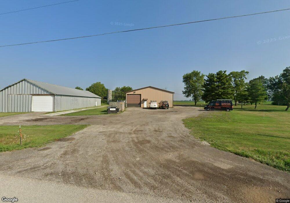
9311 State Route 762 Orient, OH 43146
Estimated Value: $174,901
--
Bed
--
Bath
4,712
Sq Ft
$37/Sq Ft
Est. Value
About This Home
This home is located at 9311 State Route 762, Orient, OH 43146 and is currently estimated at $174,901, approximately $37 per square foot. 9311 State Route 762 is a home located in Pickaway County.
Ownership History
Date
Name
Owned For
Owner Type
Purchase Details
Closed on
Dec 4, 1998
Sold by
Bapst Robert O
Bought by
Bapst Inc
Current Estimated Value
Purchase Details
Closed on
Dec 26, 1996
Sold by
Sherrick Lewis E
Bought by
Bapst Robert O and Bapst L
Home Financials for this Owner
Home Financials are based on the most recent Mortgage that was taken out on this home.
Original Mortgage
$33,000
Interest Rate
7.64%
Mortgage Type
Commercial
Create a Home Valuation Report for This Property
The Home Valuation Report is an in-depth analysis detailing your home's value as well as a comparison with similar homes in the area
Home Values in the Area
Average Home Value in this Area
Purchase History
| Date | Buyer | Sale Price | Title Company |
|---|---|---|---|
| Bapst Inc | $62,000 | -- | |
| Bapst Robert O | $62,000 | -- |
Source: Public Records
Mortgage History
| Date | Status | Borrower | Loan Amount |
|---|---|---|---|
| Previous Owner | Bapst Robert O | $33,000 |
Source: Public Records
Tax History Compared to Growth
Tax History
| Year | Tax Paid | Tax Assessment Tax Assessment Total Assessment is a certain percentage of the fair market value that is determined by local assessors to be the total taxable value of land and additions on the property. | Land | Improvement |
|---|---|---|---|---|
| 2024 | -- | $40,940 | $21,730 | $19,210 |
| 2023 | $1,883 | $40,940 | $21,730 | $19,210 |
| 2022 | $1,568 | $31,860 | $14,350 | $17,510 |
| 2021 | $1,544 | $31,860 | $14,350 | $17,510 |
| 2020 | $1,609 | $31,860 | $14,350 | $17,510 |
| 2019 | $1,444 | $30,200 | $13,630 | $16,570 |
| 2018 | $1,440 | $30,200 | $13,630 | $16,570 |
| 2017 | $1,490 | $30,200 | $13,630 | $16,570 |
| 2016 | $1,410 | $28,610 | $12,510 | $16,100 |
| 2015 | $1,359 | $27,680 | $12,510 | $15,170 |
| 2014 | $1,356 | $27,680 | $12,510 | $15,170 |
| 2013 | $1,374 | $27,680 | $12,510 | $15,170 |
Source: Public Records
Map
Nearby Homes
- 0 Burgett Rd
- 10819 Thrailkill Rd
- 7789 State Route 762
- 11652 Matville Rd
- 0 Scioto-Darby Rd Unit 225032793
- 0 Matville Rd Unit 225036975
- 0 Matville Rd Unit 225031013
- 0 Matville Rd Unit 225030661
- 0 Matville Rd Unit 225030635
- 11044 Coontz Rd
- 186 Red Oak Ct
- 182 Honey Locust Ln
- 169 Chestnut Commons Dr
- 166 Rosewood Loop SE
- 161 Chestnut Estates Dr
- 8143 Snyder Rd
- 9924 Keplar Ford Rd
- 7879 Railroad St
- 7529 Stahl Rd
- 12232 Cleo Rd
- 9291 State Route 762
- 9381 State Route 762
- 10521 Thrailkill Rd
- 10530 Thrailkill Rd
- 10565 Thrailkill Rd
- 9403 State Route 762
- 10560 Thrailkill Rd
- 9425 State Route 762
- 9124 State Route 762
- 9127 State Route 762
- 10621 Thrailkill Rd
- 9419 State Route 762
- 10643 Thrailkill Rd
- 10675 Thrailkill Rd
- 8952 State Route 762
- 10705 Thrailkill Rd
- 10725 Thrailkill Rd
- 8901 State Route 762
- 10755 Thrailkill Rd
- 9641 State Route 762