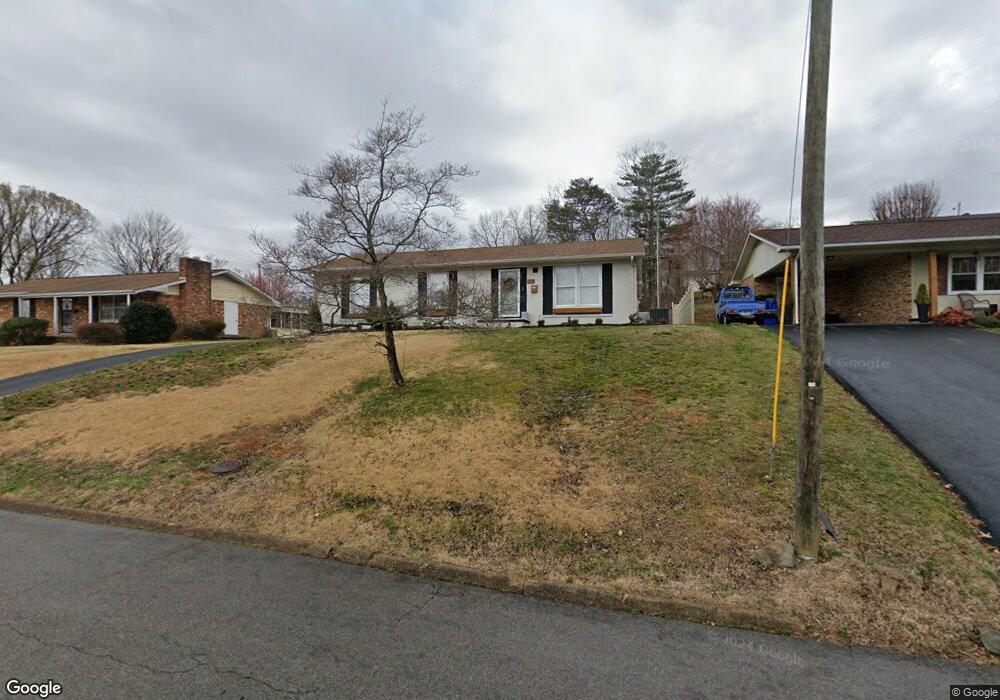
932 Lane Dr Kingsport, TN 37660
Estimated Value: $222,273 - $270,000
--
Bed
2
Baths
1,323
Sq Ft
$184/Sq Ft
Est. Value
About This Home
This home is located at 932 Lane Dr, Kingsport, TN 37660 and is currently estimated at $243,818, approximately $184 per square foot. 932 Lane Dr is a home located in Sullivan County with nearby schools including George Washington Elementary School, John Sevier Middle School, and Ross N. Robinson Middle School.
Ownership History
Date
Name
Owned For
Owner Type
Purchase Details
Closed on
Dec 6, 2021
Sold by
Watson Rhonda S
Bought by
Absher Terra and Absher Christopher
Current Estimated Value
Home Financials for this Owner
Home Financials are based on the most recent Mortgage that was taken out on this home.
Original Mortgage
$168,393
Outstanding Balance
$154,836
Interest Rate
3.09%
Mortgage Type
FHA
Estimated Equity
$88,982
Purchase Details
Closed on
Apr 3, 2014
Sold by
Myers Richard L
Bought by
Watson Rhonda S
Purchase Details
Closed on
Aug 23, 1990
Create a Home Valuation Report for This Property
The Home Valuation Report is an in-depth analysis detailing your home's value as well as a comparison with similar homes in the area
Home Values in the Area
Average Home Value in this Area
Purchase History
| Date | Buyer | Sale Price | Title Company |
|---|---|---|---|
| Absher Terra | $171,500 | Evergreen Ttl & Closing Llc | |
| Watson Rhonda S | $122,000 | -- | |
| -- | $47,500 | -- |
Source: Public Records
Mortgage History
| Date | Status | Borrower | Loan Amount |
|---|---|---|---|
| Open | Absher Terra | $168,393 |
Source: Public Records
Tax History Compared to Growth
Tax History
| Year | Tax Paid | Tax Assessment Tax Assessment Total Assessment is a certain percentage of the fair market value that is determined by local assessors to be the total taxable value of land and additions on the property. | Land | Improvement |
|---|---|---|---|---|
| 2024 | -- | $31,725 | $2,250 | $29,475 |
| 2023 | $1,397 | $31,725 | $2,250 | $29,475 |
| 2022 | $1,397 | $31,725 | $2,250 | $29,475 |
| 2021 | $1,366 | $31,875 | $2,250 | $29,625 |
| 2020 | $769 | $31,875 | $2,250 | $29,625 |
| 2019 | $1,387 | $29,925 | $2,250 | $27,675 |
| 2018 | $1,354 | $29,925 | $2,250 | $27,675 |
| 2017 | $1,354 | $29,925 | $2,250 | $27,675 |
| 2016 | $1,084 | $23,325 | $2,250 | $21,075 |
| 2014 | $1,021 | $23,329 | $0 | $0 |
Source: Public Records
Map
Nearby Homes
- 2137 Hiara Dr
- 2029 Louita Ave
- 2001 Sand St
- 0 Granby Rd Unit 9960138
- 2228 Hall St
- 606 Hollis St
- 2046 Lowell Dr
- 375 Sky S
- 819 Danbury St
- 1950 W Stone Dr
- 1461 Gress Mag Mountain
- 829 Granby Rd
- 805 Granby Rd
- 1244 Stamp Lodge Rd
- 0 Stonegate Rd
- 1249 Stamp Lodge Rd
- 1237 Stamp Lodge Rd
- 1620 Lake St
- 1413 Gress Mag Mountain
- 870 Granby Rd