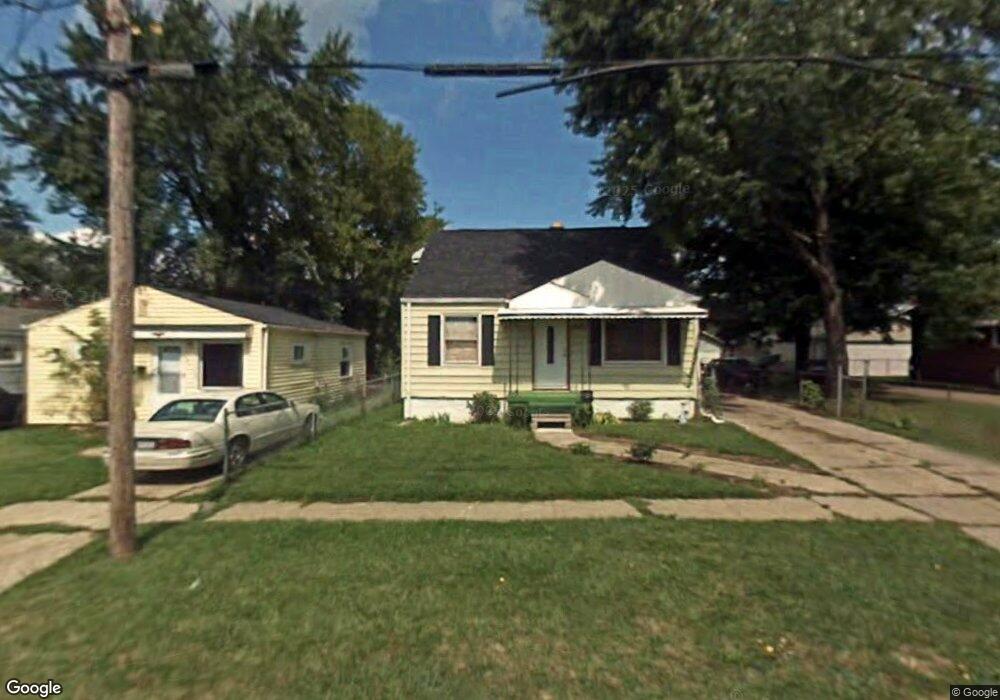
932 Markham St Flint, MI 48507
South Side NeighborhoodEstimated Value: $52,450 - $76,000
3
Beds
1
Bath
984
Sq Ft
$64/Sq Ft
Est. Value
About This Home
This home is located at 932 Markham St, Flint, MI 48507 and is currently estimated at $62,863, approximately $63 per square foot. 932 Markham St is a home located in Genesee County with nearby schools including Neithercut Elementary School, Flint Southwestern Classical Academy, and International Academy of Flint (K-12).
Ownership History
Date
Name
Owned For
Owner Type
Purchase Details
Closed on
Mar 28, 2018
Sold by
Derthick Susan L and Prast Susan L
Bought by
Leopard And Polarbear Properties Llc
Current Estimated Value
Purchase Details
Closed on
Apr 19, 2012
Sold by
Derthick Robert
Bought by
Leopard & Polar Bear Properties
Purchase Details
Closed on
Nov 4, 2011
Sold by
Derthick Robert
Bought by
Leopard & Polar Bear Properties
Purchase Details
Closed on
Oct 22, 2003
Sold by
Matlock Paul and Matlock Terry
Bought by
Prast Susan L
Purchase Details
Closed on
Sep 10, 2003
Sold by
Oller Karolina
Bought by
Matlock Paul
Create a Home Valuation Report for This Property
The Home Valuation Report is an in-depth analysis detailing your home's value as well as a comparison with similar homes in the area
Home Values in the Area
Average Home Value in this Area
Purchase History
| Date | Buyer | Sale Price | Title Company |
|---|---|---|---|
| Leopard And Polarbear Properties Llc | -- | None Available | |
| Leopard & Polar Bear Properties | -- | None Available | |
| Leopard & Polar Bear Properties | -- | None Available | |
| Prast Susan L | $72,000 | Cislo Title Company | |
| Matlock Paul | $53,000 | Cislo Title Company |
Source: Public Records
Tax History
| Year | Tax Paid | Tax Assessment Tax Assessment Total Assessment is a certain percentage of the fair market value that is determined by local assessors to be the total taxable value of land and additions on the property. | Land | Improvement |
|---|---|---|---|---|
| 2025 | $1,199 | $19,900 | $0 | $0 |
| 2024 | $1,079 | $20,600 | $0 | $0 |
| 2023 | $1,056 | $16,700 | $0 | $0 |
| 2022 | $0 | $14,000 | $0 | $0 |
| 2021 | $1,180 | $12,600 | $0 | $0 |
| 2020 | $1,093 | $12,600 | $0 | $0 |
| 2019 | $1,106 | $13,000 | $0 | $0 |
| 2018 | $973 | $11,400 | $0 | $0 |
| 2017 | $948 | $0 | $0 | $0 |
| 2016 | $941 | $0 | $0 | $0 |
| 2015 | -- | $0 | $0 | $0 |
| 2014 | -- | $0 | $0 | $0 |
| 2012 | -- | $14,100 | $0 | $0 |
Source: Public Records
Map
Nearby Homes
- 939 Ingleside Ave
- 846 W Hemphill Rd
- 912 Huron St
- 1122 Markham St
- 1015 Alvord Ave
- 1125 Ingleside Ave
- 845 Alvord Ave
- 1210 Pinehurst Ave
- 805 Alvord Ave
- 806 Alvord Ave
- 1234 Huron St
- 925 Leland St
- 1318 Ingleside Ave
- 1216 E Hemphill Rd
- 1310 Huron St
- 842 Leland St
- 1310 Alvord Ave
- 3902 Brunswick Ave
- 1219 Norton St
- 1028 Campbell St
Your Personal Tour Guide
Ask me questions while you tour the home.