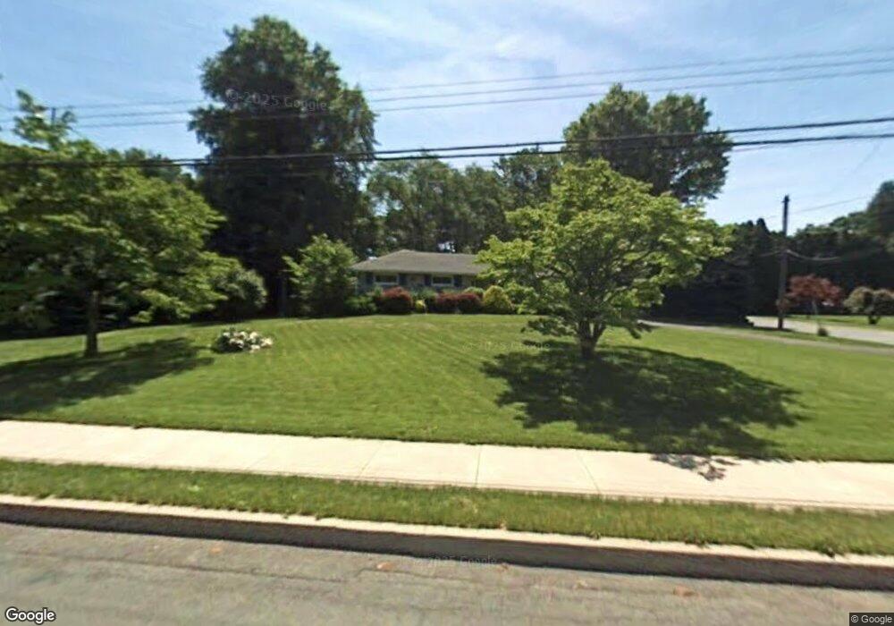
932 Miller Rd Pottstown, PA 19465
North Coventry NeighborhoodEstimated Value: $374,000 - $467,000
3
Beds
2
Baths
1,576
Sq Ft
$262/Sq Ft
Est. Value
About This Home
This home is located at 932 Miller Rd, Pottstown, PA 19465 and is currently estimated at $412,967, approximately $262 per square foot. 932 Miller Rd is a home located in Chester County with nearby schools including North Coventry Elementary School, Owen J Roberts Middle School, and Owen J Roberts High School.
Ownership History
Date
Name
Owned For
Owner Type
Purchase Details
Closed on
Apr 2, 2025
Sold by
Evans Shirley S
Bought by
David Trevor Evans And Shirley Sophie Lukac E and Evans
Current Estimated Value
Purchase Details
Closed on
Oct 12, 1998
Sold by
Lukac Sophie H
Bought by
Evans Shirley S
Create a Home Valuation Report for This Property
The Home Valuation Report is an in-depth analysis detailing your home's value as well as a comparison with similar homes in the area
Home Values in the Area
Average Home Value in this Area
Purchase History
| Date | Buyer | Sale Price | Title Company |
|---|---|---|---|
| David Trevor Evans And Shirley Sophie Lukac E | -- | None Listed On Document | |
| David Trevor Evans And Shirley Sophie Lukac E | -- | None Listed On Document | |
| Evans Shirley S | -- | -- |
Source: Public Records
Tax History Compared to Growth
Tax History
| Year | Tax Paid | Tax Assessment Tax Assessment Total Assessment is a certain percentage of the fair market value that is determined by local assessors to be the total taxable value of land and additions on the property. | Land | Improvement |
|---|---|---|---|---|
| 2025 | $5,828 | $137,600 | $25,910 | $111,690 |
| 2024 | $5,828 | $137,600 | $25,910 | $111,690 |
| 2023 | $5,746 | $137,600 | $25,910 | $111,690 |
| 2022 | $5,628 | $137,600 | $25,910 | $111,690 |
| 2021 | $5,530 | $137,600 | $25,910 | $111,690 |
| 2020 | $5,390 | $137,600 | $25,910 | $111,690 |
| 2019 | $5,291 | $137,600 | $25,910 | $111,690 |
| 2018 | $5,149 | $137,600 | $25,910 | $111,690 |
| 2017 | $5,015 | $137,600 | $25,910 | $111,690 |
| 2016 | $4,236 | $137,600 | $25,910 | $111,690 |
| 2015 | $4,236 | $137,600 | $25,910 | $111,690 |
| 2014 | $4,236 | $137,600 | $25,910 | $111,690 |
Source: Public Records
Map
Nearby Homes
- 1025 Darby Ct
- 1111 Riverside Dr
- 1079 Riverside Dr
- 1027 Riverside Dr
- 28 Wil-Be Dr
- 780 E Cedarville Rd
- 5 N Savanna Dr
- 1145 Industrial Ave
- 537 Schoolhouse Rd
- 1143 Cherry St
- 764 Queen St
- 3 Brower Ln
- 1057 South St
- 1107 South St
- 851 Queen St
- 1116 Queen St
- 1237 South St
- 1239 South St
- 1150 Queen St
- 866 E High St
- 922 Miller Rd
- 1405 Delmar Ave
- 946 Miller Rd
- 1404 E Meadowbrook Rd
- 1412 E Meadowbrook Rd
- 935 Miller Rd
- 1406 Delmar Ave
- 927 Miller Rd
- 956 Miller Rd
- 1417 Delmar Ave
- 941 Miller Rd
- 917 Miller Rd
- 1406 E Meadowbrook Rd
- 1414 E Meadowbrook Rd
- 1410 Delmar Ave
- 951 Miller Rd
- 1422 E Meadowbrook Rd
- 1422 Delmar Ave
- 1435 Delmar Ave
- 959 Miller Rd