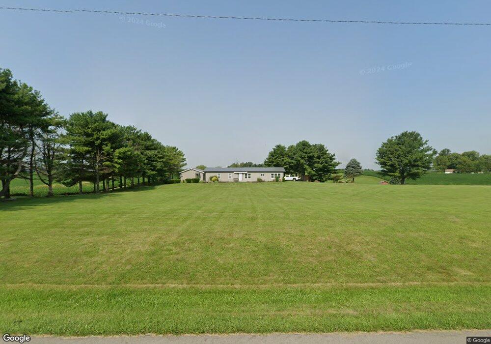
9321 N 25 W Fountaintown, IN 46130
Estimated Value: $321,000 - $368,000
3
Beds
2
Baths
1,809
Sq Ft
$184/Sq Ft
Est. Value
About This Home
This home is located at 9321 N 25 W, Fountaintown, IN 46130 and is currently estimated at $333,161, approximately $184 per square foot. 9321 N 25 W is a home located in Shelby County with nearby schools including Morristown Elementary School and Morristown Junior/Senior High School.
Ownership History
Date
Name
Owned For
Owner Type
Purchase Details
Closed on
Dec 15, 2021
Sold by
Narmore Ralph E and Narmore Rhonda L
Bought by
Narmore Ralph E and Owensby Michelle R
Current Estimated Value
Home Financials for this Owner
Home Financials are based on the most recent Mortgage that was taken out on this home.
Original Mortgage
$179,080
Interest Rate
5.51%
Mortgage Type
FHA
Create a Home Valuation Report for This Property
The Home Valuation Report is an in-depth analysis detailing your home's value as well as a comparison with similar homes in the area
Home Values in the Area
Average Home Value in this Area
Purchase History
| Date | Buyer | Sale Price | Title Company |
|---|---|---|---|
| Narmore Ralph E | -- | Hennessey Law Firm |
Source: Public Records
Mortgage History
| Date | Status | Borrower | Loan Amount |
|---|---|---|---|
| Previous Owner | Narmore Ralph E | $179,080 |
Source: Public Records
Tax History Compared to Growth
Tax History
| Year | Tax Paid | Tax Assessment Tax Assessment Total Assessment is a certain percentage of the fair market value that is determined by local assessors to be the total taxable value of land and additions on the property. | Land | Improvement |
|---|---|---|---|---|
| 2024 | $3,031 | $196,500 | $53,100 | $143,400 |
| 2023 | $3,022 | $191,400 | $53,100 | $138,300 |
| 2022 | $1,616 | $186,200 | $53,100 | $133,100 |
| 2021 | $1,584 | $181,100 | $53,100 | $128,000 |
| 2020 | $1,488 | $176,100 | $53,100 | $123,000 |
| 2019 | $1,302 | $159,500 | $52,500 | $107,000 |
| 2018 | $1,202 | $149,600 | $52,500 | $97,100 |
| 2017 | $1,151 | $149,800 | $52,500 | $97,300 |
| 2016 | $1,124 | $155,900 | $52,500 | $103,400 |
| 2014 | $1,012 | $146,600 | $51,400 | $95,200 |
| 2013 | $1,012 | $142,400 | $50,800 | $91,600 |
Source: Public Records
Map
Nearby Homes
- 256 E 1000 N
- 10686 N Division Rd
- 11131 N State Road 9
- 11497 N State Road 9
- 1744 E 850 N
- 1898 E 1000 N
- 11600 N 100 E
- 83 E Walnut St
- 6 U S 52
- 5 U S 52
- 2903 E Freeport Rd
- 8825 N 300 E
- 8968 N 300 E
- 10812 N Blue River Trail
- 5555 S 200 E
- 10614 N 300 E
- 10618 N 300 E
- 10620 N 300 E
- 11546 N Shelby 300 W
- 0 S 300 East- 2
- 9385 N 25 W
- 9228 N 25 W
- 9401 N 25 W
- 9583 N Division Rd
- 9134 N 25 W
- 0 Division Rd Unit 21586882
- 0 Division Rd Unit 21456022
- 0 Division Rd Unit 21455830
- 0 Division Rd Unit 21455834
- 0 Division Rd Unit 21455701
- 0 N Division Rd Unit 21572814
- 320 Hidden Valley Ct
- 320 Hidden Valley Ct
- 285 Hidden Valley Ct
- 606 W 900 N
- 0 E Hidden Valley Ct Unit 21311358
- 0 E Hidden Valley Ct Unit 21311349
- 600 W 900 N
- 321 W 1000 N
- 399 Hidden Valley Ct