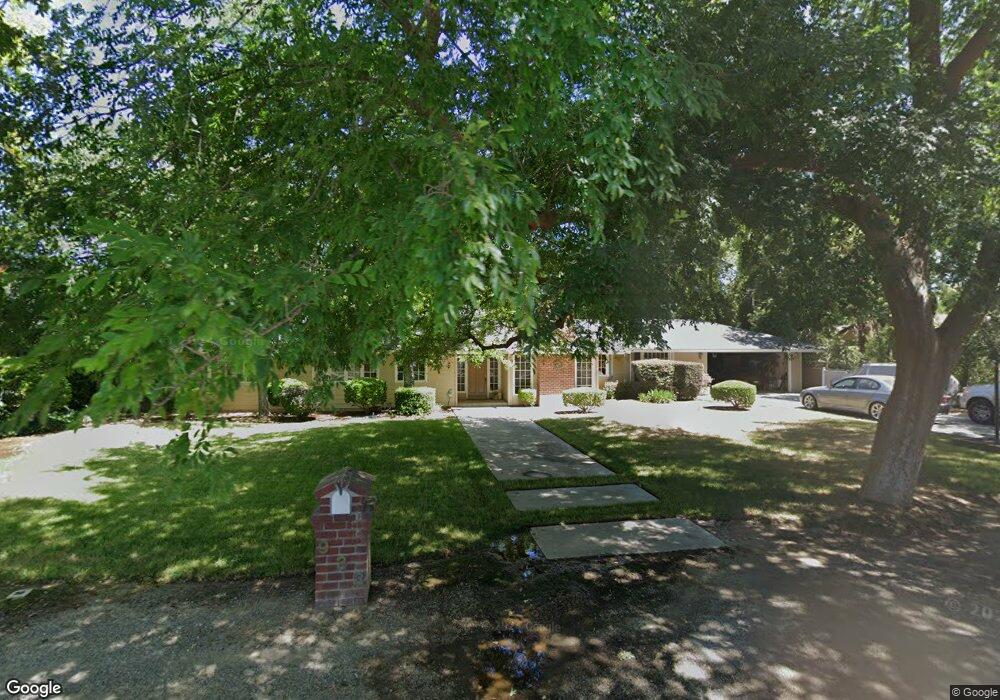
933 E Pico Ave Fresno, CA 93704
Fig Garden NeighborhoodEstimated Value: $589,901 - $617,000
3
Beds
2
Baths
2,183
Sq Ft
$275/Sq Ft
Est. Value
About This Home
This home is located at 933 E Pico Ave, Fresno, CA 93704 and is currently estimated at $599,634, approximately $274 per square foot. 933 E Pico Ave is a home located in Fresno County with nearby schools including Powers-Ginsburg Elementary, Bullard High School, and Endeavor Charter.
Ownership History
Date
Name
Owned For
Owner Type
Purchase Details
Closed on
Sep 11, 1995
Sold by
Eichman Ronald D
Bought by
Ely Tom L and Ely Julianne
Current Estimated Value
Home Financials for this Owner
Home Financials are based on the most recent Mortgage that was taken out on this home.
Original Mortgage
$203,100
Interest Rate
7.92%
Purchase Details
Closed on
Jul 18, 1994
Sold by
Professional Foreclosure Corp
Bought by
Federal Home Loan Mortgage Corporation
Create a Home Valuation Report for This Property
The Home Valuation Report is an in-depth analysis detailing your home's value as well as a comparison with similar homes in the area
Home Values in the Area
Average Home Value in this Area
Purchase History
| Date | Buyer | Sale Price | Title Company |
|---|---|---|---|
| Ely Tom L | $259,000 | Stewart Title | |
| Federal Home Loan Mortgage Corporation | $90,000 | First American Title Ins Co |
Source: Public Records
Mortgage History
| Date | Status | Borrower | Loan Amount |
|---|---|---|---|
| Closed | Ely Tom L | $203,100 |
Source: Public Records
Tax History
| Year | Tax Paid | Tax Assessment Tax Assessment Total Assessment is a certain percentage of the fair market value that is determined by local assessors to be the total taxable value of land and additions on the property. | Land | Improvement |
|---|---|---|---|---|
| 2025 | $5,355 | $430,239 | $66,433 | $363,806 |
| 2023 | $5,046 | $413,534 | $63,854 | $349,680 |
| 2022 | $4,976 | $405,426 | $62,602 | $342,824 |
| 2021 | $4,836 | $397,477 | $61,375 | $336,102 |
| 2020 | $4,816 | $393,402 | $60,746 | $332,656 |
| 2019 | $4,626 | $385,689 | $59,555 | $326,134 |
| 2018 | $4,523 | $378,128 | $58,388 | $319,740 |
| 2017 | $4,444 | $370,715 | $57,244 | $313,471 |
| 2016 | $4,293 | $363,447 | $56,122 | $307,325 |
| 2015 | $4,227 | $357,988 | $55,279 | $302,709 |
| 2014 | $4,144 | $350,977 | $54,197 | $296,780 |
Source: Public Records
Map
Nearby Homes
- 820 E Gettysburg Ave
- 741 E Rialto Ave
- 1216 E Pico Ave
- 1041 E Alamos Ave
- 4564 N Van Ness Blvd
- 1035 E Fairmont Ave
- 705 E Alamos Ave
- 4633 N Glenn Ave
- 4605 N Glenn Ave
- 1448 E Gettysburg Ave
- 4355 N College Ave
- 5075 N College Ave
- 336 E Gettysburg Ave
- 1408 E Richert Ave
- 5082 N Maroa Ave
- 4750 N Palm Ave
- 1541 E Fairmont Ave Unit 103
- 5055 N Wishon Ave Unit A-FIK
- 4872 N Arcade Ave
- 5090 N College Ave Unit 117
- 911 E Pico Ave
- 1011 E Pico Ave
- 936 E Rialto Ave
- 918 E Rialto Ave
- 1010 E Rialto Ave
- 907 E Pico Ave
- 1002 E Pico Ave
- 930 E Pico Ave
- 4680 N Maroa Ave
- 1022 E Pico Ave
- 910 E Pico Ave
- 1041 E Pico Ave
- 0 N Maroa Ave
- 1038 E Rialto Ave
- 1009 E Gettysburg Ave
- 929 E Gettysburg Ave
- 1042 E Pico Ave
- 1019 E Gettysburg Ave
- 909 E Gettysburg Ave
- 4647 N Maroa Ave
Your Personal Tour Guide
Ask me questions while you tour the home.