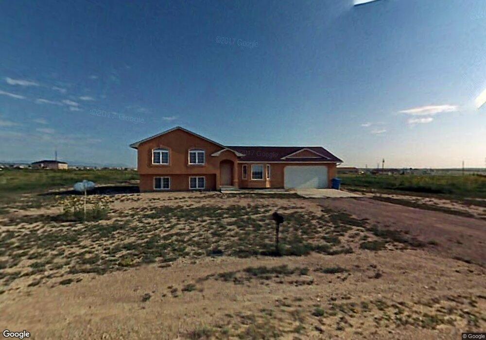
933 E Sandusky Dr Unit 16 Pueblo West, CO 81007
Estimated Value: $405,289 - $437,000
3
Beds
3
Baths
1,416
Sq Ft
$296/Sq Ft
Est. Value
About This Home
This home is located at 933 E Sandusky Dr Unit 16, Pueblo West, CO 81007 and is currently estimated at $419,572, approximately $296 per square foot. 933 E Sandusky Dr Unit 16 is a home located in Pueblo County with nearby schools including Prairie Winds Elementary School, Liberty Point International School, and Pueblo West High School.
Ownership History
Date
Name
Owned For
Owner Type
Purchase Details
Closed on
Jul 21, 2006
Sold by
Kuhn Homes Llc
Bought by
Montoya Dale A and Montoya Ramona G
Current Estimated Value
Home Financials for this Owner
Home Financials are based on the most recent Mortgage that was taken out on this home.
Original Mortgage
$157,500
Outstanding Balance
$93,246
Interest Rate
6.6%
Mortgage Type
Unknown
Estimated Equity
$326,326
Purchase Details
Closed on
Feb 7, 2006
Sold by
Johnson Kurt A and Johnson Debra J
Bought by
Kuhn Homes Llc
Create a Home Valuation Report for This Property
The Home Valuation Report is an in-depth analysis detailing your home's value as well as a comparison with similar homes in the area
Home Values in the Area
Average Home Value in this Area
Purchase History
| Date | Buyer | Sale Price | Title Company |
|---|---|---|---|
| Montoya Dale A | $175,000 | Stewart Title Of Colorado | |
| Kuhn Homes Llc | $15,000 | Stewart Title Of Colorado |
Source: Public Records
Mortgage History
| Date | Status | Borrower | Loan Amount |
|---|---|---|---|
| Open | Montoya Dale A | $157,500 |
Source: Public Records
Tax History Compared to Growth
Tax History
| Year | Tax Paid | Tax Assessment Tax Assessment Total Assessment is a certain percentage of the fair market value that is determined by local assessors to be the total taxable value of land and additions on the property. | Land | Improvement |
|---|---|---|---|---|
| 2024 | $2,618 | $26,100 | -- | -- |
| 2023 | $2,648 | $29,780 | $3,580 | $26,200 |
| 2022 | $2,043 | $20,356 | $2,100 | $18,256 |
| 2021 | $2,094 | $20,940 | $2,160 | $18,780 |
| 2020 | $1,733 | $21,170 | $2,390 | $18,780 |
| 2019 | $1,727 | $17,285 | $608 | $16,677 |
| 2018 | $1,534 | $15,343 | $396 | $14,947 |
| 2017 | $1,536 | $15,343 | $396 | $14,947 |
| 2016 | $1,464 | $14,650 | $637 | $14,013 |
| 2015 | $1,452 | $14,650 | $637 | $14,013 |
| 2014 | $1,335 | $13,462 | $716 | $12,746 |
Source: Public Records
Map
Nearby Homes
- 946 E Walden Dr
- 962 E Sandusky Dr
- 967 E Thorpe Ct
- 958 E Thorpe Ct
- 1171 N Kirkwood Dr
- 1251 N Kirkwood Dr
- 995 E Kirkwood Dr
- 1231 E Kirkwood Dr
- 873 E Linda Ave
- 834 E Bedford Dr
- 1287 N Dailey Dr
- 1319 N Dailey Dr
- 1258 N Kirkwood Dr
- 1288 N Kirkwood Dr
- 1107 N Kirkwood Dr
- 1203 N Gantts Fort Ave
- 1356 N Gantts Fort Ave
- 1396 N Dailey Dr
- 1117 N Matt Dr
- 1186 E Gunpowder Ln
- 933 E Sandusky Dr
- 936 E Sandusky Dr
- 936 E Sandusky Dr Unit 20
- 950 E Sandusky Dr
- 961 E Sandusky Dr
- 961 E Sandusky Dr Unit 14
- 924 E Sandusky Dr Unit 19
- 924 E Sandusky Dr
- 912 E Sandusky Dr Unit 18
- 912 E Sandusky Dr
- 975 E Sandusky Dr Unit 13
- 975 E Sandusky Dr
- 895 E Sandusky Dr
- 892 E Sandusky Dr Unit 17
- 932 E Walden Dr
- 932 E Walden Dr Unit 7
- 946 E Walden Dr Unit 8
- 978 E Sandusky Dr
- 978 E Sandusky Dr Unit 23
- 960 E Walden Dr