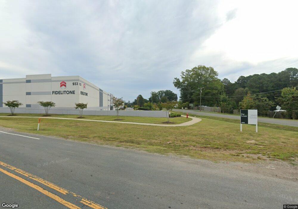
933 Ellis Rd Durham, NC 27703
Campus Hills NeighborhoodEstimated Value: $51,719,696
2
Beds
1
Bath
274,399
Sq Ft
$188/Sq Ft
Est. Value
About This Home
This home is located at 933 Ellis Rd, Durham, NC 27703 and is currently estimated at $51,719,696, approximately $188 per square foot. 933 Ellis Rd is a home located in Durham County with nearby schools including R.N. Harris Elementary School, James E. Shepard Middle School, and Hillside High School.
Ownership History
Date
Name
Owned For
Owner Type
Purchase Details
Closed on
May 3, 2024
Sold by
Sif Ii Tca Ellis Road Development Ventur
Bought by
Egp Ellis Road 1031 Llc
Current Estimated Value
Purchase Details
Closed on
Feb 15, 2021
Sold by
Ray Bridgett Higgins and Ray Randy
Bought by
Sif Ii Tca Ellis Road Dev Ven Llc
Purchase Details
Closed on
Jul 8, 2009
Sold by
Harris Shannon Barbee and Harris David
Bought by
Noel Louise
Create a Home Valuation Report for This Property
The Home Valuation Report is an in-depth analysis detailing your home's value as well as a comparison with similar homes in the area
Home Values in the Area
Average Home Value in this Area
Purchase History
| Date | Buyer | Sale Price | Title Company |
|---|---|---|---|
| Egp Ellis Road 1031 Llc | $53,200,000 | None Listed On Document | |
| Egp Ellis Road 1031 Llc | $53,200,000 | None Listed On Document | |
| Sif Ii Tca Ellis Road Dev Ven Llc | -- | None Available | |
| Sif Ii Tca Ellis Road Dev Ven Llc | $1,050,000 | None Available | |
| Noel Louise | -- | None Available | |
| Higgins Helen B | -- | None Available |
Source: Public Records
Tax History Compared to Growth
Tax History
| Year | Tax Paid | Tax Assessment Tax Assessment Total Assessment is a certain percentage of the fair market value that is determined by local assessors to be the total taxable value of land and additions on the property. | Land | Improvement |
|---|---|---|---|---|
| 2025 | $520,596 | $52,516,451 | $17,888,640 | $34,627,811 |
| 2024 | $444,775 | $31,885,777 | $1,137,501 | $30,748,276 |
| 2023 | $240,276 | $1,219,900 | $1,219,900 | $0 |
| 2022 | $15,613 | $1,219,900 | $1,219,900 | $0 |
| 2021 | $951 | $74,630 | $22,700 | $51,930 |
| 2020 | $928 | $74,630 | $22,700 | $51,930 |
| 2019 | $928 | $74,630 | $22,700 | $51,930 |
| 2018 | $837 | $61,694 | $20,100 | $41,594 |
| 2017 | $831 | $61,694 | $20,100 | $41,594 |
| 2016 | $803 | $61,694 | $20,100 | $41,594 |
| 2015 | $737 | $53,243 | $19,725 | $33,518 |
| 2014 | $737 | $53,243 | $19,725 | $33,518 |
Source: Public Records
Map
Nearby Homes
- 1412 Scholar Dr
- 1202 Ellis Rd
- 1206 Ellis Rd
- 2115 Collier Rd
- 1905 Edgerton Dr
- 2401 Southern Dr
- 3521 Esther Dr
- 3306 Opal Dr
- 3304 Opal Dr
- 3300 Opal Dr
- 2002 Strickland Oak Way
- 1905 Capps St
- 2200 Wyman Place
- 2300 S Alston Ave
- 1811 Capps St
- 511 Commonwealth St
- 3004 Cypress Lagoon Ct
- 2114 Baltic Ave
- 1112 Pate Farm Ln
- 2018 Athens Ave