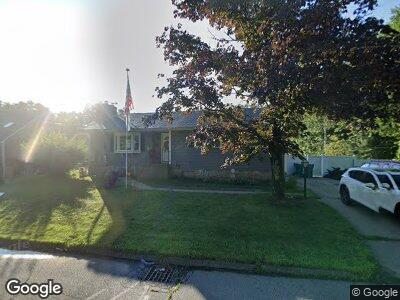
933 Main St Whitinsville, MA 01588
Estimated Value: $420,000 - $473,000
2
Beds
2
Baths
1,204
Sq Ft
$366/Sq Ft
Est. Value
About This Home
This home is located at 933 Main St, Whitinsville, MA 01588 and is currently estimated at $440,254, approximately $365 per square foot. 933 Main St is a home located in Worcester County with nearby schools including Northbridge Elementary School, Northbridge Middle School, and Northbridge High School.
Ownership History
Date
Name
Owned For
Owner Type
Purchase Details
Closed on
Sep 26, 2008
Sold by
Cove James R and Fletcher Lisa A
Bought by
Deorsey Michael and Deorsey Stacey
Current Estimated Value
Home Financials for this Owner
Home Financials are based on the most recent Mortgage that was taken out on this home.
Original Mortgage
$240,620
Interest Rate
6.57%
Mortgage Type
Purchase Money Mortgage
Purchase Details
Closed on
Sep 5, 2003
Sold by
Brooks Joan and Brooks Joseph H
Bought by
Cove James R and Fletcher Lisa A
Home Financials for this Owner
Home Financials are based on the most recent Mortgage that was taken out on this home.
Original Mortgage
$77,500
Interest Rate
6.02%
Mortgage Type
Purchase Money Mortgage
Create a Home Valuation Report for This Property
The Home Valuation Report is an in-depth analysis detailing your home's value as well as a comparison with similar homes in the area
Home Values in the Area
Average Home Value in this Area
Purchase History
| Date | Buyer | Sale Price | Title Company |
|---|---|---|---|
| Deorsey Michael | $245,000 | -- | |
| Deorsey Michael | $245,000 | -- | |
| Cove James R | $65,000 | -- | |
| Cove James R | $65,000 | -- |
Source: Public Records
Mortgage History
| Date | Status | Borrower | Loan Amount |
|---|---|---|---|
| Open | Deorsey Stacey | $221,000 | |
| Closed | Brooks Joseph | $240,798 | |
| Closed | Deorsey Michael | $240,620 | |
| Previous Owner | Cove James R | $77,500 | |
| Previous Owner | Brooks Joseph | $85,000 |
Source: Public Records
Tax History Compared to Growth
Tax History
| Year | Tax Paid | Tax Assessment Tax Assessment Total Assessment is a certain percentage of the fair market value that is determined by local assessors to be the total taxable value of land and additions on the property. | Land | Improvement |
|---|---|---|---|---|
| 2025 | $4,604 | $390,500 | $139,500 | $251,000 |
| 2024 | $4,448 | $367,900 | $139,500 | $228,400 |
| 2023 | $4,498 | $347,100 | $132,200 | $214,900 |
| 2022 | $4,127 | $299,700 | $101,700 | $198,000 |
| 2021 | $3,892 | $255,600 | $96,900 | $158,700 |
| 2020 | $3,450 | $249,300 | $96,900 | $152,400 |
| 2019 | $3,712 | $241,500 | $96,900 | $144,600 |
| 2018 | $2,983 | $230,500 | $92,200 | $138,300 |
| 2017 | $2,991 | $221,100 | $92,200 | $128,900 |
| 2016 | $2,767 | $201,200 | $79,100 | $122,100 |
| 2015 | $2,692 | $201,200 | $79,100 | $122,100 |
| 2014 | $2,668 | $201,200 | $79,100 | $122,100 |
Source: Public Records
Map
Nearby Homes
- 81 Prentice Rd
- 80 Barnett Rd
- 39 C St
- 14 Virginia Ave
- 24 Barnett Rd
- 35 B St Unit 35
- 68 Lackey Dam Rd
- 2 A St Unit 2
- 87 N Main St Unit 87
- 9 Bayliss Way
- 70 Fairlawn St
- 8 Hough Rd
- 8 Bayliss Way
- 22 Bayliss Way
- 26 Bayliss Way
- 258-260 Main St
- 14 Whitin Ave Unit 14
- 29 Nautical Way Unit 105
- 25 Nautical Way Unit 103
- 27 Nautical Way Unit 104