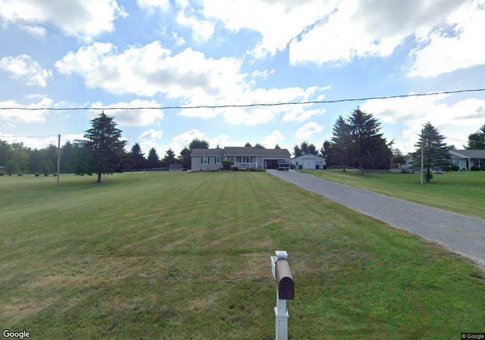
9331 N Adrian Hwy Tecumseh, MI 49286
Estimated Value: $308,013 - $362,000
--
Bed
--
Bath
1,196
Sq Ft
$275/Sq Ft
Est. Value
About This Home
This home is located at 9331 N Adrian Hwy, Tecumseh, MI 49286 and is currently estimated at $329,004, approximately $275 per square foot. 9331 N Adrian Hwy is a home located in Lenawee County with nearby schools including Patterson Elementary School, Tecumseh Middle School, and Tecumseh High School.
Ownership History
Date
Name
Owned For
Owner Type
Purchase Details
Closed on
Nov 10, 2008
Sold by
Dade Gwendolyn A
Bought by
Funchion Timothy and Dade Gwendolyn A
Current Estimated Value
Home Financials for this Owner
Home Financials are based on the most recent Mortgage that was taken out on this home.
Original Mortgage
$146,927
Outstanding Balance
$95,825
Interest Rate
5.95%
Mortgage Type
FHA
Estimated Equity
$233,179
Purchase Details
Closed on
Mar 14, 2007
Sold by
Crawford Daniel S and Crawford Barbara Y
Bought by
Dade Gwendolyn A
Create a Home Valuation Report for This Property
The Home Valuation Report is an in-depth analysis detailing your home's value as well as a comparison with similar homes in the area
Home Values in the Area
Average Home Value in this Area
Purchase History
| Date | Buyer | Sale Price | Title Company |
|---|---|---|---|
| Funchion Timothy | -- | None Available | |
| Dade Gwendolyn A | $172,000 | American Title Insurance Co |
Source: Public Records
Mortgage History
| Date | Status | Borrower | Loan Amount |
|---|---|---|---|
| Open | Funchion Timothy | $146,927 |
Source: Public Records
Tax History Compared to Growth
Tax History
| Year | Tax Paid | Tax Assessment Tax Assessment Total Assessment is a certain percentage of the fair market value that is determined by local assessors to be the total taxable value of land and additions on the property. | Land | Improvement |
|---|---|---|---|---|
| 2025 | $2,681 | $139,500 | $0 | $0 |
| 2024 | $1,928 | $143,100 | $0 | $0 |
| 2023 | $2,577 | $118,800 | $0 | $0 |
| 2022 | $2,177 | $117,400 | $0 | $0 |
| 2021 | $2,837 | $110,500 | $0 | $0 |
| 2020 | $2,804 | $97,400 | $0 | $0 |
| 2019 | $264,229 | $110,200 | $0 | $0 |
| 2018 | $2,685 | $104,170 | $0 | $0 |
| 2017 | $2,657 | $106,204 | $0 | $0 |
| 2016 | $2,568 | $105,973 | $0 | $0 |
| 2014 | -- | $102,417 | $0 | $0 |
Source: Public Records
Map
Nearby Homes
- 1251 E Monroe Rd
- 9000 Matthews Hwy
- 2003 E M-50 Hwy
- 1351 Taylor Rd
- 2905 E Munger Rd
- 9402 Pleasant Dr
- 0 BLK Pleasant Dr
- Integrity 2280 Plan at Indian Hills
- 410 Settlers Cove
- 11481 N Adrian Hwy
- 700 Blk N Occidental Rd
- 681 Ridge Ln
- 609 Red Maple Dr
- 609 Hickory Ridge Dr
- 1203 Carriage Dr
- 1000 Dinius Rd Unit 1000 Blk.
- 609 Pequot Way
- 9200 Walnut Dr
- 1510 Fox Run
- 9410 Newburg Ct
- 9317 N Adrian Hwy
- 9345 N Adrian Hwy
- 9303 N Adrian Hwy
- 9295 N Adrian Hwy
- 9382 N Adrian Hwy
- 9382 N Adrian Hwy Unit Moulton Lane
- 9287 N Adrian Hwy
- 9350 N Adrian Hwy
- 9350 N Adrian Hwy Unit Moulton Lane
- 9344 N Adrian Hwy
- 9411 N Adrian Hwy
- 9500 N Adrian Hwy
- 9760 N Adrian Hwy
- 9358 Moulton Ln Unit 9358 N. Adrian Hwy
- 9185 N Adrian Hwy
- 9362 N Moulton Ln
- 9107 N Adrian Hwy
- 9515 N Adrian Hwy
- 1237 E Munger Rd
- 9675 N Adrian Hwy