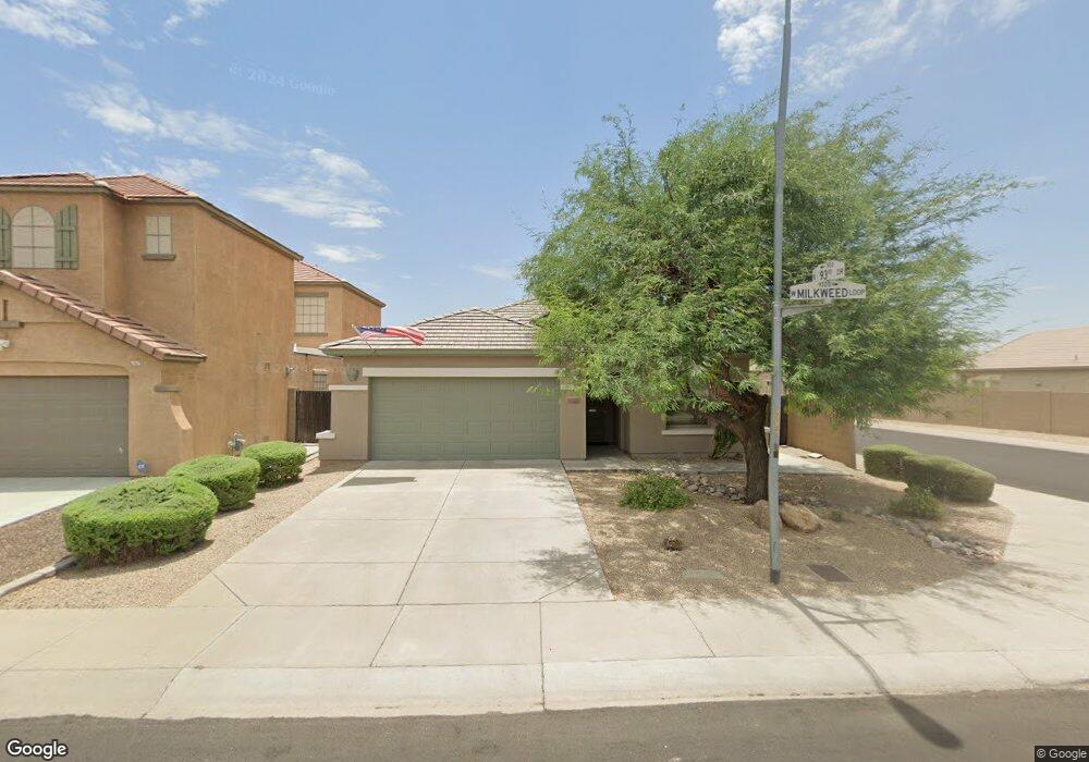
9337 W Milkweed Loop Phoenix, AZ 85037
Estimated Value: $371,820 - $424,000
4
Beds
2
Baths
1,769
Sq Ft
$223/Sq Ft
Est. Value
About This Home
This home is located at 9337 W Milkweed Loop, Phoenix, AZ 85037 and is currently estimated at $394,455, approximately $222 per square foot. 9337 W Milkweed Loop is a home located in Maricopa County with nearby schools including Sheely Farms Elementary School, Tolleson Union High School, and Pan-American Charter School.
Ownership History
Date
Name
Owned For
Owner Type
Purchase Details
Closed on
Jun 16, 2014
Sold by
Cash Rodney D and Cash Gail M
Bought by
The Cash Family Trust and Cash Gail M
Current Estimated Value
Purchase Details
Closed on
Dec 23, 2003
Sold by
Pulte Homes Inc
Bought by
Cash Rodney D and Cash Gail M
Home Financials for this Owner
Home Financials are based on the most recent Mortgage that was taken out on this home.
Original Mortgage
$63,000
Outstanding Balance
$29,050
Interest Rate
5.81%
Mortgage Type
New Conventional
Estimated Equity
$365,405
Create a Home Valuation Report for This Property
The Home Valuation Report is an in-depth analysis detailing your home's value as well as a comparison with similar homes in the area
Purchase History
| Date | Buyer | Sale Price | Title Company |
|---|---|---|---|
| The Cash Family Trust | -- | None Available | |
| Cash Rodney D | $172,080 | Transnation Title Ins Co |
Source: Public Records
Mortgage History
| Date | Status | Borrower | Loan Amount |
|---|---|---|---|
| Open | Cash Rodney D | $63,000 |
Source: Public Records
Tax History
| Year | Tax Paid | Tax Assessment Tax Assessment Total Assessment is a certain percentage of the fair market value that is determined by local assessors to be the total taxable value of land and additions on the property. | Land | Improvement |
|---|---|---|---|---|
| 2025 | $1,690 | $12,549 | -- | -- |
| 2024 | $1,500 | $11,951 | -- | -- |
| 2023 | $1,500 | $26,470 | $5,290 | $21,180 |
| 2022 | $1,444 | $20,130 | $4,020 | $16,110 |
| 2021 | $1,383 | $19,400 | $3,880 | $15,520 |
| 2020 | $1,345 | $17,560 | $3,510 | $14,050 |
| 2019 | $1,345 | $16,030 | $3,200 | $12,830 |
| 2018 | $1,217 | $14,720 | $2,940 | $11,780 |
| 2017 | $1,087 | $12,320 | $2,460 | $9,860 |
| 2016 | $1,029 | $11,880 | $2,370 | $9,510 |
| 2015 | $988 | $10,980 | $2,190 | $8,790 |
Source: Public Records
Map
Nearby Homes
- 9422 W Palm Ln
- 9418 W Eaton Rd
- 9407 W Eaton Rd
- 8949 W Hubbell St
- 2218 N 91st Ln
- 8922 W Monte Vista Rd
- 1802 N 89th Ave
- 9419 W Virginia Ave
- 9427 W Virginia Ave
- 8838 W Encanto Blvd
- 8837 W Virginia Ave
- 2705 N 90th Ave
- 8709 W Vernon Ave
- 9553 W Verde Ln
- 8565 W Monte Vista Rd
- 8807 W Christa Way
- 9152 W Garfield St
- 10773 W Baden St
- 711 N 95th Dr
- 9715 W Catalina Dr
- 9333 W Milkweed Loop
- 9329 W Milkweed Loop
- 9341 W Milkweed Loop
- 9266 W Berkeley Rd
- 9262 W Berkeley Rd
- 9258 W Berkeley Rd
- 9302 W Berkeley Rd
- 9325 W Milkweed Loop
- 9345 W Milkweed Loop
- 9336 W Milkweed Loop
- 9332 W Milkweed Loop
- 9254 W Berkeley Rd
- 9306 W Berkeley Rd
- 9328 W Milkweed Loop
- 9321 W Milkweed Loop
- 9349 W Milkweed Loop
- 9250 W Berkeley Rd
- 9310 W Berkeley Rd
- 9316 W Milkweed Loop
- 9317 W Milkweed Loop
Your Personal Tour Guide
Ask me questions while you tour the home.