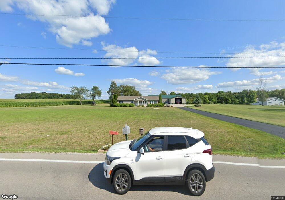
9338 Us Highway 127 West Unity, OH 43570
Estimated Value: $243,000 - $276,000
3
Beds
2
Baths
1,680
Sq Ft
$152/Sq Ft
Est. Value
About This Home
This home is located at 9338 Us Highway 127, West Unity, OH 43570 and is currently estimated at $255,798, approximately $152 per square foot. 9338 Us Highway 127 is a home located in Williams County with nearby schools including Hilltop Elementary School and Hilltop High School.
Ownership History
Date
Name
Owned For
Owner Type
Purchase Details
Closed on
Jul 3, 2015
Sold by
Buehrer Billy and Buehrer Angela L
Bought by
Buehrer Billy and Buehrer Angela L
Current Estimated Value
Purchase Details
Closed on
Dec 22, 1997
Bought by
Buehrer Billy and Buehrer Smith Angela L
Create a Home Valuation Report for This Property
The Home Valuation Report is an in-depth analysis detailing your home's value as well as a comparison with similar homes in the area
Home Values in the Area
Average Home Value in this Area
Purchase History
| Date | Buyer | Sale Price | Title Company |
|---|---|---|---|
| Buehrer Billy | -- | None Available | |
| Buehrer Billy | $14,000 | -- |
Source: Public Records
Tax History Compared to Growth
Tax History
| Year | Tax Paid | Tax Assessment Tax Assessment Total Assessment is a certain percentage of the fair market value that is determined by local assessors to be the total taxable value of land and additions on the property. | Land | Improvement |
|---|---|---|---|---|
| 2024 | $3,141 | $85,720 | $9,800 | $75,920 |
| 2023 | $3,141 | $67,870 | $9,520 | $58,350 |
| 2022 | $2,946 | $67,870 | $9,520 | $58,350 |
| 2021 | $2,946 | $67,870 | $9,520 | $58,350 |
| 2020 | $2,515 | $56,670 | $8,050 | $48,620 |
| 2019 | $2,501 | $56,670 | $8,050 | $48,620 |
| 2018 | $2,100 | $56,670 | $8,050 | $48,620 |
| 2017 | $1,809 | $40,890 | $7,040 | $33,850 |
| 2016 | $1,669 | $39,700 | $7,040 | $32,660 |
| 2015 | $1,805 | $39,700 | $7,040 | $32,660 |
| 2014 | $1,805 | $39,490 | $6,830 | $32,660 |
| 2013 | $1,781 | $39,490 | $6,830 | $32,660 |
Source: Public Records
Map
Nearby Homes
- 18 Cobblestone Rd
- 15664 County Road K
- 16806 US Highway 20a
- 340 S Main St
- 205 Taylor Dr
- 10628 Ohio 15
- 0 St Rt 15 Unit 10001011
- 311 W Rings St
- 000 W Jackson
- 000 Old Farm Trail
- 0 County Road 18
- 17738 County Rd E
- 222 Lakeview Dr
- 229 Lakeview Dr
- 6695 Ohio 15
- 107 Shaffer Blvd
- 301 Horton St
- 305 W Mulberry St
- 18097 State Route 34
- 113 Sycamore Ln
- 9349 Us Highway 127
- 9302 Us Highway 127
- 9302 U S 127
- 9387 Us Highway 127
- 17484 County Road I50
- 17528 County Road I50
- 17444 County Road I50
- 17529 County Road I50
- 17360 County Road I50
- 9483 Us Highway 127
- 17312 County Road I50
- 9270 US Hwy 127
- 17377 County Road I50
- 17274 County Road I50
- 9140 Us Highway 127
- 9177 Us Highway 127
- 17757 County Road I50
- 17123 County Road I50
- 9034 Us Highway 127
- 9532 County Road 17