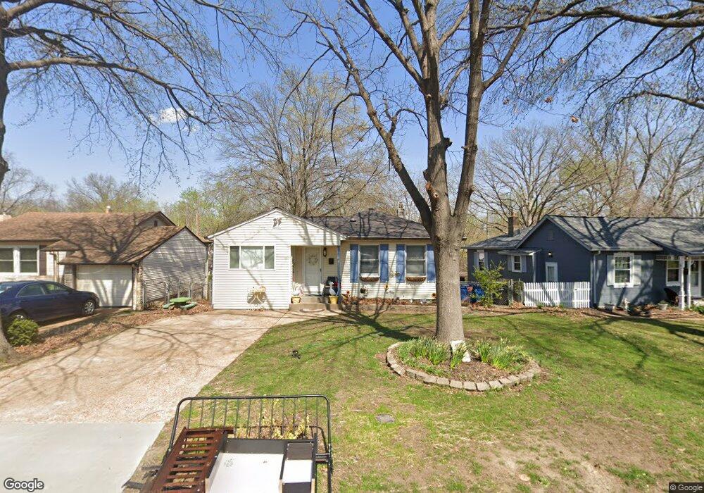
9339 Cloverhurst Dr Saint Louis, MO 63123
Estimated Value: $190,000 - $227,000
2
Beds
1
Bath
1,264
Sq Ft
$164/Sq Ft
Est. Value
About This Home
This home is located at 9339 Cloverhurst Dr, Saint Louis, MO 63123 and is currently estimated at $207,390, approximately $164 per square foot. 9339 Cloverhurst Dr is a home located in St. Louis County with nearby schools including Mesnier Primary School, Gotsch Intermediate School, and Rogers Middle School.
Ownership History
Date
Name
Owned For
Owner Type
Purchase Details
Closed on
Feb 27, 2006
Sold by
Manor Real Estate Residential Llc
Bought by
Foster William L and Foster Amy A
Current Estimated Value
Home Financials for this Owner
Home Financials are based on the most recent Mortgage that was taken out on this home.
Original Mortgage
$134,030
Outstanding Balance
$74,961
Interest Rate
6.09%
Mortgage Type
FHA
Estimated Equity
$132,429
Purchase Details
Closed on
May 9, 2005
Sold by
Diebold John
Bought by
Manor Real Estate Residential Llc
Purchase Details
Closed on
Jul 18, 2000
Sold by
Handshy Kathleen J
Bought by
Diebold John
Home Financials for this Owner
Home Financials are based on the most recent Mortgage that was taken out on this home.
Original Mortgage
$83,920
Interest Rate
8.23%
Create a Home Valuation Report for This Property
The Home Valuation Report is an in-depth analysis detailing your home's value as well as a comparison with similar homes in the area
Home Values in the Area
Average Home Value in this Area
Purchase History
| Date | Buyer | Sale Price | Title Company |
|---|---|---|---|
| Foster William L | $136,200 | None Available | |
| Manor Real Estate Residential Llc | $105,000 | U S Title | |
| Diebold John | $104,900 | -- |
Source: Public Records
Mortgage History
| Date | Status | Borrower | Loan Amount |
|---|---|---|---|
| Open | Foster William L | $134,030 | |
| Previous Owner | Diebold John | $83,920 |
Source: Public Records
Tax History Compared to Growth
Tax History
| Year | Tax Paid | Tax Assessment Tax Assessment Total Assessment is a certain percentage of the fair market value that is determined by local assessors to be the total taxable value of land and additions on the property. | Land | Improvement |
|---|---|---|---|---|
| 2025 | $2,508 | $36,880 | $13,490 | $23,390 |
| 2024 | $2,508 | $30,820 | $9,630 | $21,190 |
| 2023 | $2,425 | $30,820 | $9,630 | $21,190 |
| 2022 | $2,460 | $26,790 | $9,630 | $17,160 |
| 2021 | $2,245 | $26,790 | $9,630 | $17,160 |
| 2020 | $2,185 | $24,320 | $9,580 | $14,740 |
| 2019 | $2,181 | $24,320 | $9,580 | $14,740 |
| 2018 | $2,135 | $21,040 | $6,690 | $14,350 |
| 2017 | $2,122 | $21,040 | $6,690 | $14,350 |
| 2016 | $1,761 | $18,530 | $3,840 | $14,690 |
| 2015 | $1,769 | $18,530 | $3,840 | $14,690 |
| 2014 | $1,827 | $19,060 | $4,520 | $14,540 |
Source: Public Records
Map
Nearby Homes
- 9327 Cloverhurst Dr
- 9332 Cloverhurst Dr
- 9405 Evandale Dr
- 9425 MacKenzie Circle Ct
- 9401 Pancho Dr
- 9228 Nemo Dr
- 9409 Alpine Dr
- 9744 Bexley Station Dr Unit 8J
- 9740 Bexley Station Dr
- 9117 Tiber Ct
- 9108 Tiber Ct
- 9332 Althea Ave
- 9347 Mackenzie Rd
- 9723 Crayford Rd Unit 1B
- 9140 Arvin Place
- 9121 Niger Dr
- 9118 Radiom Dr
- 9313 Brenda Ave
- 9409 Sequoia Ct
- 9211 Niles Place
- 9343 Cloverhurst Dr
- 9335 Cloverhurst Dr
- 9331 Cloverhurst Dr
- 9338 Cloverhurst Dr
- 9342 Cloverhurst Dr
- 2 Bblt-Ryan Iii-Pardee Gardens
- 9350 Cloverhurst Dr
- 9323 Cloverhurst Dr
- 9307 Evandale Dr
- 9405 Upland Dr
- 9319 Evandale Dr
- 9413 Upland Dr
- 9319 Cloverhurst Dr
- 9400 Cloverhurst Dr
- 9567 Cantwell Dr
- 9323 Evandale Dr
- 9400 Upland Dr
- 9417 Upland Dr
- 9315 Cloverhurst Dr