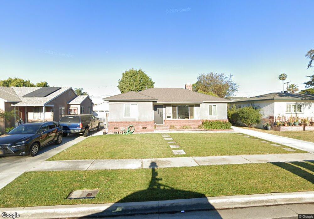
9339 Tarryton Ave Whittier, CA 90605
South Whittier NeighborhoodEstimated Value: $807,523 - $866,000
3
Beds
2
Baths
1,724
Sq Ft
$488/Sq Ft
Est. Value
About This Home
This home is located at 9339 Tarryton Ave, Whittier, CA 90605 and is currently estimated at $842,131, approximately $488 per square foot. 9339 Tarryton Ave is a home located in Los Angeles County with nearby schools including Laurel Elementary School, Hillview Middle School, and Whittier High School.
Ownership History
Date
Name
Owned For
Owner Type
Purchase Details
Closed on
May 9, 2009
Sold by
Mcgrath Leola A and The Leola Alice Mcgrath Revoca
Bought by
Hart Matthew A
Current Estimated Value
Home Financials for this Owner
Home Financials are based on the most recent Mortgage that was taken out on this home.
Original Mortgage
$345,950
Outstanding Balance
$218,226
Interest Rate
4.82%
Mortgage Type
FHA
Estimated Equity
$623,905
Purchase Details
Closed on
Dec 17, 2008
Sold by
Mcgrath Leola A
Bought by
Mcgrath Leola A and The Leola Alice Mcgrath Revocable Trust
Create a Home Valuation Report for This Property
The Home Valuation Report is an in-depth analysis detailing your home's value as well as a comparison with similar homes in the area
Home Values in the Area
Average Home Value in this Area
Purchase History
| Date | Buyer | Sale Price | Title Company |
|---|---|---|---|
| Hart Matthew A | $360,000 | Western Resources Title Co | |
| Mcgrath Leola A | -- | None Available |
Source: Public Records
Mortgage History
| Date | Status | Borrower | Loan Amount |
|---|---|---|---|
| Open | Hart Matthew A | $345,950 |
Source: Public Records
Tax History
| Year | Tax Paid | Tax Assessment Tax Assessment Total Assessment is a certain percentage of the fair market value that is determined by local assessors to be the total taxable value of land and additions on the property. | Land | Improvement |
|---|---|---|---|---|
| 2025 | $5,680 | $463,579 | $234,363 | $229,216 |
| 2024 | $5,680 | $454,490 | $229,768 | $224,722 |
| 2023 | $5,584 | $445,579 | $225,263 | $220,316 |
| 2022 | $5,464 | $436,844 | $220,847 | $215,997 |
| 2021 | $5,354 | $428,279 | $216,517 | $211,762 |
| 2019 | $5,248 | $415,578 | $210,096 | $205,482 |
| 2018 | $5,072 | $407,430 | $205,977 | $201,453 |
| 2016 | $4,799 | $391,611 | $197,980 | $193,631 |
| 2015 | $4,769 | $385,730 | $195,007 | $190,723 |
| 2014 | $4,704 | $378,175 | $191,188 | $186,987 |
Source: Public Records
Map
Nearby Homes
- 9344 Firebird Ave
- 9308 Tarryton Ave
- 13649 Lanning Dr
- 9467 Amsdell Ave
- 9551 Barkerville Ave
- 13448 Dunton Dr
- 9563 Greening Ave
- 13856 Mulberry Dr
- 13814 Mystic St
- 13540 Reis St
- 14056 Hawes St
- 13414 Reis St
- 9834 Ahmann Ave
- 10202 Mina Ave
- 10035 Ben Hur Ave
- 9134 Greenleaf Ave
- 14102 La Forge St
- 12918 Shreve Rd
- 14058 Carnell St
- 14030 Dicky St
- 9335 Tarryton Ave
- 9345 Tarryton Ave
- 9329 Tarryton Ave
- 9349 Tarryton Ave
- 9338 Firebird Ave
- 9334 Firebird Ave
- 9355 Tarryton Ave
- 9325 Tarryton Ave
- 9328 Firebird Ave Unit A
- 9328 Firebird Ave
- 9348 Firebird Ave
- 9338 Tarryton Ave
- 9344 Tarryton Ave
- 9332 Tarryton Ave
- 9354 Firebird Ave
- 9322 Firebird Ave
- 9348 Tarryton Ave
- 9328 Tarryton Ave
- 9319 Tarryton Ave
- 9354 Tarryton Ave
Your Personal Tour Guide
Ask me questions while you tour the home.