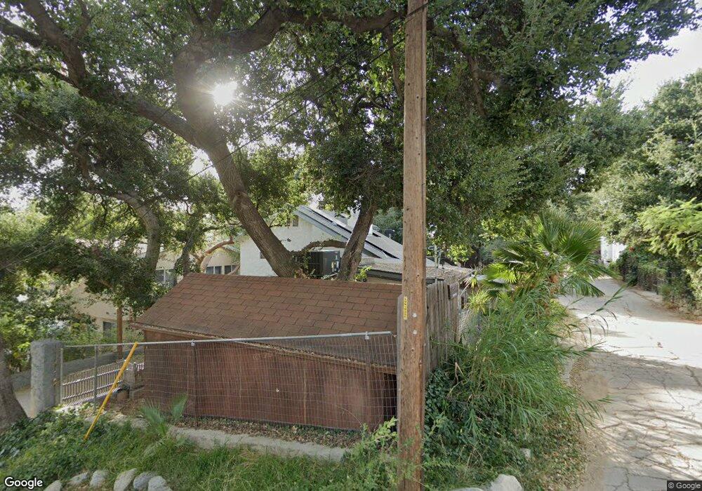
9341 Rollins Rd Chatsworth, CA 91311
Estimated Value: $648,000 - $840,000
2
Beds
2
Baths
1,624
Sq Ft
$466/Sq Ft
Est. Value
About This Home
This home is located at 9341 Rollins Rd, Chatsworth, CA 91311 and is currently estimated at $757,520, approximately $466 per square foot. 9341 Rollins Rd is a home located in Los Angeles County with nearby schools including Pomelo Community Charter, Justice Street Academy Charter, and Chatsworth Charter High School.
Ownership History
Date
Name
Owned For
Owner Type
Purchase Details
Closed on
Dec 12, 2023
Sold by
Klouzal Theodore J and Klouzal Janet M
Bought by
Klouzal Theodore J and Clark-Klouzal Janet M
Current Estimated Value
Purchase Details
Closed on
Aug 25, 2005
Sold by
Klouzal Theodore J and Klouzal Janet M
Bought by
Klouzal Theodore J
Home Financials for this Owner
Home Financials are based on the most recent Mortgage that was taken out on this home.
Original Mortgage
$387,000
Interest Rate
1%
Mortgage Type
Negative Amortization
Purchase Details
Closed on
Nov 29, 1999
Sold by
Klouzal Theodore J and Klouzal Janet M
Bought by
Klouzal Theodore J
Create a Home Valuation Report for This Property
The Home Valuation Report is an in-depth analysis detailing your home's value as well as a comparison with similar homes in the area
Home Values in the Area
Average Home Value in this Area
Purchase History
| Date | Buyer | Sale Price | Title Company |
|---|---|---|---|
| Klouzal Theodore J | -- | None Listed On Document | |
| Klouzal Theodore J | -- | First American Title Company | |
| Klouzal Theodore J | -- | First Southwestern Title Co |
Source: Public Records
Mortgage History
| Date | Status | Borrower | Loan Amount |
|---|---|---|---|
| Previous Owner | Klouzal Theodore J | $387,000 |
Source: Public Records
Tax History Compared to Growth
Tax History
| Year | Tax Paid | Tax Assessment Tax Assessment Total Assessment is a certain percentage of the fair market value that is determined by local assessors to be the total taxable value of land and additions on the property. | Land | Improvement |
|---|---|---|---|---|
| 2025 | $3,697 | $289,827 | $175,689 | $114,138 |
| 2024 | $3,697 | $284,145 | $172,245 | $111,900 |
| 2023 | $3,583 | $278,574 | $168,868 | $109,706 |
| 2022 | $3,322 | $273,112 | $165,557 | $107,555 |
| 2021 | $3,310 | $267,758 | $162,311 | $105,447 |
| 2019 | $3,196 | $259,818 | $157,498 | $102,320 |
| 2018 | $3,176 | $254,724 | $154,410 | $100,314 |
| 2016 | $3,021 | $244,835 | $148,415 | $96,420 |
| 2015 | $2,974 | $241,158 | $146,186 | $94,972 |
| 2014 | $2,980 | $236,435 | $143,323 | $93,112 |
Source: Public Records
Map
Nearby Homes
- 9240 Slater Terrace
- 23329 Raymond St
- 207 La Gross Way
- 8657 Valley Circle Blvd
- 0 Thompson Ave Unit SR25183828
- 8 Thompson Ave
- 9333 Rowell Ave
- 9319 Rowell Ave
- 9246 Rowell Ave
- 215 La Gross Way
- 23403 Lake Manor Dr
- 0 Notre Dame Ave Unit SR25120358
- 107 Ventura Way
- 0 Amigo Unit SR25035988
- 9322 Franklin St
- 200 Amigo Rd
- 9522 Andora Ave
- 9515 Andora Ave
- 9538 N Andora Ave
- 9531 Andora Ave
- 23212 County Line Rd
- 0 Rollins Rd Unit 217013843
- 0 Rollins Rd Unit 218010885
- 0 Rollins Rd Unit 218004567
- 0 Rollins Rd Unit P638111
- 0 Rollins Rd Unit Y1205468
- 0 Rollins Rd Unit SR13250571
- 0 Rollins Rd Unit SR14066037
- 0 Rollins Rd Unit SR14066027
- 0 Rollins Rd Unit 14-785247
- 0 Rollins Rd Unit 14-785623
- 0 Rollins Rd Unit 14-785619
- 0 Rollins Rd Unit CRSR24108001
- 0 Rollins Rd Unit SR24108001
- 0 Rollins Rd Unit F1823459
- 0 Rollins Rd Unit 217013843
- 0 Rollins Rd Unit SR19159187
- 0 Rollins Rd Unit SR19154122
- 0 Rollins Rd Unit 219000696
- 9348 Dennis Way
