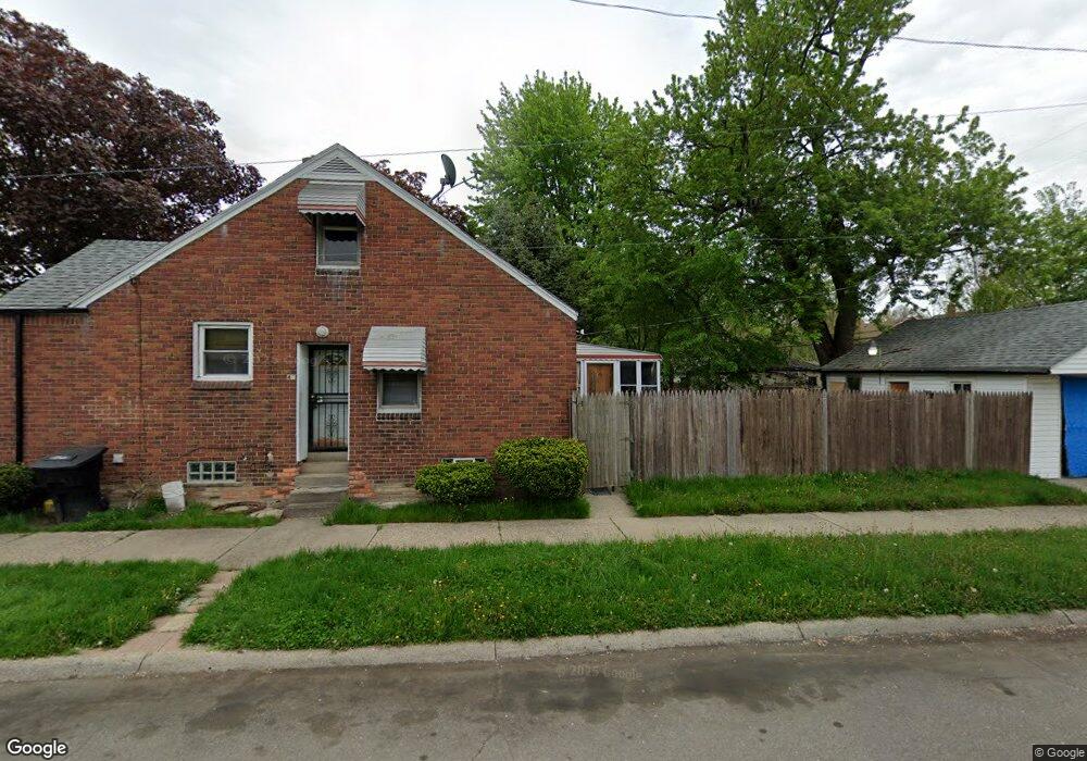
9343 Morang Dr Detroit, MI 48224
Yorkshire Woods NeighborhoodEstimated Value: $66,000 - $80,000
--
Bed
1
Bath
957
Sq Ft
$77/Sq Ft
Est. Value
About This Home
This home is located at 9343 Morang Dr, Detroit, MI 48224 and is currently estimated at $73,333, approximately $76 per square foot. 9343 Morang Dr is a home located in Wayne County with nearby schools including Carleton Elementary School, Edward 'Duke' Ellington Conservatory of Music and Art, and Charles L. Spain Elementary-Middle School.
Ownership History
Date
Name
Owned For
Owner Type
Purchase Details
Closed on
Feb 14, 2019
Sold by
United Community Housing Coalition
Bought by
Clark James and Hudson Latrice
Current Estimated Value
Purchase Details
Closed on
Feb 12, 2019
Sold by
City Of Detroit
Bought by
United Community Housing Coalition
Purchase Details
Closed on
Oct 22, 2018
Sold by
Wayne County Treasurer
Bought by
City Of Detroit Planning And Development
Create a Home Valuation Report for This Property
The Home Valuation Report is an in-depth analysis detailing your home's value as well as a comparison with similar homes in the area
Home Values in the Area
Average Home Value in this Area
Purchase History
| Date | Buyer | Sale Price | Title Company |
|---|---|---|---|
| Clark James | $1,000 | None Available | |
| United Community Housing Coalition | $158,725 | None Available | |
| City Of Detroit Planning And Development | $3,126 | None Available |
Source: Public Records
Tax History Compared to Growth
Tax History
| Year | Tax Paid | Tax Assessment Tax Assessment Total Assessment is a certain percentage of the fair market value that is determined by local assessors to be the total taxable value of land and additions on the property. | Land | Improvement |
|---|---|---|---|---|
| 2025 | $828 | $0 | $0 | $0 |
| 2024 | $828 | $24,700 | $0 | $0 |
| 2023 | $924 | $20,000 | $0 | $0 |
| 2022 | $885 | $16,900 | $0 | $0 |
| 2021 | $981 | $11,700 | $0 | $0 |
| 2020 | $971 | $10,400 | $0 | $0 |
| 2019 | $240 | $0 | $0 | $0 |
| 2018 | $871 | $8,200 | $0 | $0 |
| 2017 | $159 | $8,400 | $0 | $0 |
| 2016 | $1,486 | $16,500 | $0 | $0 |
| 2015 | $1,650 | $16,500 | $0 | $0 |
| 2013 | $2,289 | $22,892 | $0 | $0 |
| 2010 | -- | $33,563 | $1,084 | $32,479 |
Source: Public Records
Map
Nearby Homes
- 9212 Woodhall St
- 9166 Guilford St
- 9140 Woodhall St
- 10400 Duprey St
- 10436 Duprey St
- 10088 Britain St
- 6303 Guilford St
- 9160 Boleyn St
- 6230 Oldtown St
- 10593 Marne St
- 10311 Britain St
- 6326 Neff Ave
- 10728 Worden St
- 10830 Mckinney St
- 10825 Worden St
- 10738 Mckinney St
- 6145 Guilford St
- 10716 Mckinney St
- 6160 Neff Ave
- 10799 Worden St
- 9335 Morang Dr
- 9327 Morang Dr
- 10301 Morang Dr
- 9319 Morang Dr
- 10311 Morang Dr
- 9234 Woodhall St
- 9228 Woodhall St
- 9240 Woodhall St
- 9311 Morang Dr
- 10219 Lanark St
- 9220 Woodhall St
- 10300 Lanark St
- 10209 Lanark St
- 9204 Woodhall St
- 9303 Morang Dr
- 10325 Morang Dr
- 10201 Lanark St
- 9196 Woodhall St
- 9303 Sanilac St
- 9253 Morang Dr Unit Bldg-Unit