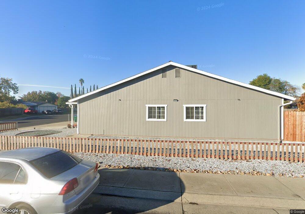
9347 Cherbourg Way Stockton, CA 95210
Valley Oak NeighborhoodEstimated Value: $264,000 - $383,208
4
Beds
2
Baths
1,136
Sq Ft
$289/Sq Ft
Est. Value
About This Home
This home is located at 9347 Cherbourg Way, Stockton, CA 95210 and is currently estimated at $328,552, approximately $289 per square foot. 9347 Cherbourg Way is a home located in San Joaquin County with nearby schools including Westwood Elementary School, Morada Middle School, and Ronald E. McNair High School.
Ownership History
Date
Name
Owned For
Owner Type
Purchase Details
Closed on
Dec 12, 2022
Sold by
Tran Tammy Thao
Bought by
Nguyen Minh-Duc and Furtak-Nguyen Sharon
Current Estimated Value
Purchase Details
Closed on
Apr 18, 2022
Sold by
Viet Toc Foundation Inc
Bought by
Tran Tammy Thao
Purchase Details
Closed on
Jan 5, 2021
Sold by
Tran Tammy Thao and Tammy Thao Tran Living Trust
Bought by
Viet Toc Foundation Inc
Purchase Details
Closed on
Jan 13, 2011
Sold by
Tran Tammy Thao
Bought by
Tran Tammy Thao and Tammy Thao Tran Living Trust
Purchase Details
Closed on
Sep 15, 2009
Sold by
Clark Laurie Ellen
Bought by
Habitat For Humanity Of San Joaquin Coun
Purchase Details
Closed on
Apr 22, 1998
Sold by
Clark Laurie Ellen
Bought by
Clark Laurie Ellen
Create a Home Valuation Report for This Property
The Home Valuation Report is an in-depth analysis detailing your home's value as well as a comparison with similar homes in the area
Home Values in the Area
Average Home Value in this Area
Purchase History
| Date | Buyer | Sale Price | Title Company |
|---|---|---|---|
| Nguyen Minh-Duc | $150,000 | -- | |
| Tran Tammy Thao | -- | -- | |
| Viet Toc Foundation Inc | -- | None Available | |
| Tran Tammy Thao | -- | None Available | |
| Habitat For Humanity Of San Joaquin Coun | -- | None Available | |
| Clark Laurie Ellen | -- | -- |
Source: Public Records
Tax History Compared to Growth
Tax History
| Year | Tax Paid | Tax Assessment Tax Assessment Total Assessment is a certain percentage of the fair market value that is determined by local assessors to be the total taxable value of land and additions on the property. | Land | Improvement |
|---|---|---|---|---|
| 2025 | $2,580 | $228,888 | $83,232 | $145,656 |
| 2024 | $2,532 | $224,400 | $81,600 | $142,800 |
| 2023 | $1,207 | $104,420 | $34,155 | $70,265 |
| 2022 | $1,179 | $102,374 | $33,486 | $68,888 |
| 2021 | $1,205 | $100,368 | $32,830 | $67,538 |
| 2020 | $1,176 | $99,340 | $32,494 | $66,846 |
| 2019 | $1,149 | $97,393 | $31,857 | $65,536 |
| 2018 | $1,129 | $95,484 | $31,233 | $64,251 |
| 2017 | $1,103 | $93,613 | $30,621 | $62,992 |
| 2016 | $1,039 | $91,779 | $30,021 | $61,758 |
| 2014 | $1,028 | $88,630 | $28,991 | $59,639 |
Source: Public Records
Map
Nearby Homes
- 9314 Cherbourg Way
- 2270 Ringwood Ave
- 2619 Claridge Ln
- 9321 Kirkby Ln
- 9332 Kirkby Ln
- 8904 Fox Creek Dr Unit 84
- 8916 Fox Creek Dr
- 8700 West Ln Unit 251
- 8700 West Ln Unit 18
- 8837 Fox Creek Dr Unit 1
- 8600 West Ln Unit 154
- 8600 West Ln Unit 116
- 8600 West Ln Unit 68
- 8600 West Ln Unit 92
- 8600 West Ln Unit 172
- 8600 West Ln Unit 76
- 9318 Eaglepoint Ln
- 9211 Eaglepoint Ln
- 9253 Bridalveil Cir
- 3069 Nicoletta Ln
- 9343 Cherbourg Way
- 2334 Valmora Dr
- 2326 Valmora Dr
- 9339 Cherbourg Way
- 9408 Cherbourg Way
- 9404 Cherbourg Way
- 9412 Cherbourg Way
- 9323 Cherbourg Way
- 2318 Valmora Dr
- 9330 Cherbourg Way
- 9416 Cherbourg Way
- 9326 Cherbourg Way
- 2310 Valmora Dr
- 9420 Cherbourg Way
- 9319 Cherbourg Way
- 9331 Cherbourg Way
- 9327 Cherbourg Way
- 9322 Cherbourg Way
- 9333 Parrish Ln
- 9329 Parrish Ln