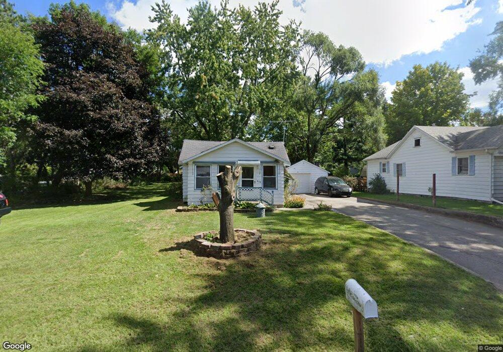
935 Winifred St Jackson, MI 49202
Estimated Value: $124,607 - $156,000
Studio
--
Bath
1,038
Sq Ft
$137/Sq Ft
Est. Value
About This Home
This home is located at 935 Winifred St, Jackson, MI 49202 and is currently estimated at $142,652, approximately $137 per square foot. 935 Winifred St is a home located in Jackson County with nearby schools including Hunt Elementary School, Middle School at Parkside, and Jackson High School.
Ownership History
Date
Name
Owned For
Owner Type
Purchase Details
Closed on
Mar 26, 2010
Sold by
Dyson Jeanne M
Bought by
Marshall Dawn
Current Estimated Value
Purchase Details
Closed on
May 17, 1999
Sold by
Lowe Alvina M
Bought by
Dyson Brian M and Dyson Jeanne M
Home Financials for this Owner
Home Financials are based on the most recent Mortgage that was taken out on this home.
Original Mortgage
$21,600
Interest Rate
6.6%
Mortgage Type
Purchase Money Mortgage
Purchase Details
Closed on
Nov 1, 1990
Bought by
Lowe
Create a Home Valuation Report for This Property
The Home Valuation Report is an in-depth analysis detailing your home's value as well as a comparison with similar homes in the area
Home Values in the Area
Average Home Value in this Area
Purchase History
| Date | Buyer | Sale Price | Title Company |
|---|---|---|---|
| Marshall Dawn | -- | At | |
| Dyson Brian M | $27,000 | -- | |
| Lowe | $20,000 | -- |
Source: Public Records
Mortgage History
| Date | Status | Borrower | Loan Amount |
|---|---|---|---|
| Previous Owner | Dyson Brian M | $21,600 |
Source: Public Records
Tax History
| Year | Tax Paid | Tax Assessment Tax Assessment Total Assessment is a certain percentage of the fair market value that is determined by local assessors to be the total taxable value of land and additions on the property. | Land | Improvement |
|---|---|---|---|---|
| 2025 | $1,529 | $56,900 | $0 | $0 |
| 2024 | $7 | $51,750 | $0 | $0 |
| 2023 | $721 | $46,300 | $0 | $0 |
| 2022 | $1,318 | $39,700 | $0 | $0 |
| 2021 | $1,299 | $36,200 | $0 | $0 |
| 2020 | $1,285 | $32,600 | $0 | $0 |
| 2019 | $1,254 | $30,700 | $0 | $0 |
| 2018 | $1,163 | $29,400 | $0 | $0 |
| 2017 | $1,028 | $28,300 | $0 | $0 |
| 2016 | $535 | $27,917 | $27,917 | $0 |
| 2015 | $1,002 | $25,892 | $25,892 | $0 |
| 2014 | $1,002 | $25,796 | $0 | $0 |
| 2013 | -- | $25,796 | $25,796 | $0 |
Source: Public Records
Map
Nearby Homes
- 923 Wayne St
- 1802 W Argyle St
- 870 Bryant Ave
- 2318 Lancaster Blvd
- 0 N Brown St
- 705 Varden Dr
- 718 Center St
- 835 N West Ave
- 831 N West Ave
- 221 N Higby St
- 836 Lincoln St
- VL Laurence Ave
- 0 VL Laurence Ave
- 534 Barrett Ave
- 1006 Wildwood Ave
- 713 Webb St
- 311 Hibbard Ave
- 1105 Clinton Rd
- 330 N West Ave
- 814 Wildwood Ave
- 929 Winifred St
- 929 Winifred St
- 1001 Winifred St
- 1006 Wayne St
- 928 Wayne St
- 915 Winifred St
- 936 Winifred St
- 936 Winifred St
- 1012 Wayne St
- 924 Wayne St
- 1015 Winifred St
- 913 Winifred St
- 906 Winifred St
- 906 Winifred St
- 906 Winifred St
- VL Wayne St
- 1024 Wayne St
- 1021 Winifred St
- 1714 W North St
- 1728 W North St
Your Personal Tour Guide
Ask me questions while you tour the home.