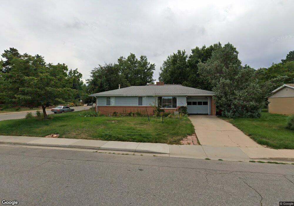
935 Yale Rd Boulder, CO 80305
Table Mesa NeighborhoodEstimated Value: $1,056,000 - $1,229,000
4
Beds
2
Baths
1,026
Sq Ft
$1,091/Sq Ft
Est. Value
About This Home
This home is located at 935 Yale Rd, Boulder, CO 80305 and is currently estimated at $1,119,697, approximately $1,091 per square foot. 935 Yale Rd is a home located in Boulder County with nearby schools including Bear Creek Elementary School, Mesa Elementary School, and Southern Hills Middle School.
Ownership History
Date
Name
Owned For
Owner Type
Purchase Details
Closed on
Nov 18, 2002
Sold by
Barghothi Jawad and Barghothi Barbara
Bought by
Hill Reginald
Current Estimated Value
Purchase Details
Closed on
Jul 28, 1992
Bought by
Hill Reginald James
Purchase Details
Closed on
Apr 24, 1992
Bought by
Hill Reginald James
Purchase Details
Closed on
Jun 18, 1981
Bought by
Hill Reginald James
Create a Home Valuation Report for This Property
The Home Valuation Report is an in-depth analysis detailing your home's value as well as a comparison with similar homes in the area
Home Values in the Area
Average Home Value in this Area
Purchase History
| Date | Buyer | Sale Price | Title Company |
|---|---|---|---|
| Hill Reginald | -- | -- | |
| Hill Reginald James | -- | -- | |
| Hill Reginald James | -- | -- | |
| Hill Reginald James | $79,000 | -- |
Source: Public Records
Tax History
| Year | Tax Paid | Tax Assessment Tax Assessment Total Assessment is a certain percentage of the fair market value that is determined by local assessors to be the total taxable value of land and additions on the property. | Land | Improvement |
|---|---|---|---|---|
| 2025 | $5,031 | $60,262 | $54,236 | $6,026 |
| 2024 | $5,031 | $60,262 | $54,236 | $6,026 |
| 2023 | $4,944 | $63,945 | $60,867 | $6,763 |
| 2022 | $4,229 | $52,494 | $46,037 | $6,457 |
| 2021 | $4,033 | $54,004 | $47,362 | $6,642 |
| 2020 | $3,609 | $48,613 | $38,896 | $9,717 |
| 2019 | $3,554 | $48,613 | $38,896 | $9,717 |
| 2018 | $3,404 | $46,462 | $30,744 | $15,718 |
| 2017 | $3,297 | $51,366 | $33,989 | $17,377 |
| 2016 | $2,758 | $39,816 | $24,756 | $15,060 |
| 2015 | $2,611 | $34,347 | $15,522 | $18,825 |
| 2014 | $2,888 | $34,347 | $15,522 | $18,825 |
Source: Public Records
Map
Nearby Homes
- 3210 Darley Ave
- 2860 Table Mesa Dr
- 1220 Edinboro Dr
- 2820 Colby Dr
- 3210 Emerson Ave
- 623 Hartford Dr
- 1270 Lehigh St
- 2795 Vassar Dr
- 3590 Endicott Dr
- 2955 Stanford Ave
- 345 S 38th St
- 1160 S Lashley Ln
- 375 S 40th St
- 3200 Eastman Ave
- 4445 Squires Cir
- 725 S 45th St
- 3000 Dartmouth Ave
- 2585 Kohler Dr
- 2640 Kohler Dr
- 2235 Vassar Dr
Your Personal Tour Guide
Ask me questions while you tour the home.