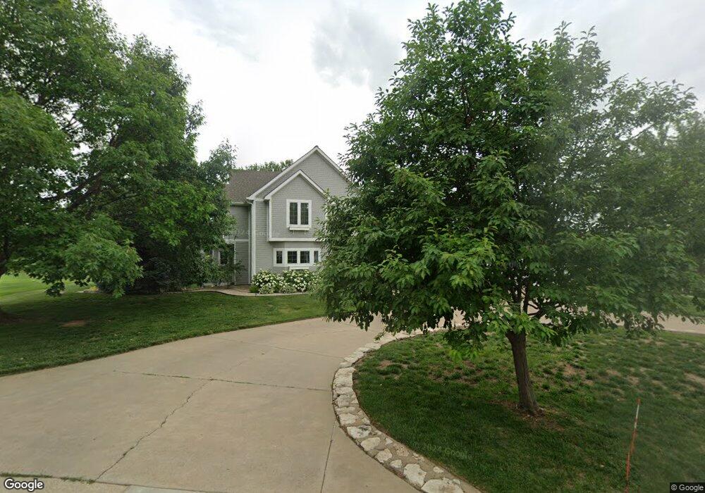
936 Barlow Dr Salina, KS 67401
Estimated Value: $242,000 - $847,269
5
Beds
4
Baths
3,388
Sq Ft
$186/Sq Ft
Est. Value
About This Home
This home is located at 936 Barlow Dr, Salina, KS 67401 and is currently estimated at $631,423, approximately $186 per square foot. 936 Barlow Dr is a home located in Saline County with nearby schools including Meadowlark Ridge Elementary School, Lakewood Middle School, and Salina High School Central.
Ownership History
Date
Name
Owned For
Owner Type
Purchase Details
Closed on
Aug 8, 2022
Sold by
Ostmeyer Jeremiah S and Ostmeyer Melissa S
Bought by
Cole Keith and Cole Laurne
Current Estimated Value
Home Financials for this Owner
Home Financials are based on the most recent Mortgage that was taken out on this home.
Original Mortgage
$604,000
Outstanding Balance
$575,032
Interest Rate
5%
Mortgage Type
New Conventional
Estimated Equity
$56,391
Create a Home Valuation Report for This Property
The Home Valuation Report is an in-depth analysis detailing your home's value as well as a comparison with similar homes in the area
Home Values in the Area
Average Home Value in this Area
Purchase History
| Date | Buyer | Sale Price | Title Company |
|---|---|---|---|
| Cole Keith | -- | Land Title |
Source: Public Records
Mortgage History
| Date | Status | Borrower | Loan Amount |
|---|---|---|---|
| Open | Cole Keith | $604,000 |
Source: Public Records
Tax History Compared to Growth
Tax History
| Year | Tax Paid | Tax Assessment Tax Assessment Total Assessment is a certain percentage of the fair market value that is determined by local assessors to be the total taxable value of land and additions on the property. | Land | Improvement |
|---|---|---|---|---|
| 2025 | $11,911 | $88,562 | $9,399 | $79,163 |
| 2024 | $11,911 | $86,825 | $6,959 | $79,866 |
| 2023 | $11,911 | $86,825 | $7,787 | $79,038 |
| 2022 | $9,602 | $71,427 | $8,830 | $62,597 |
| 2021 | $8,240 | $59,742 | $7,140 | $52,602 |
| 2020 | $8,367 | $59,949 | $8,227 | $51,722 |
| 2019 | $7,640 | $56,902 | $8,124 | $48,778 |
| 2018 | $7,745 | $56,316 | $7,605 | $48,711 |
| 2017 | $0 | $53,717 | $7,580 | $46,137 |
| 2016 | $0 | $53,340 | $7,166 | $46,174 |
| 2015 | -- | $54,729 | $7,191 | $47,538 |
| 2013 | -- | $0 | $0 | $0 |
Source: Public Records
Map
Nearby Homes
- 1250 Columbine Cir
- 839B Fairdale Rd
- 1117 Bentgrass Dr
- 00000 Bentgrass Dr
- 2033 Ridgeview Rd
- B4 L3 Timber Ridge Dr
- B4 L2 Timber Ridge Dr
- B4 L1 Timber Ridge Dr
- B1 L7 Timber Ridge Dr
- B1 L6 Timber Ridge Dr
- B1 L5 Timber Ridge Dr
- 677 Georgetown Rd
- 671 Georgetown Rd
- 1529 Cedar Point Place
- 1620 Overlook Dr
- 2009 Riverrun Pkwy
- 2016 Riverrun Pkwy
- 2024 Riverrun Pkwy
- 649 Seitz Dr
- 1737 Overlook Dr
- 1195 Columbine Cir
- 942 Barlow Dr
- 930 Barlow Dr
- 949 Barlow Dr
- 948 Barlow Dr
- 924 Barlow Dr
- 954 Barlow Dr
- 2143 Columbine Ct
- 911 Barlow Dr
- 912 Barlow Dr
- 2137 Columbine Ct
- 2144 Columbine Ct
- 900 Barlow Dr
- 1185 Columbine Cir
- 855 Fairdale Rd
- 863 Eastridge Dr
- 2138 Columbine Ct
- 2131 Columbine Ct
- 1013 S Marymount Rd
- 857 Eastridge Dr