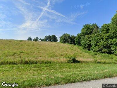
936 Bridgeport Rd Edmonton, KY 42129
Estimated Value: $162,000 - $222,419
3
Beds
2
Baths
1,462
Sq Ft
$127/Sq Ft
Est. Value
About This Home
This home is located at 936 Bridgeport Rd, Edmonton, KY 42129 and is currently estimated at $185,855, approximately $127 per square foot. 936 Bridgeport Rd is a home located in Metcalfe County with nearby schools including Metcalfe County Elementary School, Metcalfe County Middle School, and Metcalfe County High School.
Ownership History
Date
Name
Owned For
Owner Type
Purchase Details
Closed on
Nov 16, 2005
Sold by
Fannie Mae
Bought by
Gordon Jason
Current Estimated Value
Home Financials for this Owner
Home Financials are based on the most recent Mortgage that was taken out on this home.
Original Mortgage
$70,000
Outstanding Balance
$5,314
Interest Rate
5.9%
Mortgage Type
Purchase Money Mortgage
Estimated Equity
$204,309
Purchase Details
Closed on
Nov 16, 2004
Sold by
Smith Ronnie and Smith Kim
Bought by
Federal National Mortgage Association
Create a Home Valuation Report for This Property
The Home Valuation Report is an in-depth analysis detailing your home's value as well as a comparison with similar homes in the area
Home Values in the Area
Average Home Value in this Area
Purchase History
| Date | Buyer | Sale Price | Title Company |
|---|---|---|---|
| Gordon Jason | $70,000 | None Available | |
| Federal National Mortgage Association | $95,614 | None Available |
Source: Public Records
Mortgage History
| Date | Status | Borrower | Loan Amount |
|---|---|---|---|
| Open | Gordon Jason | $70,000 |
Source: Public Records
Tax History Compared to Growth
Tax History
| Year | Tax Paid | Tax Assessment Tax Assessment Total Assessment is a certain percentage of the fair market value that is determined by local assessors to be the total taxable value of land and additions on the property. | Land | Improvement |
|---|---|---|---|---|
| 2024 | $824 | $77,700 | $0 | $0 |
| 2023 | $715 | $67,700 | $0 | $0 |
| 2022 | $722 | $67,700 | $0 | $0 |
| 2021 | $734 | $67,700 | $0 | $0 |
| 2020 | $750 | $67,700 | $0 | $0 |
| 2019 | $762 | $67,700 | $0 | $0 |
| 2018 | $749 | $67,700 | $0 | $0 |
| 2017 | $740 | $67,700 | $0 | $0 |
| 2016 | $699 | $67,700 | $0 | $0 |
| 2015 | -- | $2,700 | $2,700 | $0 |
| 2013 | -- | $85,000 | $0 | $0 |
Source: Public Records
Map
Nearby Homes
- 257 Hubbard Cemetery Rd
- 1900 Columbia Rd
- 2144 Greensburg Rd
- Ac Old Glasgow Rd
- 11160 Greensburg Rd
- 104 Harris St
- 505 N Main St
- 1188 Breeding Rd
- 201 Greensburg St
- 0 Burdette Rd
- 150 Bill Moore Rd
- 401 Muncie Ct
- 1047 Cedar Top Church Rd
- 104 Skyline Dr
- 5100 Subtle Rd
- 0 Preston Sullivan Rd Unit 23160457
- 10 Preston Sullivan Rd Unit Tract 2
- 10 Preston Sullivan Rd Unit Tract 10
- 302 Glasgow St
- AC Maple Hill Spur Rd
- 936 Bridgeport Rd
- 888 Bridgeport Rd
- 975 Bridgeport Rd
- 1075 Bridgeport Rd
- 764 Bridgeport Rd
- 721 Bridgeport Rd
- 187 Mell Cork Rd
- Ac Cork-Gascon Rd
- 106 Rogue Mountain Rd
- 645 Bridgeport Rd
- 183 Mell Cork Rd
- 1453 Bridgeport Rd
- 3080 Cork Gascon Rd
- 2727 Cork Gascon Rd
- 2911 Cork Gascon Rd
- 0 Chris Harper Rd
- 368 Mell Cork Rd
- 1733 Bridgeport Rd
- 1591 Bridgeport Rd
- 457 Bridgeport Rd
