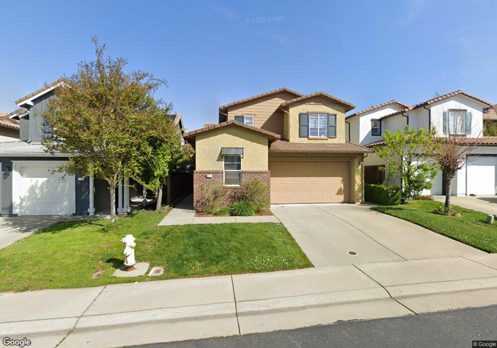
937 Campfire Cir Rocklin, CA 95765
Whitney Ranch NeighborhoodEstimated Value: $668,000 - $703,000
About This Home
This home is located at 937 Campfire Cir, Rocklin, CA 95765 and is currently estimated at $684,696, approximately $285 per square foot. 937 Campfire Cir is a home located in Placer County with nearby schools including Sunset Ranch Elementary, Granite Oaks Middle, and Whitney High.
Ownership History
We collect this data history from publicly available records. To have your information removed, we recommend requesting removal directly through your county’s website.
Purchase Details
Home Financials for this Owner
Home Financials are based on the most recent Mortgage that was taken out on this home.Purchase Details
Home Financials for this Owner
Home Financials are based on the most recent Mortgage that was taken out on this home.Purchase Details
Home Financials for this Owner
Home Financials are based on the most recent Mortgage that was taken out on this home.Home Values in the Area
Average Home Value in this Area
Purchase History
We collect this data history from publicly available records. To have your information removed, we recommend requesting removal directly through your county’s website.
| Date | Buyer | Sale Price | Title Company |
|---|---|---|---|
| $295,000 | Stewart Title Of Sacramento | ||
| -- | Chicago Title Servicelink Di | ||
| $490,727 | Chicago Title Company |
Mortgage History
We collect this data history from publicly available records. To have your information removed, we recommend requesting removal directly through your county’s website.
| Date | Status | Borrower | Loan Amount |
|---|---|---|---|
| Open | $233,000 | ||
| Previous Owner | $409,693 | ||
| Previous Owner | $392,550 |
Tax History
We collect this data history from publicly available records. To have your information removed, we recommend requesting removal directly through your county’s website.
| Year | Tax Paid | Tax Assessment Tax Assessment Total Assessment is a certain percentage of the fair market value that is determined by local assessors to be the total taxable value of land and additions on the property. | Land | Improvement |
|---|---|---|---|---|
| 2025 | $7,131 | $380,777 | $77,441 | $303,336 |
| 2023 | $7,131 | $365,993 | $74,435 | $291,558 |
| 2022 | $6,865 | $358,818 | $72,976 | $285,842 |
| 2021 | $6,696 | $351,784 | $71,546 | $280,238 |
| 2020 | $6,632 | $348,178 | $70,813 | $277,365 |
| 2019 | $6,514 | $341,352 | $69,425 | $271,927 |
| 2018 | $6,346 | $334,660 | $68,064 | $266,596 |
| 2017 | $6,191 | $328,099 | $66,730 | $261,369 |
| 2016 | $6,262 | $321,667 | $65,422 | $256,245 |
| 2015 | $6,159 | $316,836 | $64,440 | $252,396 |
| 2014 | $6,034 | $310,630 | $63,178 | $247,452 |
Map
- 2660 Flintlock Ln
- 2229 Apple Grey Ln
- 716 Gray Dawn Dr
- 717 Gray Dawn Dr
- 2408 Galloping Trail Ct
- 2557 Creek Hollow Rd
- 907 Farm House Ln
- 951 Anvil Cir
- 800 Lazy Creek Dr
- 751 Bandera Dr
- 2232 Ranch View Dr
- 3034 Sidewinder Loop
- 965 Browning Ln
- 2234 Telegraph Hill Ct
- 1823 Sorrell Cir
- 3139 Golden Trail St
- 3026 Blackpoint Ct
- 3147 Golden Trail St
- 3027 Blackpoint Ct
- 962 Browning Ln
- 939 Campfire Cir
- 941 Campfire Cir
- 933 Campfire Cir
- 943 Campfire Cir
- 931 Campfire Cir
- 818 Morning Dove Ln
- 938 Campfire Cir
- 940 Campfire Cir
- 945 Campfire Cir
- 929 Campfire Cir
- 942 Campfire Cir
- 816 Morning Dove Ln Unit Lot61
- 816 Morning Dove Ln
- 944 Campfire Cir
- 927 Campfire Cir
- 814 Morning Dove Ln Unit Lot62
- 814 Morning Dove Ln
- 817 Morning Dove Ln
- 946 Campfire Cir
- 949 Campfire Cir
Ask me questions while you tour the home.