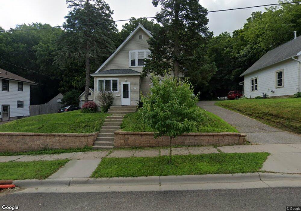
937 West Ave Red Wing, MN 55066
Estimated Value: $216,000 - $241,614
3
Beds
1
Bath
1,325
Sq Ft
$173/Sq Ft
Est. Value
About This Home
This home is located at 937 West Ave, Red Wing, MN 55066 and is currently estimated at $229,654, approximately $173 per square foot. 937 West Ave is a home located in Goodhue County with nearby schools including Sunnyside Elementary School, Burnside Elementary School, and Twin Bluff Middle School.
Ownership History
Date
Name
Owned For
Owner Type
Purchase Details
Closed on
Jul 10, 2018
Sold by
Wynveen Joseph W
Bought by
Meyer Carsten M
Current Estimated Value
Purchase Details
Closed on
Oct 15, 2010
Sold by
Bowen Brooke and Bowen Kenneth
Bought by
Not Provided
Purchase Details
Closed on
Feb 6, 2004
Sold by
Ramstad Katie M and Ramstad Jeffrey A
Bought by
Raw Brooke
Purchase Details
Closed on
Oct 9, 1998
Sold by
Callinan M Richard
Bought by
Watzke Kaye and Lumbar Richard
Create a Home Valuation Report for This Property
The Home Valuation Report is an in-depth analysis detailing your home's value as well as a comparison with similar homes in the area
Home Values in the Area
Average Home Value in this Area
Purchase History
| Date | Buyer | Sale Price | Title Company |
|---|---|---|---|
| Meyer Carsten M | $135,000 | -- | |
| Not Provided | $115,000 | -- | |
| Raw Brooke | $118,500 | -- | |
| Watzke Kaye | $48,500 | -- |
Source: Public Records
Tax History Compared to Growth
Tax History
| Year | Tax Paid | Tax Assessment Tax Assessment Total Assessment is a certain percentage of the fair market value that is determined by local assessors to be the total taxable value of land and additions on the property. | Land | Improvement |
|---|---|---|---|---|
| 2025 | $4,644 | $207,600 | $43,800 | $163,800 |
| 2024 | $4,644 | $201,600 | $43,800 | $157,800 |
| 2023 | $1,209 | $190,100 | $43,800 | $146,300 |
| 2022 | $2,476 | $189,000 | $43,800 | $145,200 |
| 2021 | $2,794 | $163,500 | $43,800 | $119,700 |
| 2020 | $1,974 | $154,300 | $43,800 | $110,500 |
| 2019 | $2,242 | $144,600 | $43,800 | $100,800 |
| 2018 | $2,672 | $143,300 | $42,000 | $101,300 |
| 2017 | $2,322 | $127,200 | $42,000 | $85,200 |
| 2016 | $2,472 | $125,600 | $42,000 | $83,600 |
| 2015 | $1,314 | $121,700 | $42,000 | $79,700 |
| 2014 | -- | $117,200 | $42,000 | $75,200 |
Source: Public Records
Map
Nearby Homes
- 1012 West Ave
- 1029 Putnam Ave
- 802 West Ave
- 642 Grace St
- 1062 Putnam Ave
- 924 Central Ave
- 1004 College Ave
- 716 Central Ave
- 1108 Hawthorne St
- 815 W 4th St
- 523 East Ave Unit 211
- 523 East Ave Unit 213
- 1109 East Ave
- 1130 W 4th St
- 1218 East Ave
- 1606 Reichert Ave
- 516 Norwood St
- 759 Plum St
- 222 Bush St Unit 402
- 222 Bush St Unit 302