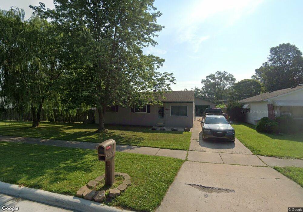
9379 Sylvia St Taylor, MI 48180
Estimated Value: $146,000 - $163,000
--
Bed
--
Bath
1,001
Sq Ft
$156/Sq Ft
Est. Value
About This Home
This home is located at 9379 Sylvia St, Taylor, MI 48180 and is currently estimated at $155,840, approximately $155 per square foot. 9379 Sylvia St is a home located in Wayne County with nearby schools including Holland Elementary School, Hoover Middle School, and Taylor High School.
Ownership History
Date
Name
Owned For
Owner Type
Purchase Details
Closed on
Apr 25, 2008
Sold by
Harrell Allen W and Harrell Kelly N
Bought by
Harrell Allen W
Current Estimated Value
Home Financials for this Owner
Home Financials are based on the most recent Mortgage that was taken out on this home.
Original Mortgage
$89,320
Outstanding Balance
$56,566
Interest Rate
5.88%
Mortgage Type
FHA
Estimated Equity
$99,274
Purchase Details
Closed on
Feb 3, 1998
Sold by
Barks Freda A and Barks Frank E
Bought by
Burgess Kelly N
Create a Home Valuation Report for This Property
The Home Valuation Report is an in-depth analysis detailing your home's value as well as a comparison with similar homes in the area
Home Values in the Area
Average Home Value in this Area
Purchase History
| Date | Buyer | Sale Price | Title Company |
|---|---|---|---|
| Harrell Allen W | -- | Michigan Title Insurance Age | |
| Burgess Kelly N | $62,000 | -- |
Source: Public Records
Mortgage History
| Date | Status | Borrower | Loan Amount |
|---|---|---|---|
| Open | Harrell Allen W | $89,320 |
Source: Public Records
Tax History Compared to Growth
Tax History
| Year | Tax Paid | Tax Assessment Tax Assessment Total Assessment is a certain percentage of the fair market value that is determined by local assessors to be the total taxable value of land and additions on the property. | Land | Improvement |
|---|---|---|---|---|
| 2025 | $1,944 | $86,200 | $0 | $0 |
| 2024 | $1,944 | $76,000 | $0 | $0 |
| 2023 | $2,353 | $69,400 | $0 | $0 |
| 2022 | $1,855 | $62,400 | $0 | $0 |
| 2021 | $2,067 | $59,100 | $0 | $0 |
| 2020 | $2,046 | $52,900 | $0 | $0 |
| 2019 | $196,761 | $45,500 | $0 | $0 |
| 2018 | $1,533 | $35,800 | $0 | $0 |
| 2017 | $914 | $36,300 | $0 | $0 |
| 2016 | $1,989 | $35,300 | $0 | $0 |
| 2015 | $3,719 | $41,000 | $0 | $0 |
| 2013 | $3,700 | $38,200 | $0 | $0 |
| 2012 | $1,599 | $37,300 | $16,000 | $21,300 |
Source: Public Records
Map
Nearby Homes
- 9404 Princess St
- 9425 Glenis St
- 9450 Continental Dr
- 8883 Beech Daly Rd
- 9915 Beech Daly Rd
- 8853 Beech Daly Rd
- 25604 Kinyon St
- 10051 Fairview St
- 25652 Chernick St
- 26110 Gary St Unit RV076
- 26031 Gary St Unit RV100
- 25315 Baker St
- 7328 Chesterfield St Unit RA265
- 26128 5th St Unit RA216
- 26034 Gary St Unit RV072
- 7330 Chesterfield St Unit RA266
- 0 Ecorse Rd Unit 20251029385
- 0 Goddard Unit 20251010304
- 26118 5th St Unit RA211
- 10160 Gulley St
- 9425 Sylvia St
- 9433 Sylvia St
- 9365 Sylvia St
- 9355 Sylvia St
- 9418 Hazel St
- 9406 Hazel St
- 9354 Hazel St
- 9430 Hazel St
- 9441 Sylvia St
- 9347 Sylvia St
- 9442 Hazel St
- 9449 Sylvia St
- 9342 Hazel St
- 9339 Sylvia St
- 9457 Sylvia St
- 9454 Hazel St
- 9330 Hazel St
- 9331 Sylvia St
- 9509 Sylvia St Unit Bldg-Unit
- 9509 Sylvia St