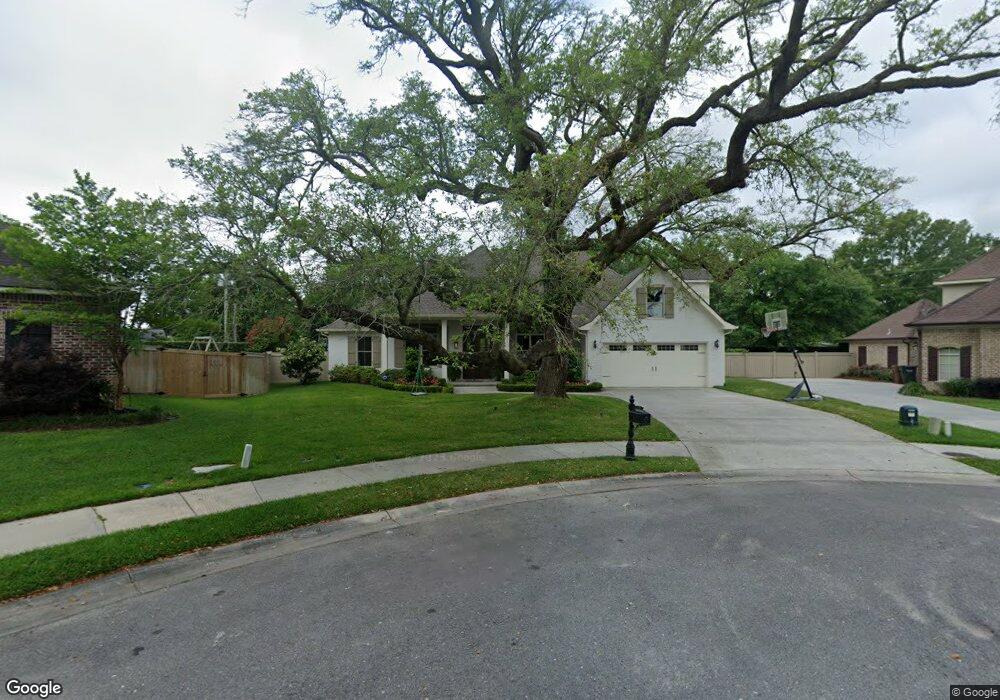
938 Caroline Dr Biloxi, MS 39532
Estimated Value: $435,000 - $742,000
--
Bed
1
Bath
3,583
Sq Ft
$160/Sq Ft
Est. Value
About This Home
This home is located at 938 Caroline Dr, Biloxi, MS 39532 and is currently estimated at $574,748, approximately $160 per square foot. 938 Caroline Dr is a home with nearby schools including North Bay Elementary School, Biloxi Junior High School, and Biloxi High School.
Ownership History
Date
Name
Owned For
Owner Type
Purchase Details
Closed on
Apr 5, 2018
Sold by
Craig Smith Builder Inc
Bought by
Weaver Jason M and Weaver Sarah G
Current Estimated Value
Home Financials for this Owner
Home Financials are based on the most recent Mortgage that was taken out on this home.
Original Mortgage
$403,068
Outstanding Balance
$346,793
Interest Rate
4.46%
Mortgage Type
New Conventional
Estimated Equity
$227,955
Purchase Details
Closed on
Dec 20, 2006
Sold by
Young Tract Llc
Bought by
Craig Smith Builder Inc
Create a Home Valuation Report for This Property
The Home Valuation Report is an in-depth analysis detailing your home's value as well as a comparison with similar homes in the area
Home Values in the Area
Average Home Value in this Area
Purchase History
| Date | Buyer | Sale Price | Title Company |
|---|---|---|---|
| Weaver Jason M | -- | -- | |
| Weaver Jason M | -- | -- | |
| Weaver Jason M | -- | -- | |
| Craig Smith Builder Inc | -- | -- |
Source: Public Records
Mortgage History
| Date | Status | Borrower | Loan Amount |
|---|---|---|---|
| Open | Weaver Jason M | $403,068 | |
| Closed | Weaver Jason M | $403,068 |
Source: Public Records
Tax History Compared to Growth
Tax History
| Year | Tax Paid | Tax Assessment Tax Assessment Total Assessment is a certain percentage of the fair market value that is determined by local assessors to be the total taxable value of land and additions on the property. | Land | Improvement |
|---|---|---|---|---|
| 2024 | $4,393 | $42,365 | $0 | $0 |
| 2023 | $4,311 | $42,004 | $0 | $0 |
| 2022 | $4,311 | $42,004 | $0 | $0 |
| 2021 | $4,302 | $41,923 | $0 | $0 |
| 2020 | $3,895 | $38,173 | $0 | $0 |
| 2019 | $3,895 | $38,173 | $0 | $0 |
| 2018 | $659 | $6,000 | $0 | $0 |
| 2017 | $659 | $6,000 | $0 | $0 |
| 2015 | $659 | $6,000 | $0 | $0 |
| 2014 | -- | $10,000 | $0 | $0 |
| 2013 | -- | $6,000 | $6,000 | $0 |
Source: Public Records
Map
Nearby Homes
- 0 Caroline Dr Unit 4117846
- 1853 Popps Ferry Rd
- 0 Campbell Road Dr Unit 4027188
- 0 Jam Ln
- 0 Popps Ferry Rd Unit 4108141
- 0 Popps Ferry Rd Unit 4108136
- 939 Tommy Munro Dr
- 1099 Campbell Dr
- 2077 Crane Ridge
- 2090 Woodfield Ln
- 748 Malpass Landing Dr
- 739 Malpass Landing Dr
- 957 Rustwood Dr
- 2053 Carolwood Dr
- 820 Leeward Dr
- 944 Cedar Lake Rd
- 694 Water's View Dr
- 712 Champagne Dr
- 0 Masterson Ave Unit 4116225
- 709 Champagne Dr
- LOT 53 Lot 53 Caroline Dr
- 41 Caroline Dr
- 930 Caroline Dr
- 928 Caroline Dr
- 932 Caroline Dr
- 925 Caroline Dr
- 926 Caroline Dr
- 0 Caroline Dr Unit 4083756
- 0 Caroline Dr Unit 3204306
- 0 Caroline Dr Unit 3225785
- 0 Caroline Dr Unit 3254524
- 0 Caroline Dr Unit 3256793
- 0 Caroline Dr Unit 3259719
- 0 Caroline Dr Unit 3321185
- 0 Caroline Dr Unit 3360038
- Lot 41 Caroline Dr
- 934 Caroline Dr
- 1896 Popp's Ferry Rd
- 923 Caroline Dr
- 922 Caroline Dr