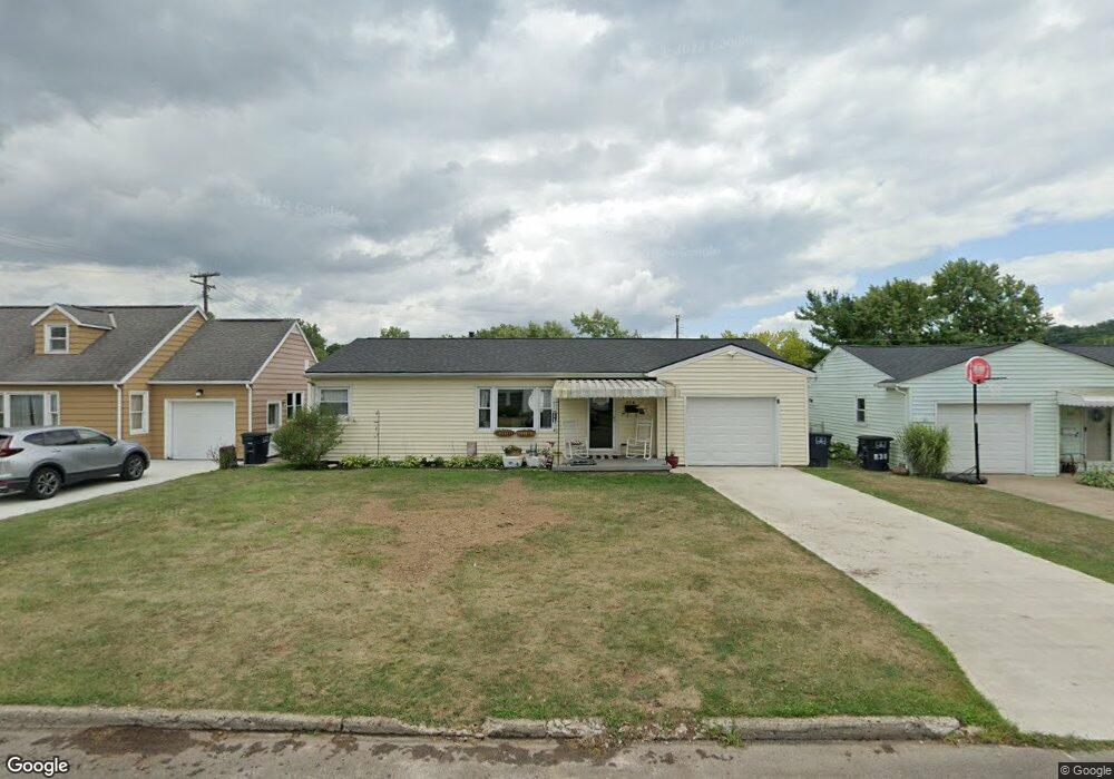
938 Clayton Dr Lancaster, OH 43130
Estimated Value: $234,503 - $260,000
3
Beds
2
Baths
1,493
Sq Ft
$163/Sq Ft
Est. Value
About This Home
This home is located at 938 Clayton Dr, Lancaster, OH 43130 and is currently estimated at $243,126, approximately $162 per square foot. 938 Clayton Dr is a home located in Fairfield County with nearby schools including Medill Elementary School, Thomas Ewing Junior High School, and Lancaster High School.
Ownership History
Date
Name
Owned For
Owner Type
Purchase Details
Closed on
Jun 29, 2016
Sold by
Parrett Timothy P and Parrett Julie M
Bought by
Wilson Daniel E and Chatfield Kristin L
Current Estimated Value
Home Financials for this Owner
Home Financials are based on the most recent Mortgage that was taken out on this home.
Original Mortgage
$112,917
Outstanding Balance
$89,527
Interest Rate
3.37%
Mortgage Type
FHA
Estimated Equity
$153,599
Purchase Details
Closed on
Apr 30, 1999
Sold by
Thomas Agnes C
Bought by
Parrett Timothy P and Williams Julie M
Home Financials for this Owner
Home Financials are based on the most recent Mortgage that was taken out on this home.
Original Mortgage
$105,211
Interest Rate
7.05%
Mortgage Type
FHA
Purchase Details
Closed on
Nov 30, 1993
Sold by
Thomas Arthur H
Bought by
Thomas Agnes C
Create a Home Valuation Report for This Property
The Home Valuation Report is an in-depth analysis detailing your home's value as well as a comparison with similar homes in the area
Home Values in the Area
Average Home Value in this Area
Purchase History
| Date | Buyer | Sale Price | Title Company |
|---|---|---|---|
| Wilson Daniel E | $115,000 | Sas Title Agency Ltd | |
| Parrett Timothy P | $105,265 | -- | |
| Thomas Agnes C | -- | -- |
Source: Public Records
Mortgage History
| Date | Status | Borrower | Loan Amount |
|---|---|---|---|
| Open | Wilson Daniel E | $112,917 | |
| Closed | Parrett Timothy P | $105,211 |
Source: Public Records
Tax History Compared to Growth
Tax History
| Year | Tax Paid | Tax Assessment Tax Assessment Total Assessment is a certain percentage of the fair market value that is determined by local assessors to be the total taxable value of land and additions on the property. | Land | Improvement |
|---|---|---|---|---|
| 2024 | $4,963 | $55,210 | $10,710 | $44,500 |
| 2023 | $2,008 | $55,210 | $10,710 | $44,500 |
| 2022 | $2,016 | $55,210 | $10,710 | $44,500 |
| 2021 | $1,604 | $41,150 | $8,930 | $32,220 |
| 2020 | $1,537 | $41,150 | $8,930 | $32,220 |
| 2019 | $1,461 | $41,150 | $8,930 | $32,220 |
| 2018 | $1,289 | $30,540 | $8,930 | $21,610 |
| 2017 | $1,289 | $34,470 | $8,930 | $25,540 |
| 2016 | $1,256 | $34,470 | $8,930 | $25,540 |
| 2015 | $1,136 | $30,270 | $8,930 | $21,340 |
| 2014 | $1,082 | $30,270 | $8,930 | $21,340 |
| 2013 | $1,082 | $30,270 | $8,930 | $21,340 |
Source: Public Records
Map
Nearby Homes
- 1522 Pleasantview Dr
- 1275 Wetsell Ave
- 1066 Lanreco Blvd
- 1660 Lynn Dr
- 105 Dogwood Ln
- 1020 Sycamore Dr
- 1159 E Fair Ave
- 1080 Sycamore Dr
- 1246 Stoneridge Place
- 1150 E Fair Ave
- 1264 Stonehill Ln Unit 1264
- 608 Sheridan Dr
- 146 Hickory Ln
- 1413 E Mulberry St
- 134 Kanawha Rd
- 1411 Epworth Forest Dr
- 1415 Epworth Forest Dr
- 831 Franklin Ave
- 1331 Marietta Rd
- 1560 E Main St