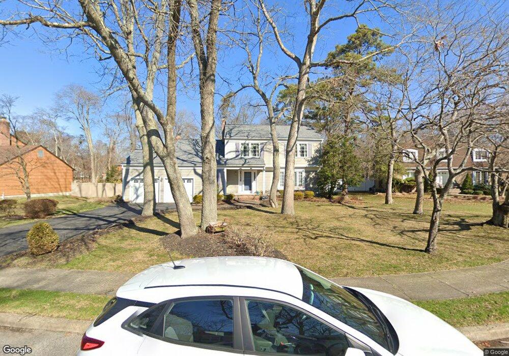
938 Millstone Ct Toms River, NJ 08753
Estimated Value: $763,269 - $791,000
4
Beds
3
Baths
4,348
Sq Ft
$179/Sq Ft
Est. Value
About This Home
This home is located at 938 Millstone Ct, Toms River, NJ 08753 and is currently estimated at $779,317, approximately $179 per square foot. 938 Millstone Ct is a home located in Ocean County.
Ownership History
Date
Name
Owned For
Owner Type
Purchase Details
Closed on
Jun 28, 2006
Sold by
Sabaski Richard S and Sabaski Carolyn J
Bought by
Ambrosio Craig and Ambrosio Geraldine
Current Estimated Value
Home Financials for this Owner
Home Financials are based on the most recent Mortgage that was taken out on this home.
Original Mortgage
$343,000
Outstanding Balance
$203,068
Interest Rate
6.6%
Mortgage Type
Purchase Money Mortgage
Estimated Equity
$576,249
Purchase Details
Closed on
Oct 22, 2001
Sold by
Chapski Joseph
Bought by
Sabaski Richard and Sabaski Carolyn
Home Financials for this Owner
Home Financials are based on the most recent Mortgage that was taken out on this home.
Original Mortgage
$135,000
Interest Rate
6.86%
Create a Home Valuation Report for This Property
The Home Valuation Report is an in-depth analysis detailing your home's value as well as a comparison with similar homes in the area
Home Values in the Area
Average Home Value in this Area
Purchase History
| Date | Buyer | Sale Price | Title Company |
|---|---|---|---|
| Ambrosio Craig | $490,000 | Lawyers Title Insurance Corp | |
| Sabaski Richard | $295,000 | -- |
Source: Public Records
Mortgage History
| Date | Status | Borrower | Loan Amount |
|---|---|---|---|
| Open | Ambrosio Craig | $343,000 | |
| Previous Owner | Sabaski Richard | $135,000 |
Source: Public Records
Tax History Compared to Growth
Tax History
| Year | Tax Paid | Tax Assessment Tax Assessment Total Assessment is a certain percentage of the fair market value that is determined by local assessors to be the total taxable value of land and additions on the property. | Land | Improvement |
|---|---|---|---|---|
| 2025 | $10,121 | $555,800 | $172,000 | $383,800 |
| 2024 | $9,621 | $555,800 | $172,000 | $383,800 |
| 2023 | $9,276 | $555,800 | $172,000 | $383,800 |
| 2022 | $9,276 | $555,800 | $172,000 | $383,800 |
| 2021 | $9,279 | $370,400 | $107,800 | $262,600 |
| 2020 | $9,238 | $370,400 | $107,800 | $262,600 |
| 2019 | $8,838 | $370,400 | $107,800 | $262,600 |
| 2018 | $8,719 | $370,400 | $107,800 | $262,600 |
| 2017 | $8,645 | $370,400 | $107,800 | $262,600 |
| 2016 | $8,419 | $370,400 | $107,800 | $262,600 |
| 2015 | $8,101 | $370,400 | $107,800 | $262,600 |
| 2014 | $7,712 | $370,400 | $107,800 | $262,600 |
Source: Public Records
Map
Nearby Homes
- 751 High Meadow Dr
- 939 Alden Dr
- 308 Cedar Grove Rd
- 241 Lester Rd
- 711 Bay Ave
- 1004 Sheila Dr
- 855 Derry Dr
- 1016 Sheila Dr
- 1115 Verdant Rd
- 308 Tradewinds Ave
- 944 Yellowbank Rd
- 821 Oak Ave
- 823 Oak Ave
- 520 Delos Dr
- 802 Carnaby Ln
- 830 Brookside Dr
- 405 Aberdeen Ln Unit 425
- 1072 Lake Placid Dr
- 367 Flaam St
- 696 Schoolhouse Ln
- 934 Millstone Ct
- 942 Millstone Ct
- 976 Tiffany Walk
- 791 Foothill Ct
- 946 Millstone Ct
- 933 Millstone Ct
- 980 Tiffany Walk
- 795 Foothill Ct
- 937 Millstone Ct
- 941 Millstone Ct
- 975 Tiffany Walk
- 787 Foothill Ct
- 950 Millstone Ct
- 799 Foothill Ct
- 947 Millstone Ct
- 984 Tiffany Walk
- 779 Heritage Way
- 786 Rue Ln
- 979 Tiffany Walk
- 788 Foothill Ct