Estimated Value: $315,335 - $343,000
3
Beds
2
Baths
1,626
Sq Ft
$202/Sq Ft
Est. Value
About This Home
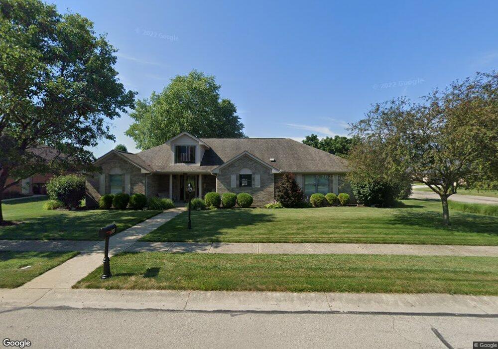
This home is located at 939 Orville Way, Xenia, OH 45385 and is currently estimated at $329,084, approximately $202 per square foot. 939 Orville Way is a home located in Greene County with nearby schools including Xenia High School, Summit Academy Community School for Alternative Learners - Xenia, and Legacy Christian Academy.
Ownership History
Date
Name
Owned For
Owner Type
Purchase Details
Closed on
Oct 9, 2007
Sold by
Benasutti Joanne M
Bought by
Benasutti Louis Dean and Benasutti Joanne M
Current Estimated Value
Purchase Details
Closed on
Apr 10, 2002
Sold by
P F D Development P L L
Bought by
Benasutti Joanne M and Joanne M Benasutti Revocable Living Tr
Purchase Details
Closed on
Nov 9, 2001
Sold by
Equity Land Title Agency Inc
Bought by
Benasutti Joanne M and Joanne M Benasutti Revocable Living Tr
Purchase Details
Closed on
Jul 13, 2001
Sold by
P F D Development P Ll
Bought by
Equity Land Title Agency Inc
Create a Home Valuation Report for This Property
The Home Valuation Report is an in-depth analysis detailing your home's value as well as a comparison with similar homes in the area
Home Values in the Area
Average Home Value in this Area
Purchase History
| Date | Buyer | Sale Price | Title Company |
|---|---|---|---|
| Benasutti Louis Dean | -- | Attorney | |
| Benasutti Joanne M | -- | -- | |
| Benasutti Joanne M | -- | Equity Land Title Agency Inc | |
| Equity Land Title Agency Inc | $32,900 | -- |
Source: Public Records
Tax History Compared to Growth
Tax History
| Year | Tax Paid | Tax Assessment Tax Assessment Total Assessment is a certain percentage of the fair market value that is determined by local assessors to be the total taxable value of land and additions on the property. | Land | Improvement |
|---|---|---|---|---|
| 2024 | $3,132 | $84,920 | $21,420 | $63,500 |
| 2023 | $3,132 | $84,920 | $21,420 | $63,500 |
| 2022 | $2,679 | $63,540 | $14,280 | $49,260 |
| 2021 | $2,716 | $63,540 | $14,280 | $49,260 |
| 2020 | $2,780 | $63,540 | $14,280 | $49,260 |
| 2019 | $2,780 | $63,910 | $18,270 | $45,640 |
| 2018 | $2,791 | $63,910 | $18,270 | $45,640 |
| 2017 | $3,186 | $63,910 | $18,270 | $45,640 |
| 2016 | $3,186 | $60,190 | $18,270 | $41,920 |
| 2015 | $3,195 | $60,190 | $18,270 | $41,920 |
| 2014 | -- | $60,190 | $18,270 | $41,920 |
Source: Public Records
Map
Nearby Homes
- 2102 High Wheel Dr
- 920 Wright Cycle Blvd
- 926 Wright Cycle Blvd
- 1348 Berkshire Dr
- 2499 Jenny Marie Dr
- 2421 Louisiana Dr
- 1255 Colorado Dr
- 0 Berkshire Dr Unit 949217
- 1750 Roxbury Dr
- 2784 Greystoke Dr
- 1403 Texas Dr
- 2821 Raxit Ct
- 1829 Gayhart Dr
- 1778 Arapaho Dr
- 1272 Bellbrook Ave
- 1358 Shannon Ln
- 1318 Prem Place
- 1248 Prem Place
- 1304 Baybury Ave
- 1298 Baybury Ave
- 929 Orville Way
- 948 Wright Ave
- 942 Wright Ave
- 921 Orville Way
- 953 Orville Way
- 938 Wright Ave
- 2000 Tandem Dr
- 934 Wright Ave
- 936 Orville Way
- 930 Wright Ave
- 2010 Tandem Dr
- 924 Orville Way
- 926 Wright Ave
- 915 Orville Way
- lot #173 Tandem Dr
- lot #172 Wright Ave
- lot #170 Wright Ave
- 961 Orville Way
- 922 Wright Ave
- 916 Orville Way