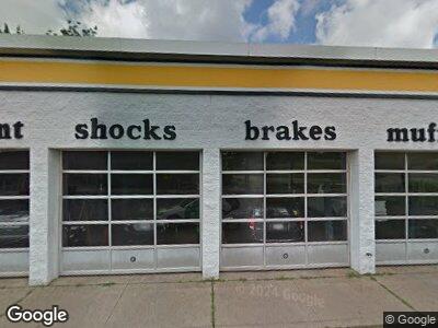
9393 Fields Ertel Rd Cincinnati, OH 45249
Highpoint NeighborhoodEstimated Value: $830,097
--
Bed
--
Bath
4,280
Sq Ft
$194/Sq Ft
Est. Value
About This Home
This home is located at 9393 Fields Ertel Rd, Cincinnati, OH 45249 and is currently estimated at $830,097, approximately $193 per square foot. 9393 Fields Ertel Rd is a home located in Hamilton County with nearby schools including Edwin H Greene Intermediate Middle School, Sycamore Junior High School, and Sycamore High School.
Ownership History
Date
Name
Owned For
Owner Type
Purchase Details
Closed on
Dec 10, 2018
Sold by
9393 Fields Ertel Road Llc
Bought by
La Marketa Market Llc
Current Estimated Value
Home Financials for this Owner
Home Financials are based on the most recent Mortgage that was taken out on this home.
Original Mortgage
$400,000
Interest Rate
4.8%
Mortgage Type
Future Advance Clause Open End Mortgage
Purchase Details
Closed on
Jun 10, 2016
Sold by
Chandler Paul T and Chandler Sharon
Bought by
9393 Fields Ertel Rd Llc
Home Financials for this Owner
Home Financials are based on the most recent Mortgage that was taken out on this home.
Original Mortgage
$240,000
Interest Rate
3.54%
Mortgage Type
Commercial
Create a Home Valuation Report for This Property
The Home Valuation Report is an in-depth analysis detailing your home's value as well as a comparison with similar homes in the area
Home Values in the Area
Average Home Value in this Area
Purchase History
| Date | Buyer | Sale Price | Title Company |
|---|---|---|---|
| La Marketa Market Llc | $500,000 | None Available | |
| 9393 Fields Ertel Rd Llc | $333,000 | -- |
Source: Public Records
Mortgage History
| Date | Status | Borrower | Loan Amount |
|---|---|---|---|
| Open | La Marketa Market Llc | $265,000 | |
| Closed | La Marketa Market Llc | $400,000 | |
| Previous Owner | 9393 Fields Ertel Rd Llc | $240,000 |
Source: Public Records
Tax History Compared to Growth
Tax History
| Year | Tax Paid | Tax Assessment Tax Assessment Total Assessment is a certain percentage of the fair market value that is determined by local assessors to be the total taxable value of land and additions on the property. | Land | Improvement |
|---|---|---|---|---|
| 2024 | $17,599 | $222,919 | $161,175 | $61,744 |
| 2023 | $17,107 | $222,919 | $161,175 | $61,744 |
| 2022 | $15,018 | $175,000 | $112,350 | $62,650 |
| 2021 | $14,968 | $175,000 | $112,350 | $62,650 |
| 2020 | $14,615 | $175,000 | $112,350 | $62,650 |
| 2019 | $10,186 | $116,550 | $105,000 | $11,550 |
| 2018 | $9,884 | $116,550 | $105,000 | $11,550 |
| 2017 | $9,488 | $116,550 | $105,000 | $11,550 |
| 2016 | $17,641 | $211,719 | $144,116 | $67,603 |
| 2015 | $16,369 | $211,719 | $144,116 | $67,603 |
| 2014 | $16,302 | $211,719 | $144,116 | $67,603 |
| 2013 | $15,991 | $209,622 | $142,688 | $66,934 |
Source: Public Records
Map
Nearby Homes
- 12041 Carrington Ln Unit 41-104
- 12041 Carrington Ln
- 410 Carrington Ln
- 120 Carrington Ln
- 12061 Carrington Ln
- 620 Carrington Place Unit 311
- 620 Carrington Place
- 710 Carrington Place
- 11981 Olde Dominion Dr
- 12026 Maxim Ave
- 12040 Maxim Way Unit 12046
- 9544 Union Cemetery Rd
- 9550 Union Cemetery Rd
- 4149 Mahogany Ln
- 9580 Creekside Dr
- 3835 Parkwood Ct
- 9212 Cedar Gate Dr
- 9254 Stratford Ct
- 6174 Whileaway Dr
- 6172 Whileaway Dr
