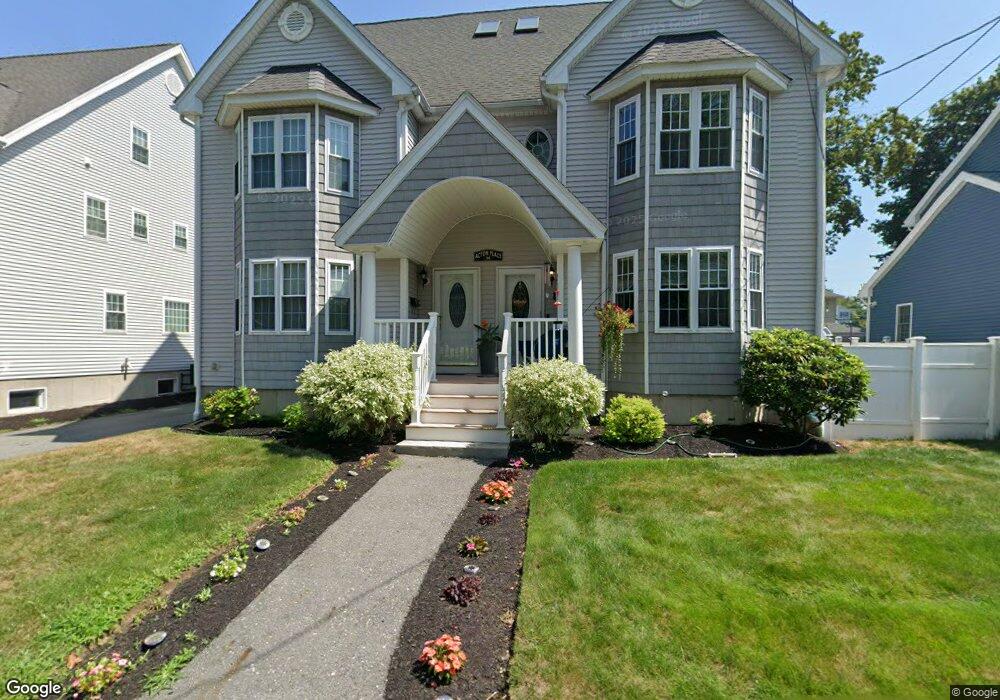
94 Acton St Unit B Lowell, MA 01852
South Lowell NeighborhoodEstimated Value: $510,000 - $590,000
3
Beds
3
Baths
1,862
Sq Ft
$295/Sq Ft
Est. Value
About This Home
This home is located at 94 Acton St Unit B, Lowell, MA 01852 and is currently estimated at $548,716, approximately $294 per square foot. 94 Acton St Unit B is a home located in Middlesex County with nearby schools including Moody Elementary School, Abraham Lincoln Elementary School, and Greenhalge Elementary School.
Ownership History
Date
Name
Owned For
Owner Type
Purchase Details
Closed on
Mar 8, 2006
Sold by
Daly Rt
Bought by
Poirier Amy Lynne
Current Estimated Value
Home Financials for this Owner
Home Financials are based on the most recent Mortgage that was taken out on this home.
Original Mortgage
$152,000
Outstanding Balance
$85,803
Interest Rate
6.15%
Mortgage Type
Purchase Money Mortgage
Estimated Equity
$462,913
Create a Home Valuation Report for This Property
The Home Valuation Report is an in-depth analysis detailing your home's value as well as a comparison with similar homes in the area
Home Values in the Area
Average Home Value in this Area
Purchase History
| Date | Buyer | Sale Price | Title Company |
|---|---|---|---|
| Poirier Amy Lynne | $299,900 | -- |
Source: Public Records
Mortgage History
| Date | Status | Borrower | Loan Amount |
|---|---|---|---|
| Open | Poirier Amy Lynne | $152,000 |
Source: Public Records
Tax History
| Year | Tax Paid | Tax Assessment Tax Assessment Total Assessment is a certain percentage of the fair market value that is determined by local assessors to be the total taxable value of land and additions on the property. | Land | Improvement |
|---|---|---|---|---|
| 2025 | $5,194 | $452,400 | $0 | $452,400 |
| 2024 | $4,899 | $411,300 | $0 | $411,300 |
| 2023 | $4,815 | $387,700 | $0 | $387,700 |
| 2022 | $4,582 | $361,100 | $0 | $361,100 |
| 2021 | $4,369 | $324,600 | $0 | $324,600 |
| 2020 | $4,299 | $321,800 | $0 | $321,800 |
| 2019 | $4,208 | $299,700 | $0 | $299,700 |
| 2018 | $3,970 | $275,900 | $0 | $275,900 |
| 2017 | $3,931 | $263,500 | $0 | $263,500 |
| 2016 | $3,817 | $251,800 | $0 | $251,800 |
| 2015 | $3,681 | $237,800 | $0 | $237,800 |
| 2013 | $3,340 | $222,500 | $0 | $222,500 |
Source: Public Records
Map
Nearby Homes
- 57 Arnold Ave
- 22 Juniper St
- 37 Stavely St
- 74 Felton St Unit A
- 1204 Lawrence St
- 28 Warnock St
- 14 Warnock St
- 132 Commonwealth Ave
- 106 Lundberg St Unit 6
- 1400 Gorham St Unit 42
- 1400 Gorham St Unit 46
- 58 Brunswick St
- 36 Crowley St
- 74 Carlisle St
- 10 Fay St
- 900 Lawrence St Unit 5
- 7 Gorham St Unit 5
- 7 Gorham St Unit 54
- 7 Gorham St Unit 36
- 5 Lenox St Unit 2
- 94 Acton St Unit A
- 88 Acton St Unit A
- 88 Acton St Unit B
- 100 Acton St
- 106 Acton St
- 91 Acton St Unit 87
- 87 Acton St
- 145 Woburn St
- 80 Acton St
- 141 Woburn St
- 153 Woburn St
- 103 Acton St
- 161 Woburn St
- 1 Carmine St Unit 2
- 1 Carmine St Unit 1
- 114 Acton St
- 70 Bolton St
- 163 Woburn St
- 27 Easton St
- 80 Bolton St
Your Personal Tour Guide
Ask me questions while you tour the home.