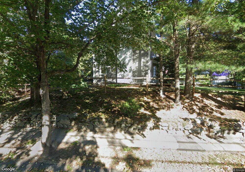
94 Beaufort Ave Needham, MA 02492
Estimated Value: $1,893,942 - $2,267,000
4
Beds
5
Baths
3,635
Sq Ft
$578/Sq Ft
Est. Value
About This Home
This home is located at 94 Beaufort Ave, Needham, MA 02492 and is currently estimated at $2,100,736, approximately $577 per square foot. 94 Beaufort Ave is a home located in Norfolk County with nearby schools including Mitchell Elementary School, High Rock Middle School, and Pollard Middle School.
Ownership History
Date
Name
Owned For
Owner Type
Purchase Details
Closed on
Sep 30, 2022
Sold by
Nichols Elizabeth A
Bought by
Elizabeth A Nichols Ft and Nichols
Current Estimated Value
Purchase Details
Closed on
May 6, 2011
Sold by
Ward Mark and Ward Kathleen
Bought by
Marsh Gregory and Cummings Julie
Home Financials for this Owner
Home Financials are based on the most recent Mortgage that was taken out on this home.
Original Mortgage
$900,000
Interest Rate
4.82%
Mortgage Type
Purchase Money Mortgage
Purchase Details
Closed on
Aug 27, 2007
Sold by
Burke Sarah E and Burke Timothy M
Bought by
Ward Kathleen and Ward Mark
Create a Home Valuation Report for This Property
The Home Valuation Report is an in-depth analysis detailing your home's value as well as a comparison with similar homes in the area
Home Values in the Area
Average Home Value in this Area
Purchase History
| Date | Buyer | Sale Price | Title Company |
|---|---|---|---|
| Elizabeth A Nichols Ft | -- | None Available | |
| Elizabeth A Nichols Ft | -- | None Available | |
| Marsh Gregory | $1,357,500 | -- | |
| Marsh Gregory | $1,357,500 | -- | |
| Ward Kathleen | $1,235,000 | -- | |
| Ward Kathleen | $1,235,000 | -- |
Source: Public Records
Mortgage History
| Date | Status | Borrower | Loan Amount |
|---|---|---|---|
| Previous Owner | Ward Kathleen | $735,000 | |
| Previous Owner | Marsh Gregory | $900,000 |
Source: Public Records
Tax History Compared to Growth
Tax History
| Year | Tax Paid | Tax Assessment Tax Assessment Total Assessment is a certain percentage of the fair market value that is determined by local assessors to be the total taxable value of land and additions on the property. | Land | Improvement |
|---|---|---|---|---|
| 2025 | $15,932 | $1,503,000 | $812,200 | $690,800 |
| 2024 | $17,384 | $1,388,500 | $597,500 | $791,000 |
| 2023 | $17,316 | $1,327,900 | $597,500 | $730,400 |
| 2022 | $16,335 | $1,221,800 | $529,700 | $692,100 |
| 2021 | $15,920 | $1,221,800 | $529,700 | $692,100 |
| 2020 | $14,899 | $1,192,900 | $529,700 | $663,200 |
| 2019 | $14,128 | $1,140,300 | $482,300 | $658,000 |
| 2018 | $13,547 | $1,140,300 | $482,300 | $658,000 |
| 2017 | $12,556 | $1,056,000 | $482,300 | $573,700 |
| 2016 | $12,257 | $1,062,100 | $482,300 | $579,800 |
| 2015 | $11,991 | $1,062,100 | $482,300 | $579,800 |
| 2014 | $11,242 | $965,800 | $403,300 | $562,500 |
Source: Public Records
Map
Nearby Homes
- 62 Washington Ave
- 332 Hillcrest Rd
- 190 Brookline St
- 8 Wilshire Park
- 26 Pinewood Rd
- 40 Otis St Unit L
- 42 Otis St Unit R
- 701 Greendale Ave
- 247 Broad Meadow Rd
- 556 Webster St
- 23 Cheney St
- 154 Warren St
- 883 Greendale Ave
- 9 Jayne Rd
- 233 Warren St
- 71 School St
- 1011 Webster St
- 143 Hunting Rd
- 193 Garden St
- 39 Mark Lee Rd
- 94 Beaufort Ave
- 102 Wyoming Ave
- 14 Nichols Rd
- 96 Wyoming Ave
- 82 Beaufort Ave
- 90 Wyoming Ave
- 10 Nichols Rd
- 87 Beaufort Ave
- 93 Beaufort Ave
- 104 Beaufort Ave
- 99 Beaufort Ave
- 4 Nichols Rd
- 81 Beaufort Ave
- 82 Wyoming Ave
- 105 Beaufort Ave
- 94 Hawthorn Ave
- 86 Hawthorn Ave
- 242 Hillcrest Rd
- 98 Hawthorn Ave
- 114 Beaufort Ave