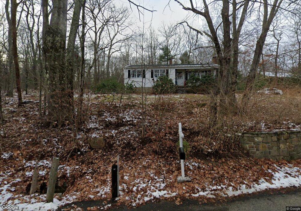
94 Colburn Rd Stafford Springs, CT 06076
Stafford NeighborhoodEstimated Value: $376,325 - $385,000
3
Beds
2
Baths
1,336
Sq Ft
$285/Sq Ft
Est. Value
About This Home
This home is located at 94 Colburn Rd, Stafford Springs, CT 06076 and is currently estimated at $380,581, approximately $284 per square foot. 94 Colburn Rd is a home located in Tolland County with nearby schools including Stafford Elementary School, Stafford Middle School, and Stafford High School.
Ownership History
Date
Name
Owned For
Owner Type
Purchase Details
Closed on
Dec 19, 2016
Sold by
Brasefield David P and Brasefield Denise L
Bought by
Brasefield David P
Current Estimated Value
Purchase Details
Closed on
Apr 18, 2007
Sold by
Callahan Michael
Bought by
Brasefield David and Brasefield Denise
Home Financials for this Owner
Home Financials are based on the most recent Mortgage that was taken out on this home.
Original Mortgage
$252,000
Interest Rate
6.19%
Create a Home Valuation Report for This Property
The Home Valuation Report is an in-depth analysis detailing your home's value as well as a comparison with similar homes in the area
Home Values in the Area
Average Home Value in this Area
Purchase History
| Date | Buyer | Sale Price | Title Company |
|---|---|---|---|
| Brasefield David P | -- | -- | |
| Brasefield David | $266,000 | -- |
Source: Public Records
Mortgage History
| Date | Status | Borrower | Loan Amount |
|---|---|---|---|
| Previous Owner | Brasefield David | $252,000 |
Source: Public Records
Tax History Compared to Growth
Tax History
| Year | Tax Paid | Tax Assessment Tax Assessment Total Assessment is a certain percentage of the fair market value that is determined by local assessors to be the total taxable value of land and additions on the property. | Land | Improvement |
|---|---|---|---|---|
| 2025 | $9,217 | $154,560 | $31,710 | $122,850 |
| 2024 | $5,964 | $154,560 | $31,710 | $122,850 |
| 2023 | $5,682 | $154,560 | $31,710 | $122,850 |
| 2022 | $5,530 | $154,560 | $31,710 | $122,850 |
| 2021 | $5,399 | $154,560 | $31,710 | $122,850 |
| 2020 | $5,169 | $147,980 | $35,070 | $112,910 |
| 2019 | $5,083 | $145,530 | $35,070 | $110,460 |
| 2018 | $4,986 | $145,530 | $35,070 | $110,460 |
| 2017 | $4,938 | $145,530 | $35,070 | $110,460 |
| 2016 | $4,877 | $145,530 | $35,070 | $110,460 |
| 2015 | $4,877 | $150,080 | $35,070 | $115,010 |
| 2014 | $4,957 | $150,080 | $35,070 | $115,010 |
Source: Public Records
Map
Nearby Homes